Description
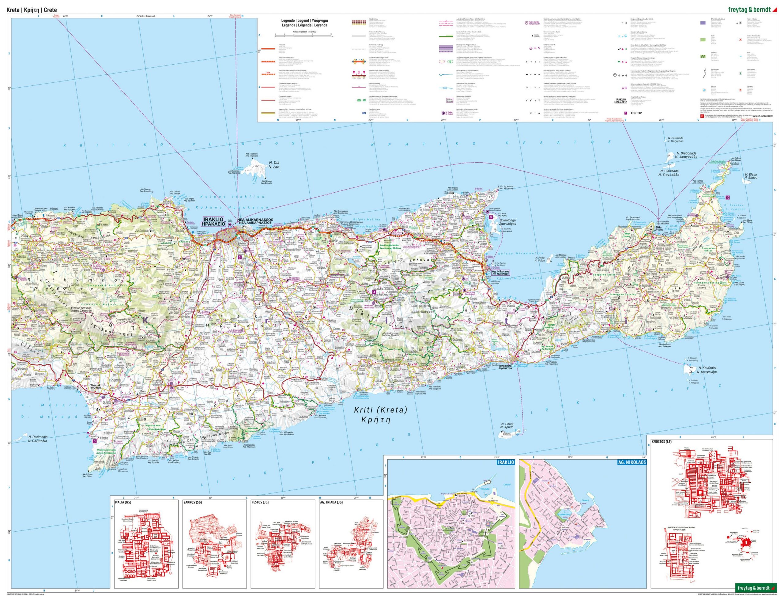
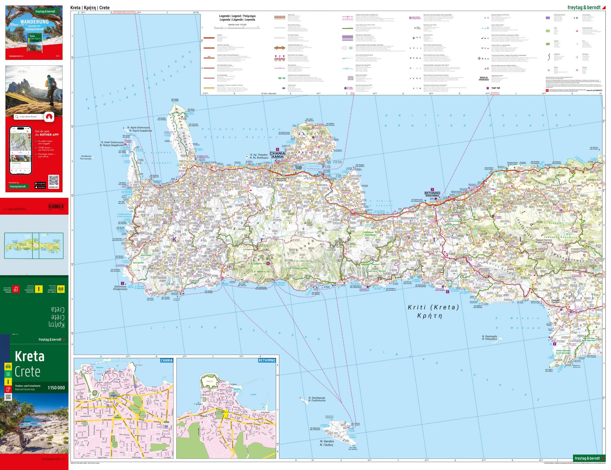
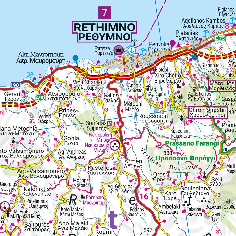
This detailed 1:150,000 scale road map of Crete is an ideal tool for those who want to explore the island by car, motorcycle or motorhome. Covering the whole of Crete, the map provides a clear and accurate representation of the road network, including distances, landscape features and a wide range of tourist destinations and excursions.
Scenically beautiful stretches of road are clearly marked, and the map also contains information that is particularly useful for travelers, such as campsites and practical orientation points. The complete place index makes it easy to find both small villages and larger towns, while separate city maps for Chania, Rethymno, Iraklio and Agios Nikolaos provide a good overview in urban areas.
On the back of the map you’ll find a digital info guide with Top Tips, where the most important sights in Crete are briefly described in several languages. The map is published in 2025 and produced in Austria with the well-known cartographic quality of freytag & berndt, which makes it well suited for both planning and use during the trip.