Description
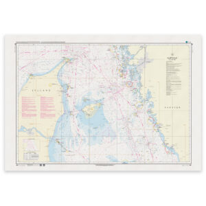
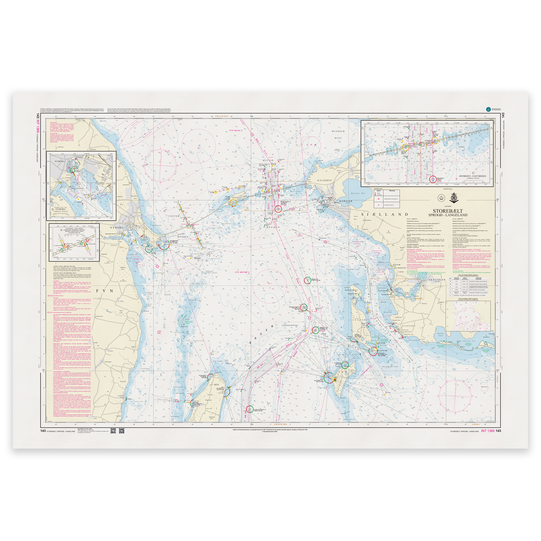
Denmark Chart 143 – Storebælt, Sprogø-Langeland (INT 1369) is an official Danish nautical chart published by Geodatastyrelsen at a scale of 1:50 000.
The map covers the waters of the Great Belt between Sprogø and Langeland, a central area in the Danish main channel between the Kattegat and the Baltic Sea. The area has significant commercial traffic, as well as recreational boating activity, and requires precise navigation with a good overview of the route, traffic separation zones, lighthouses, beacons and detailed depth conditions.
This is a navigational chart with a high level of detail. The scale of 1:50,000 provides better precision than the overall passage maps, and is particularly suitable for:
Operational navigation in the Great Belt
Sailing in busy main roads
Planning of calls to nearby ports
Navigation in areas with complex currents and traffic conditions
The chart is also published as INT 1369 and is part of the International Chart Series coordinated by IHO. The INT number means that the chart follows international standards and is harmonized for use in international shipping.
The map is delivered as Print-on-Demand (POD) under license from Geodatastyrelsen. It is printed when ordered and updated to the latest available Notices to Mariners at the time of production.
You’ll receive a fresh and updated reprint based on current official map data.
The chart is produced on durable, matte 125 g paper approved for official nautical charts.
Corrections are published continuously and new updates may occur after printing. Print-on-Demand ensures that you get the most up-to-date paper edition available when ordering.