Description
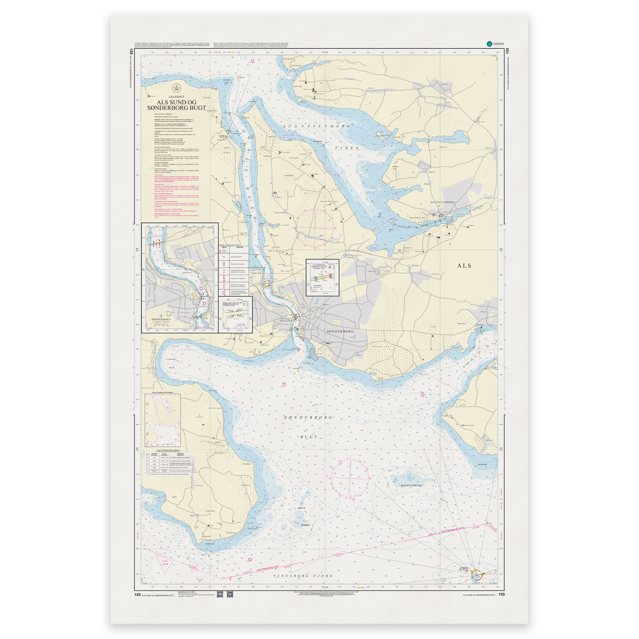
Denmark Chart 155 – Lillebælt, Als Sund and Sønderborg Bugt is an official Danish nautical chart published by Geodatastyrelsen at a scale of 1:20 000.
The map covers Als Sund and Sønderborg Bugt in the southern part of the Little Belt area. The area consists of narrow channels, shallow areas, harbors and busy passages that require precise navigation and a good overview of local conditions.
This is a large-scale specialty chart, developed for detailed navigation in coastal waters, straits and harbors. The high level of detail makes the map particularly suitable for:
Sailing through Als Sund
Navigation in Sønderborg Bay
Port calls in the Sønderborg area
Maneuvering in narrow channels and shallow waters
The map shows detailed depth conditions, leads, beacons, lighthouses and other navigation installations that are essential for safe navigation.
The map is delivered as Print-on-Demand (POD) under license from Geodatastyrelsen. It is printed when ordered and updated to the latest available Notices to Mariners at the time of production.
You’ll receive a fresh and updated reprint based on current official map data.
The chart is produced on durable, matte 125 g paper approved for official nautical charts.
Corrections are published continuously and new updates may occur after printing. Print-on-Demand ensures that you get the most up-to-date paper edition available when ordering.