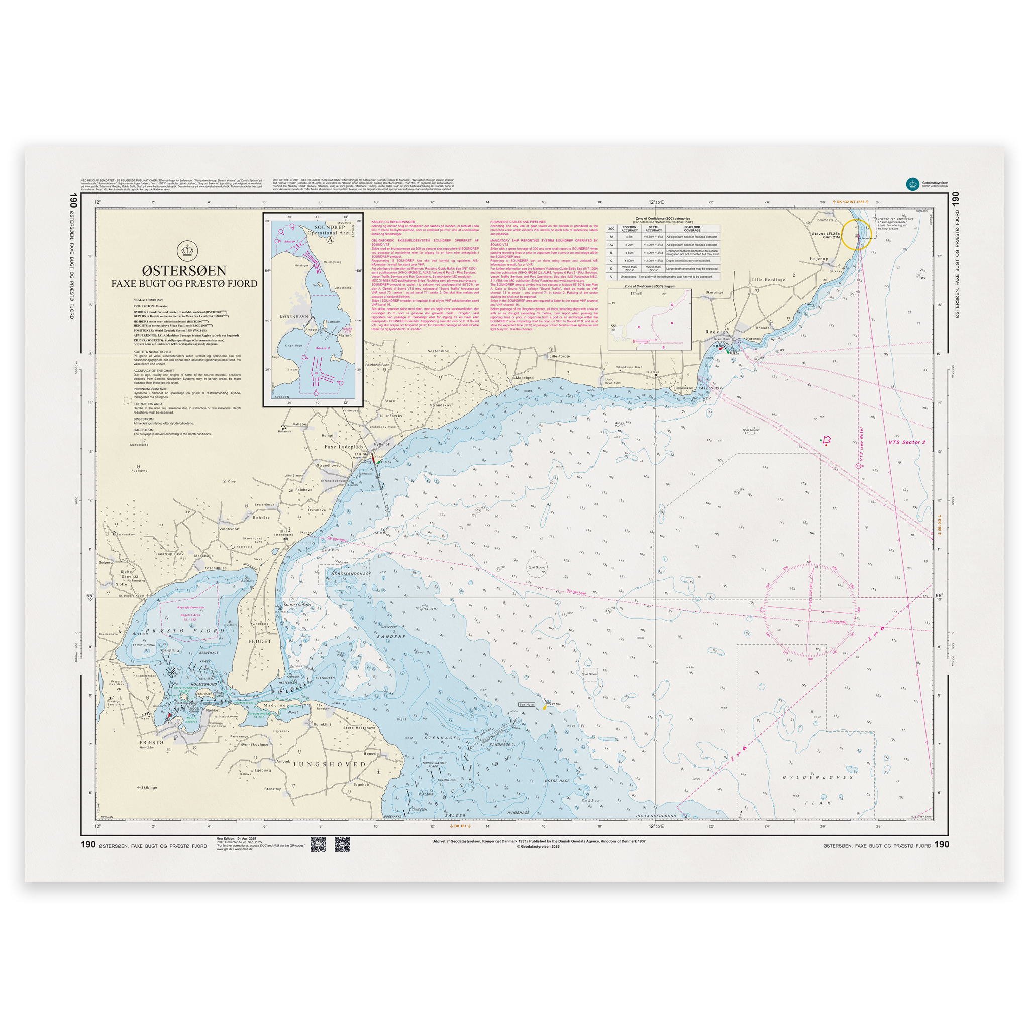
Description
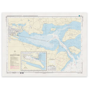
Denmark Chart 190 – Baltic Sea, Faxe Bugt and Præstø Fjord is an official Danish nautical chart published by Geodatastyrelsen at a scale of 1:50 000.
The map covers Faxe Bugt and Præstø Fjord on the southeast coast of Zealand – an area with a varied coastline, shallow areas, leads and harbor entrances that require precise navigation.
This is a navigational chart, developed for detailed coastal navigation and harbor approaches. The scale of 1:50,000 provides a good balance between overview and detail, and makes the map particularly suitable for:
Sailing along the coast of Faxe Bugt
Entrance to Præstø Fjord
Navigation in shallow and coastal waters
Planning of local and regional coastal sailing
The map shows detailed depth conditions, beacons, lighthouses, cables and other navigation installations that are essential for safe navigation.
In areas where special maps are available on a larger scale, some details may be simplified, but the map provides a complete and operational coverage of the waters.
The map is delivered as Print-on-Demand (POD) under license from Geodatastyrelsen. It is printed when ordered and updated to the latest available Notices to Mariners at the time of production.
You’ll receive a fresh and updated reprint based on current official map data.
The chart is produced on durable, matte 125 g paper approved for official nautical charts.
Corrections are published continuously and new updates may occur after printing. Print-on-Demand ensures that you get the most up-to-date paper edition available when ordering.