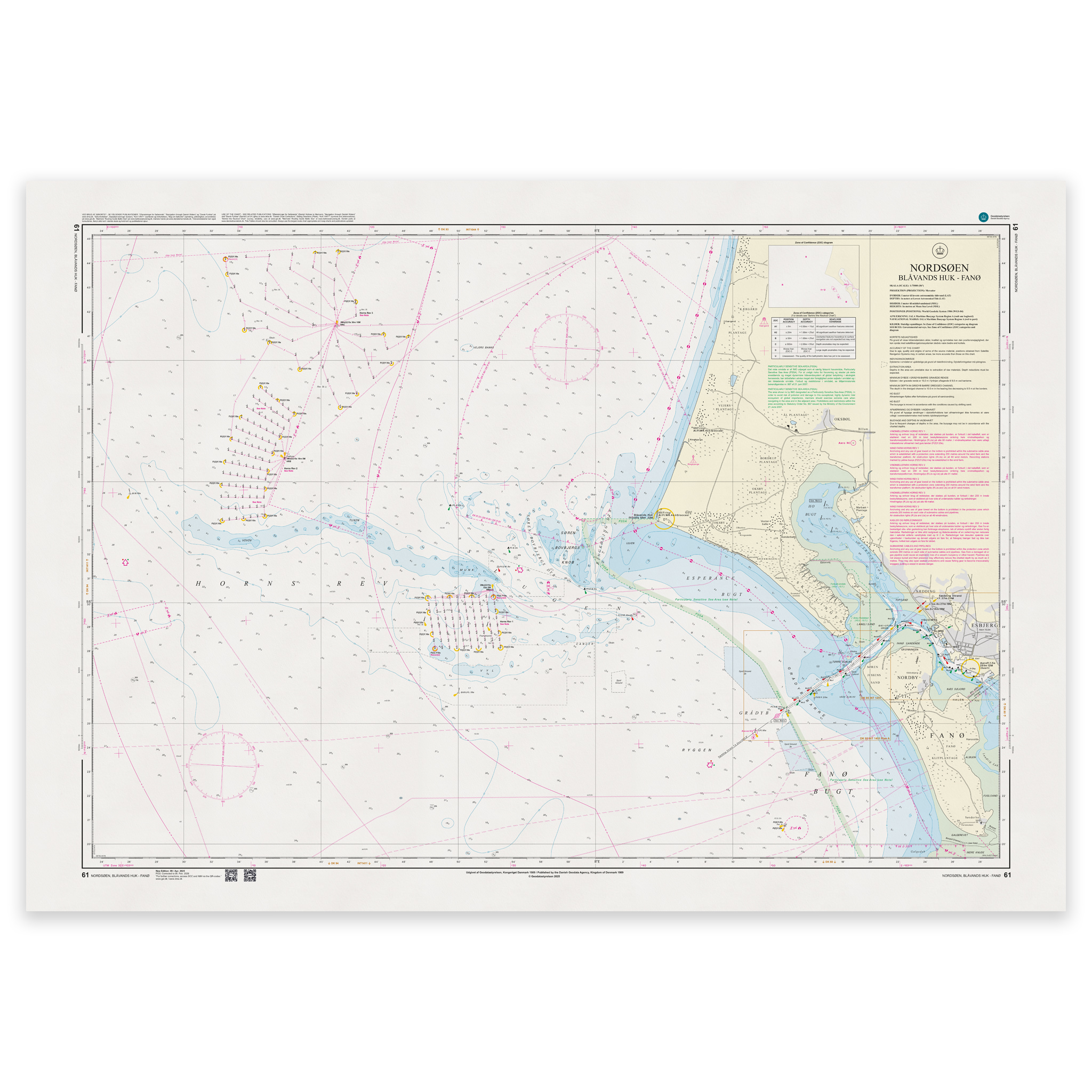
Description
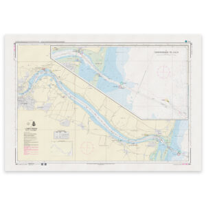
Denmark Chart 61 – North Sea, Blåvands Huk – Fanø is an official Danish nautical chart published by Geodatastyrelsen at a scale of 1:75 000.
The map covers the waters off Blåvands Huk and the area southwest towards Fanø – an open and weather-exposed area of the North Sea with sandbanks, shallow areas and traffic to and from Esbjerg.
This is a port of call and transit chart, developed for navigation in main waters and coastal leads. The scale of 1:75,000 provides a good balance between overview and detail, and is particularly suitable for:
Sailing along the west coast of Jutland
Sailing to and from Esbjerg
Navigation at Blåvands Huk
Transition between open sea and coastal waters
The map shows detailed depth conditions, sandbanks, lighthouses, beacons, traffic lanes and other navigation installations that are essential for safe navigation in the area.
The west coast is known for its changing seabed conditions and tidal influences, which makes an up-to-date nautical chart particularly important when planning a voyage.
The map is delivered as Print-on-Demand (POD) under license from Geodatastyrelsen. It is printed when ordered and updated to the latest available Notices to Mariners at the time of production.
You’ll receive a fresh and updated reprint based on current official map data.
The chart is produced on durable, matte 125 g paper approved for official nautical charts.
Corrections are published continuously and new updates may occur after printing. Print-on-Demand ensures that you get the most up-to-date paper edition available when ordering.