Description
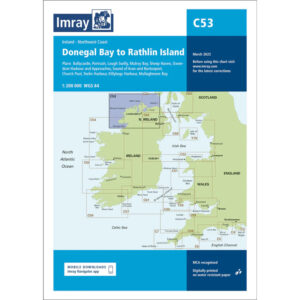
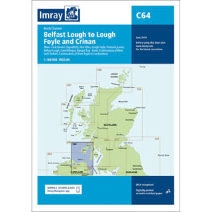
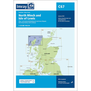
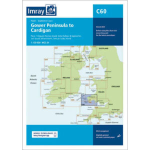
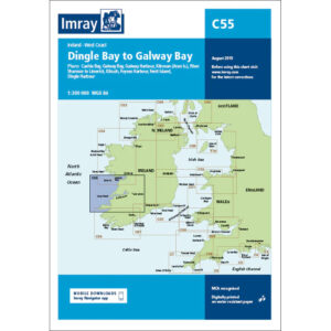
This boating map covers the west coast of Ireland from Dingle Bay to Galway Bay. The area is characterized by a rugged Atlantic coastline with long stretches of sea, large bays, islands and several important ports used by both leisure boats and long-distance sailors.
The chart is well suited to route planning and overview navigation for coastal voyages along the west coast of Ireland, where tides, currents and weather conditions are important. It provides a clear representation of coastlines, main channels and key approaches and is often used in conjunction with more detailed Imray charts for ports and local waters.
Imray is a renowned British chart manufacturer with extensive experience in nautical charts and publications for leisure boats. Designed for practical use on board, their charts combine clear cartography with reliable nautical information for sailors and powerboaters.