
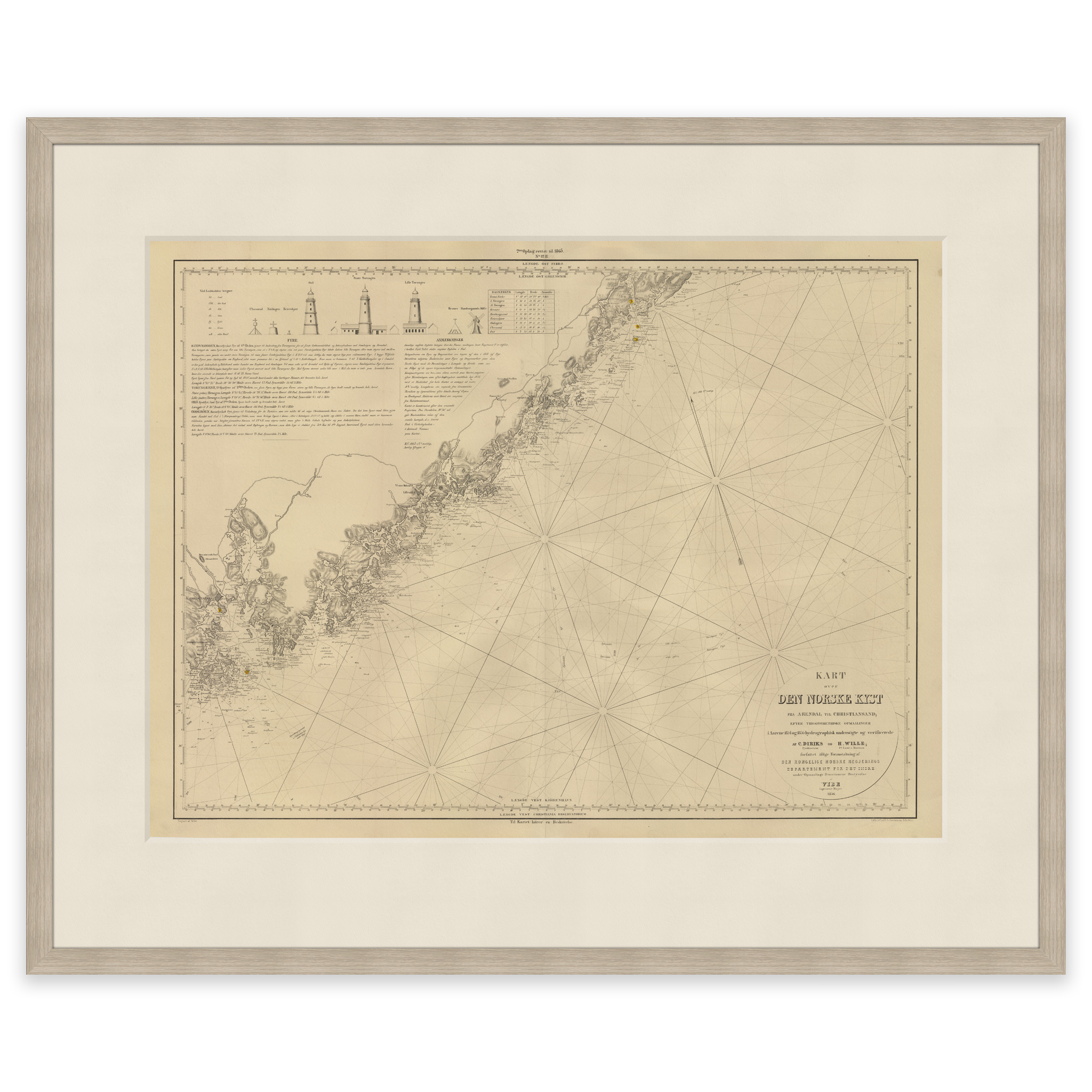
 Historic nautical chart of the Kristiansand to Arendal stretch
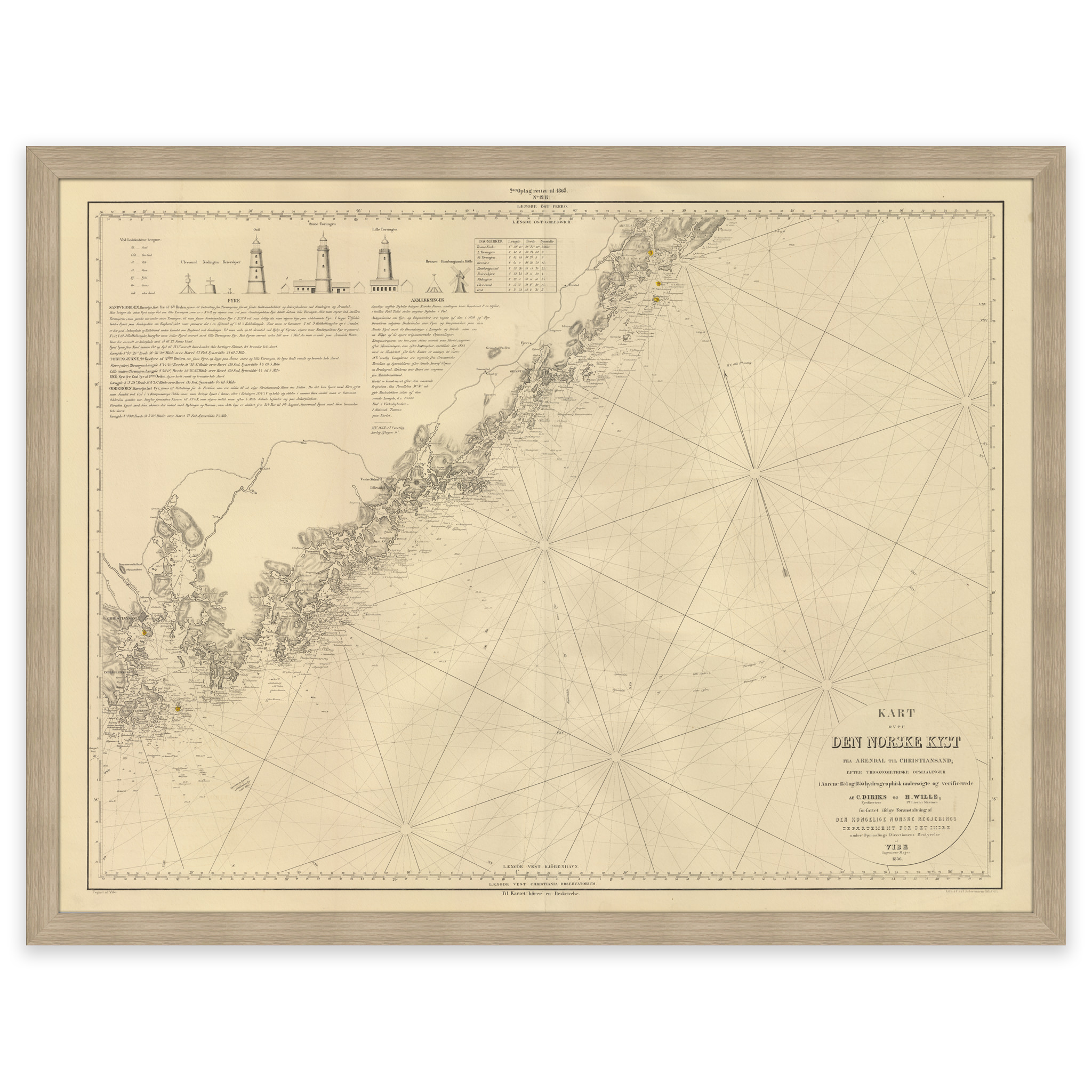
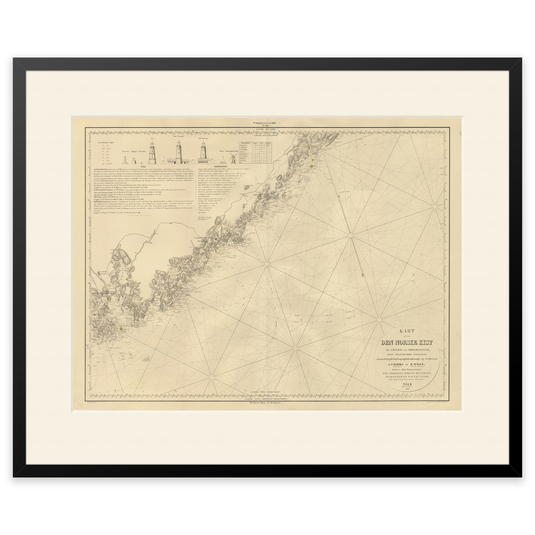
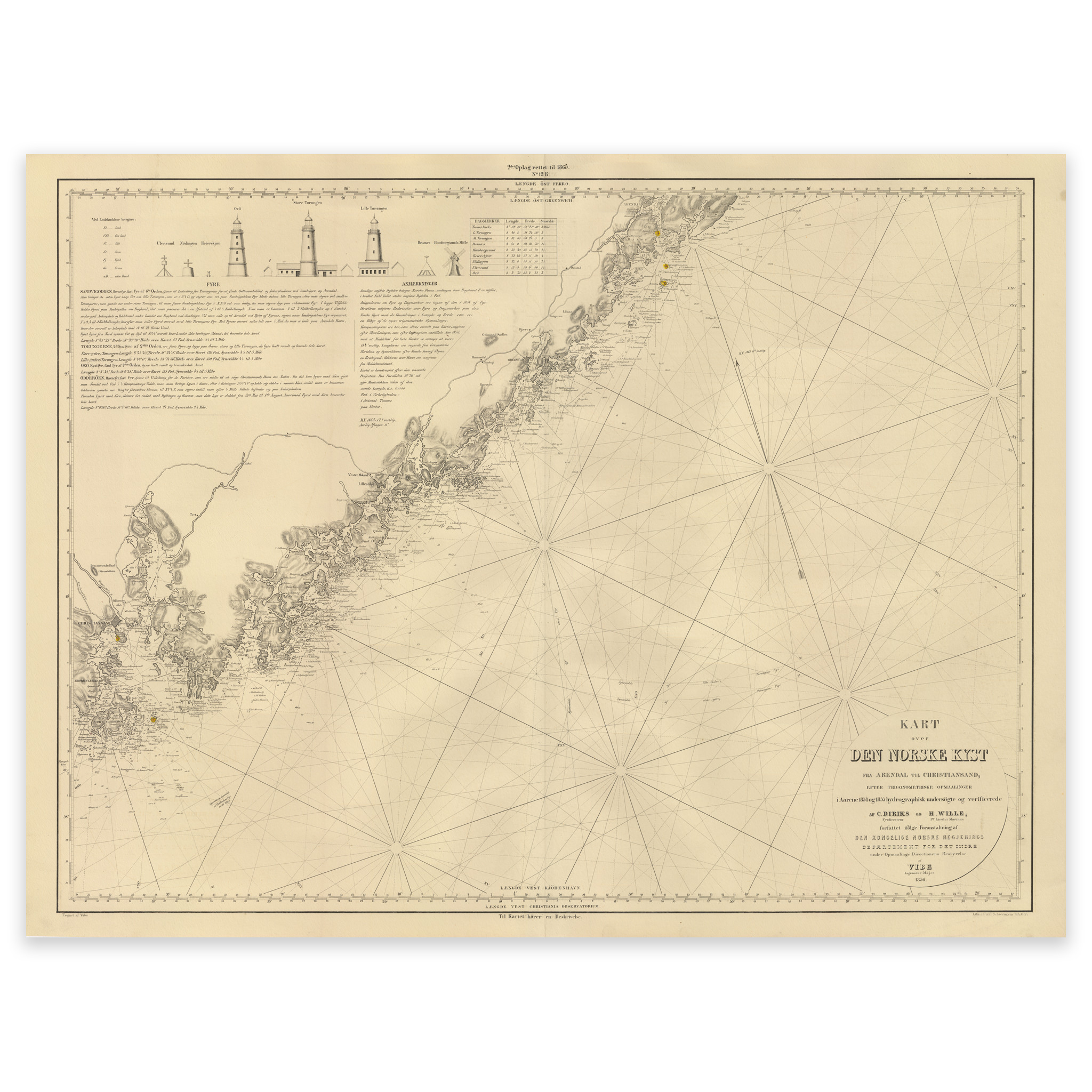
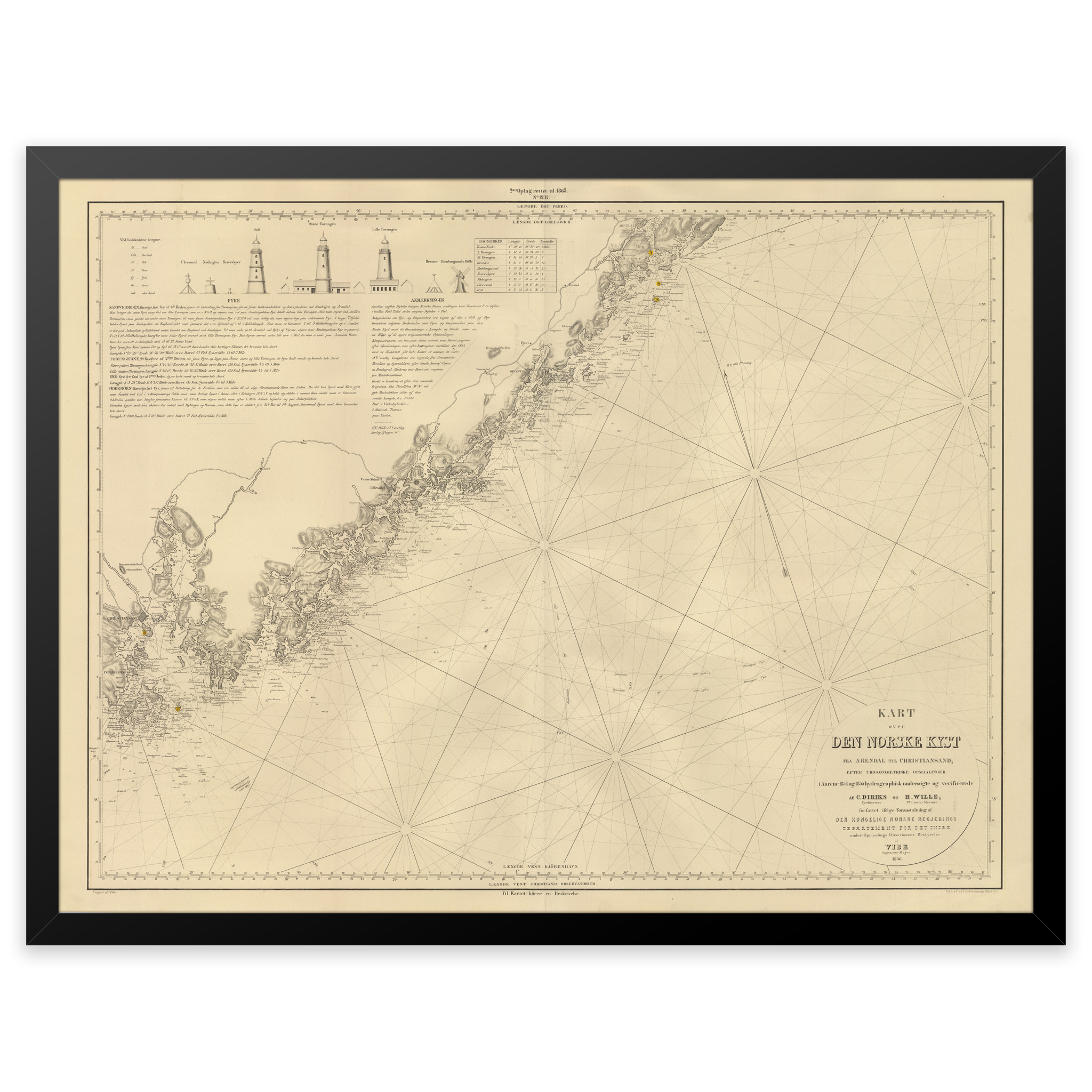
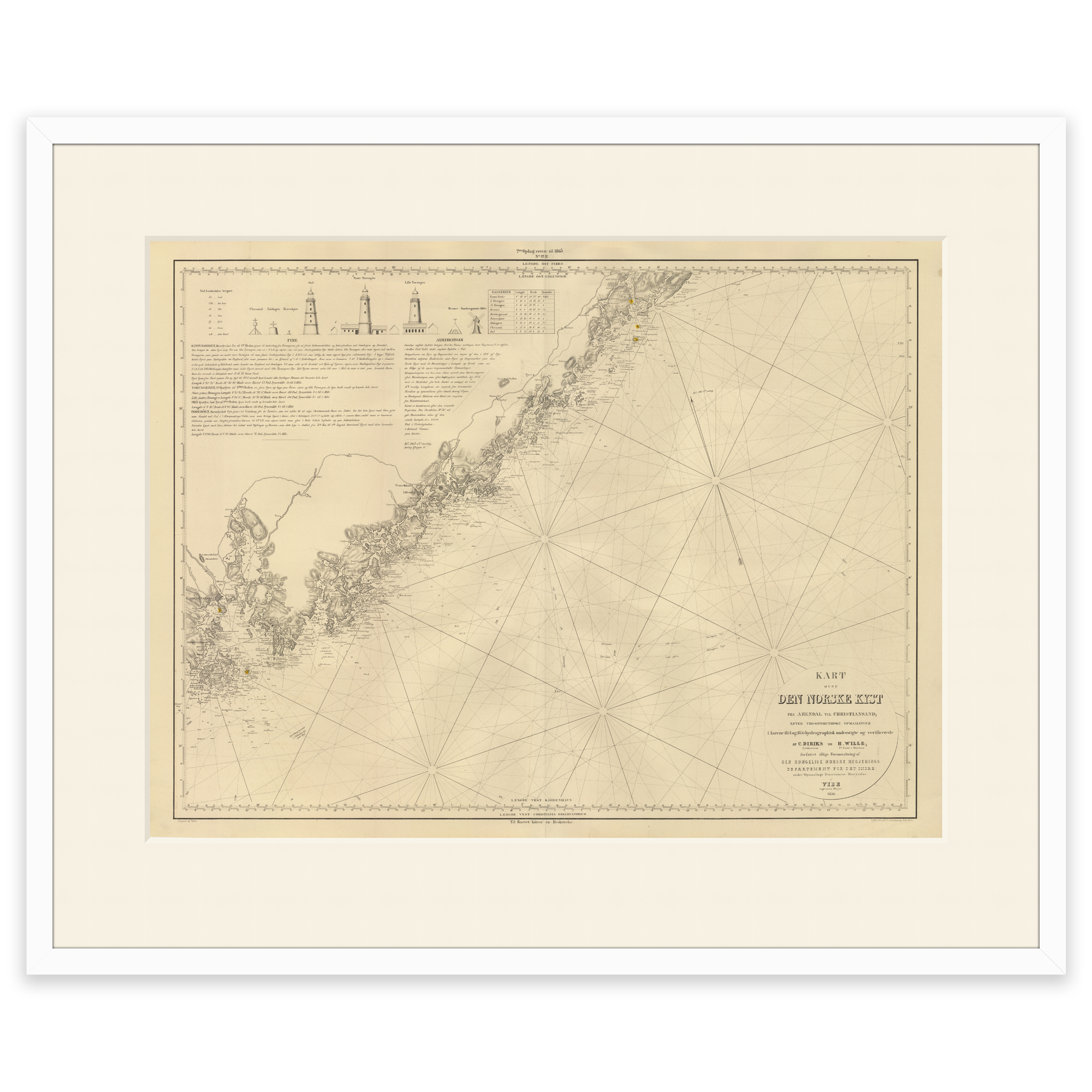
Historic nautical chart of the Kristiansand to Arendal stretch
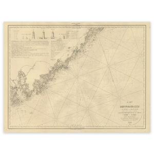
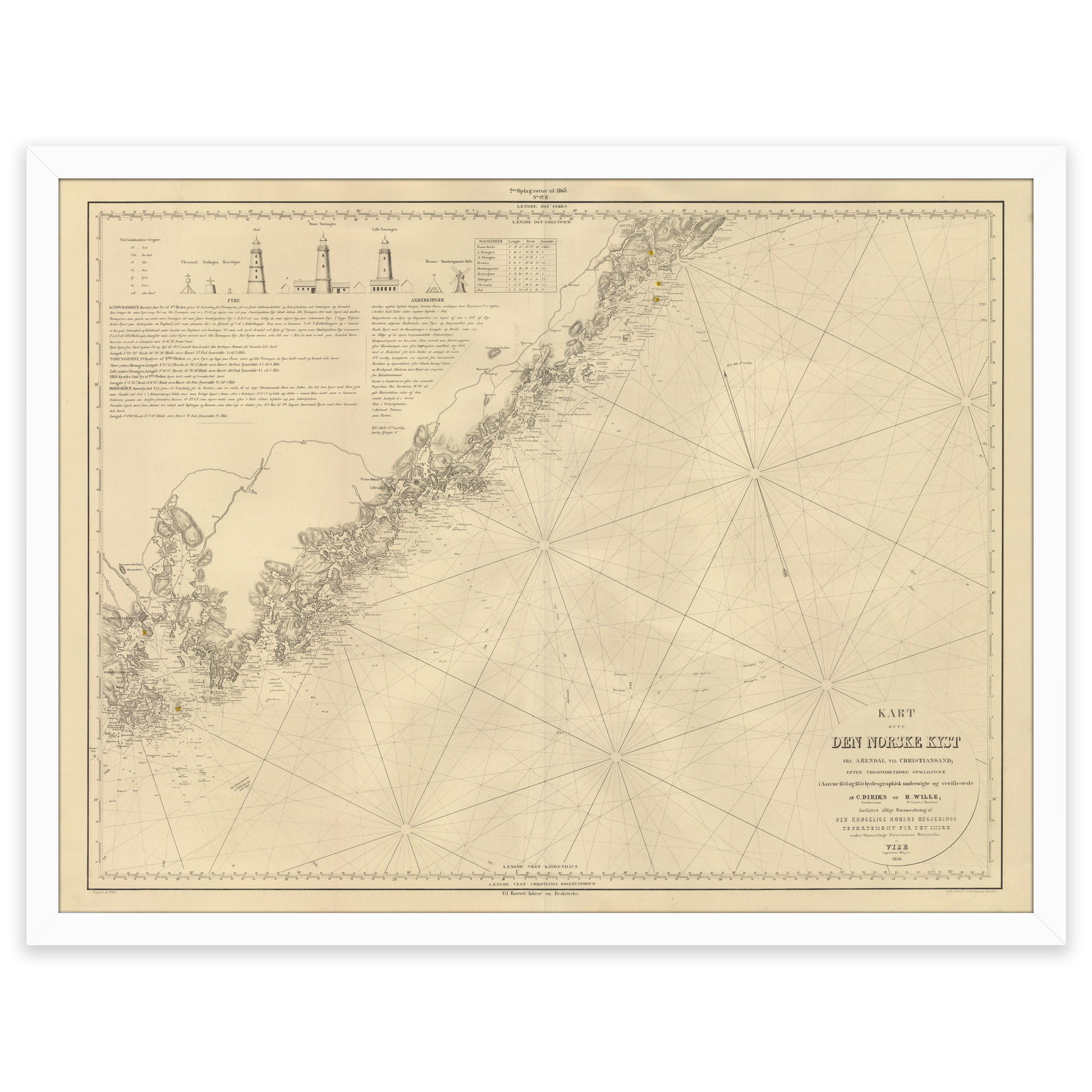
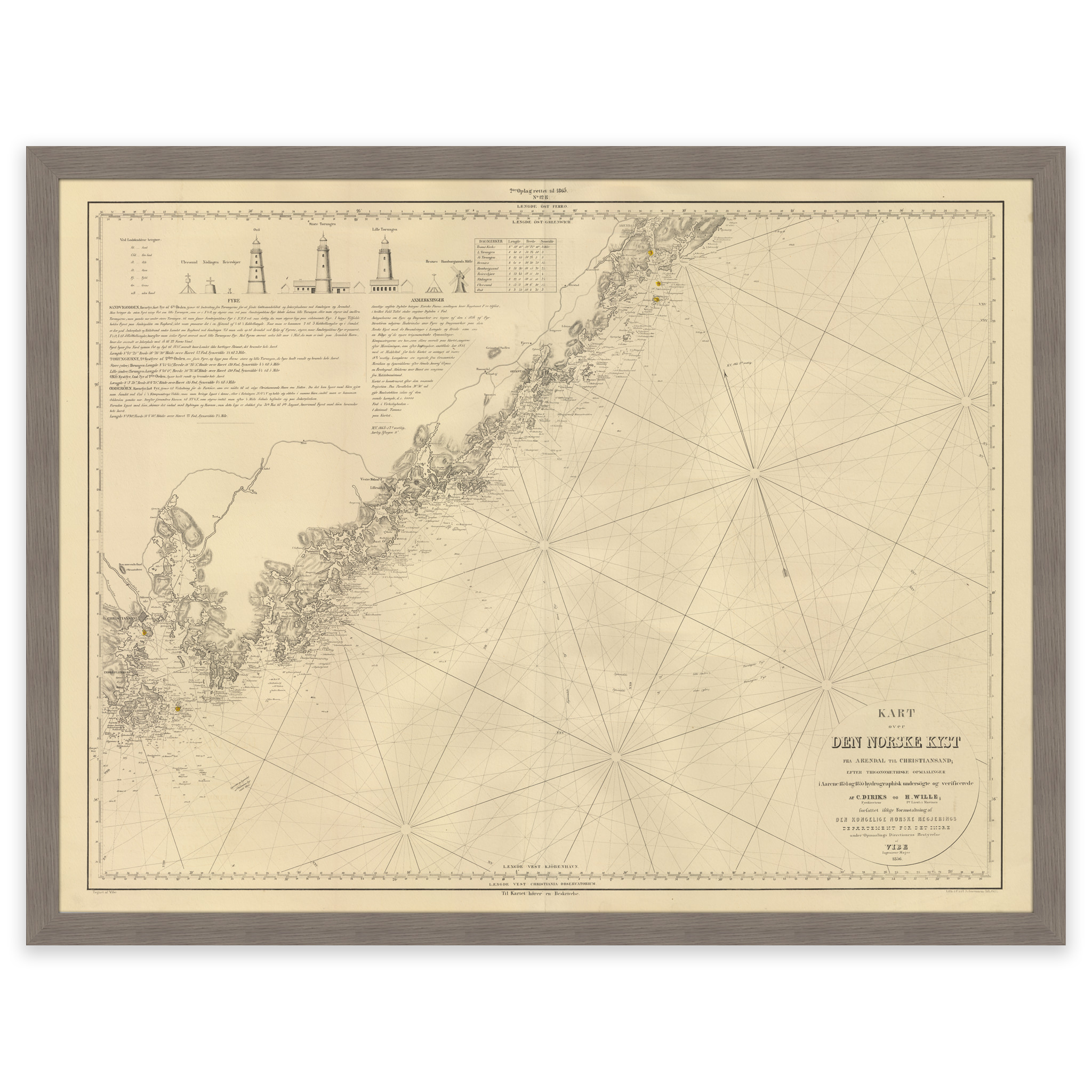
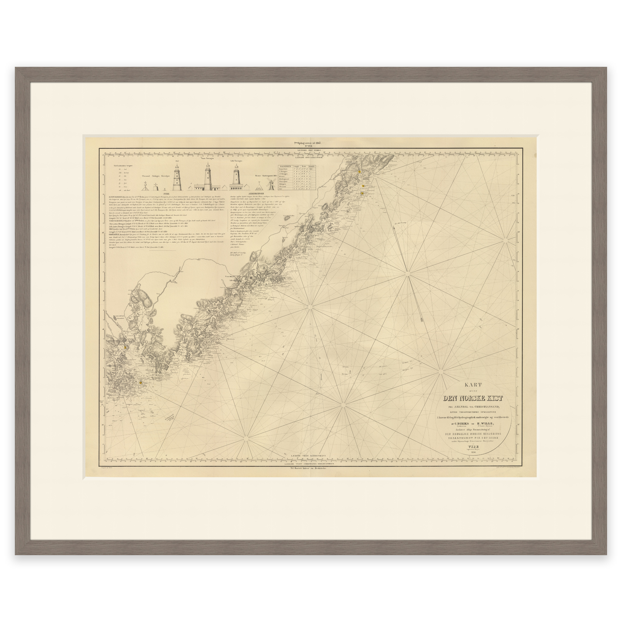
This nautical chart from 1865 shows the stretch from Kristiansand to Arendal. The map is delivered in its original size of 60.2 x 45.3 cm. The size with frame and passepartout is 78.2 x 64.3 cm. Do you want the map in a different size? Just get in touch – we’ll be happy to give you a quote for customization.