

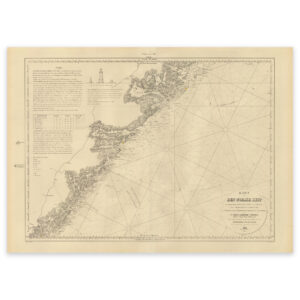
 Historical nautical chart of the Jomruland and Kragerø to Arendal section


Historical nautical chart of the Jomruland and Kragerø to Arendal section
This nautical chart from 1865 shows the stretch from Jomfruland and Kragerø to Arendal. The map comes in its original size of 64.3 x 46.2 cm. The size with frame and passe-partout is 82.3 x 65.2 cm. Would you like the map in a different size? Just get in touch – we’ll be happy to give you a quote for customization.