

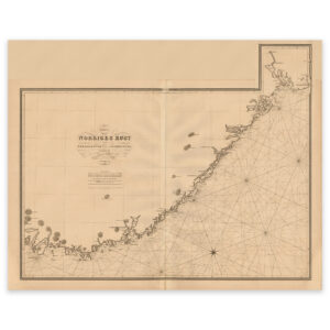
 Historical nautical chart of the Norwegian coast from Lindesnes to Fredrikstad


Historical nautical chart of the Norwegian coast from Lindesnes to Fredrikstad
This map from 1842 shows the entire coastline from Lindesnes to Fredrikstead. The map is delivered in its original size of 91.8 x 91.3 cm. Do you want the map in a different size? Just get in touch – we’ll be happy to give you a quote for customization.