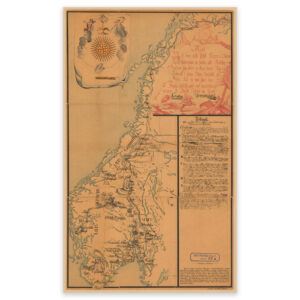


 Jeløya 1822
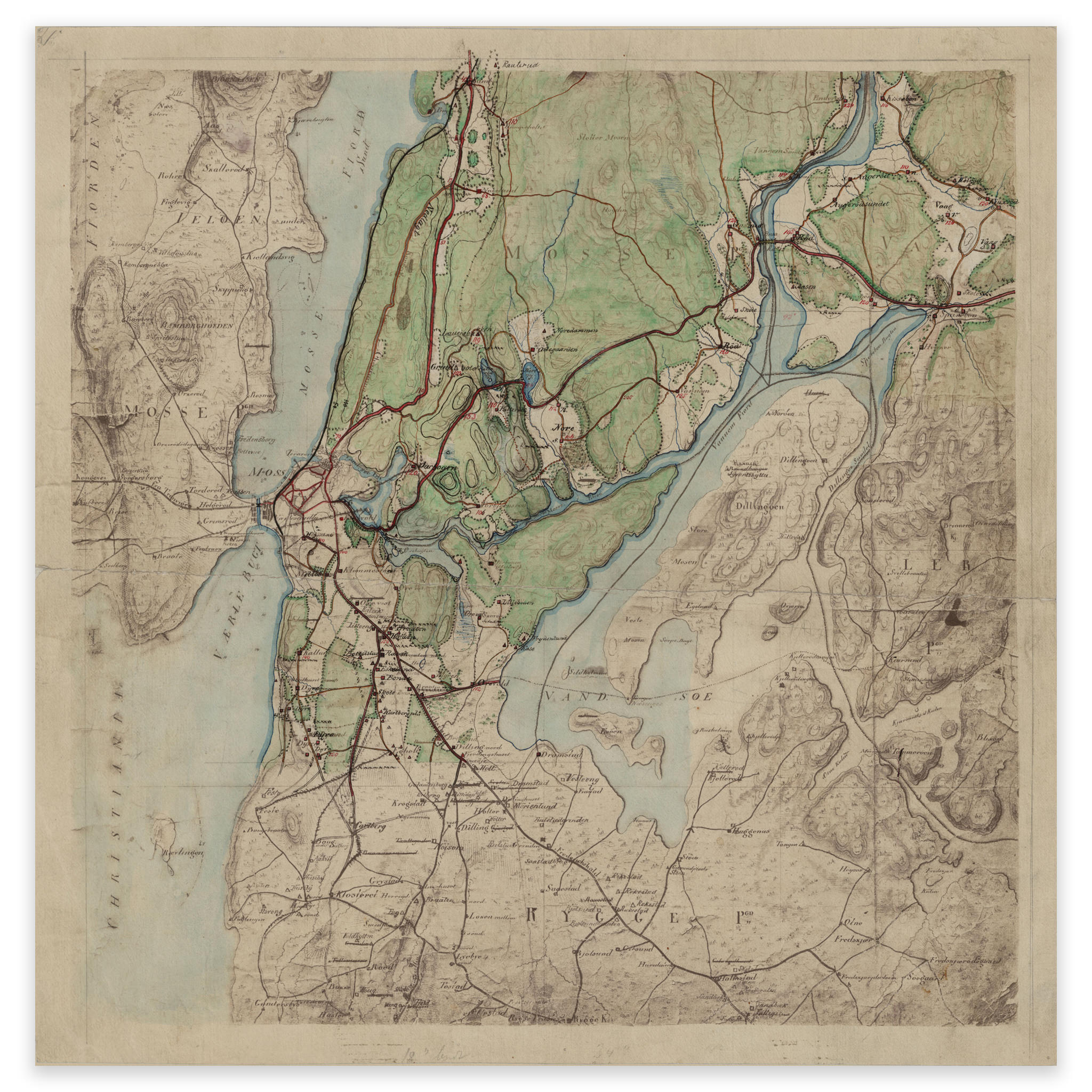
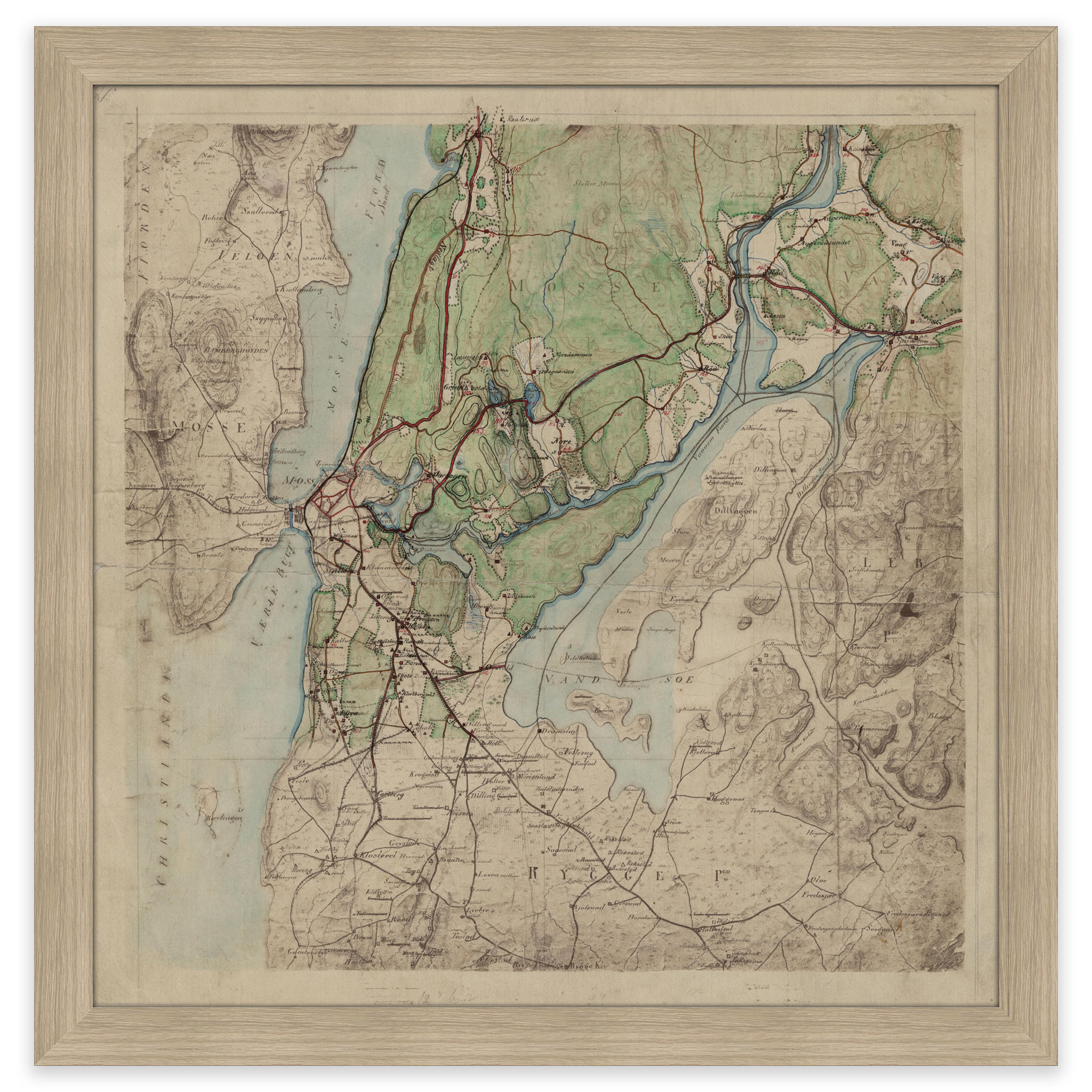
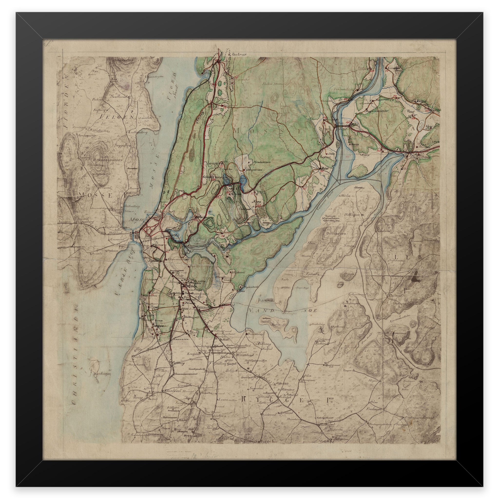
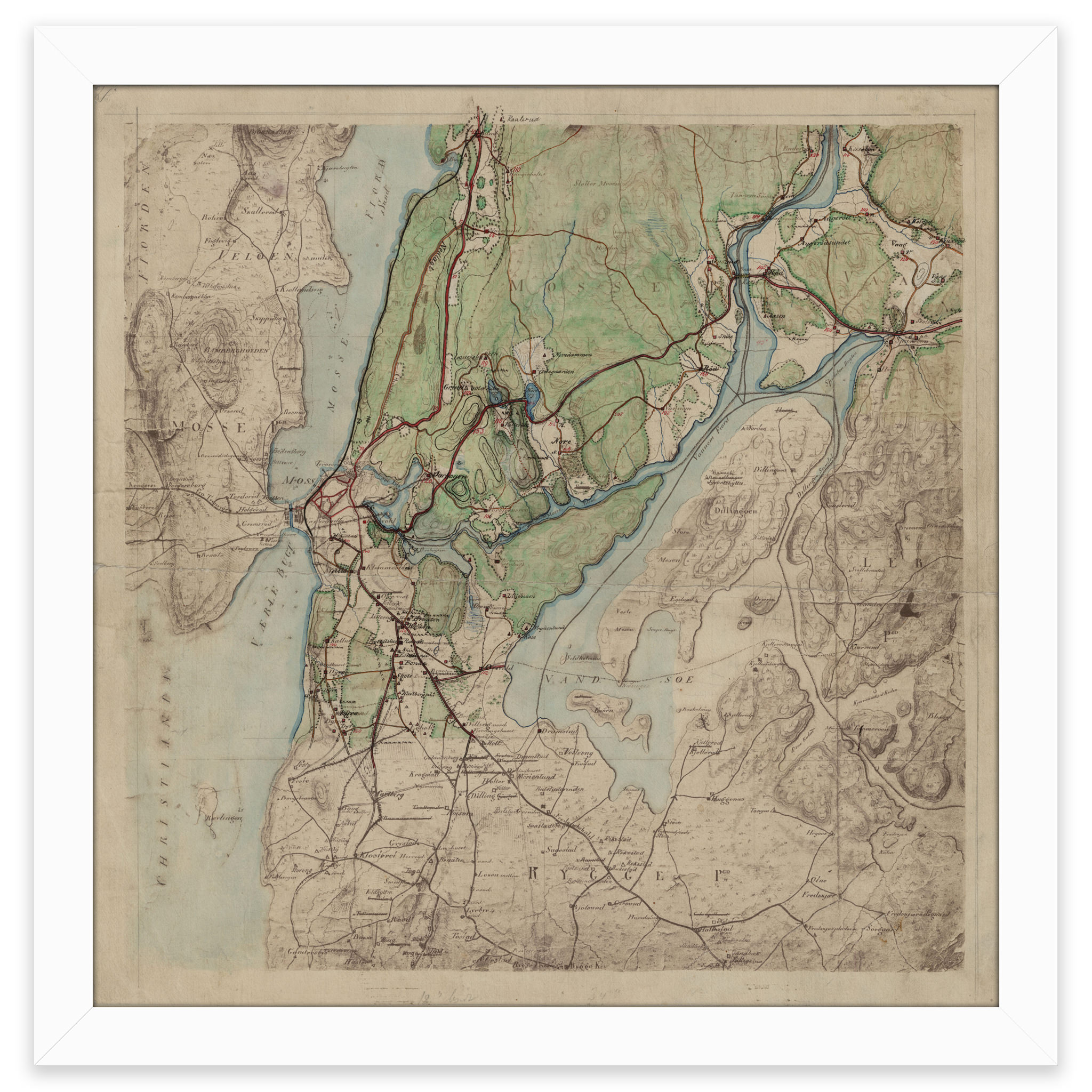
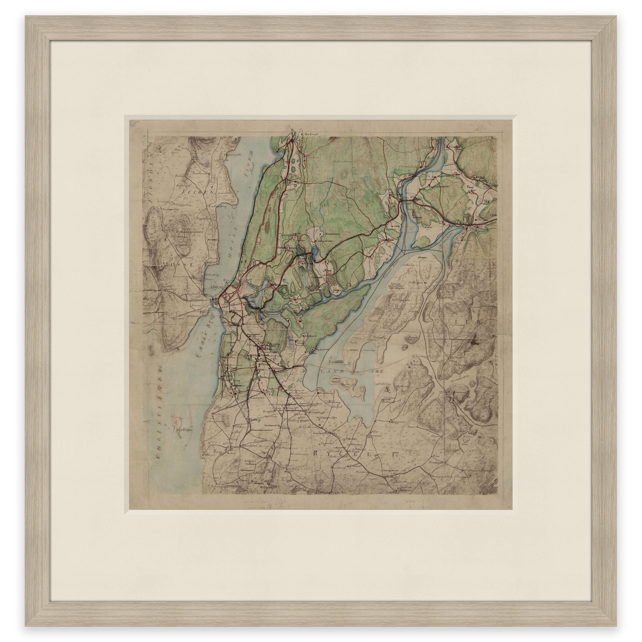
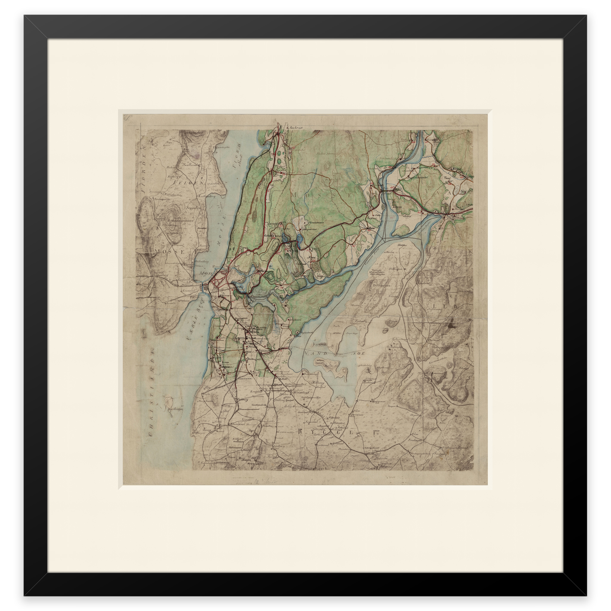
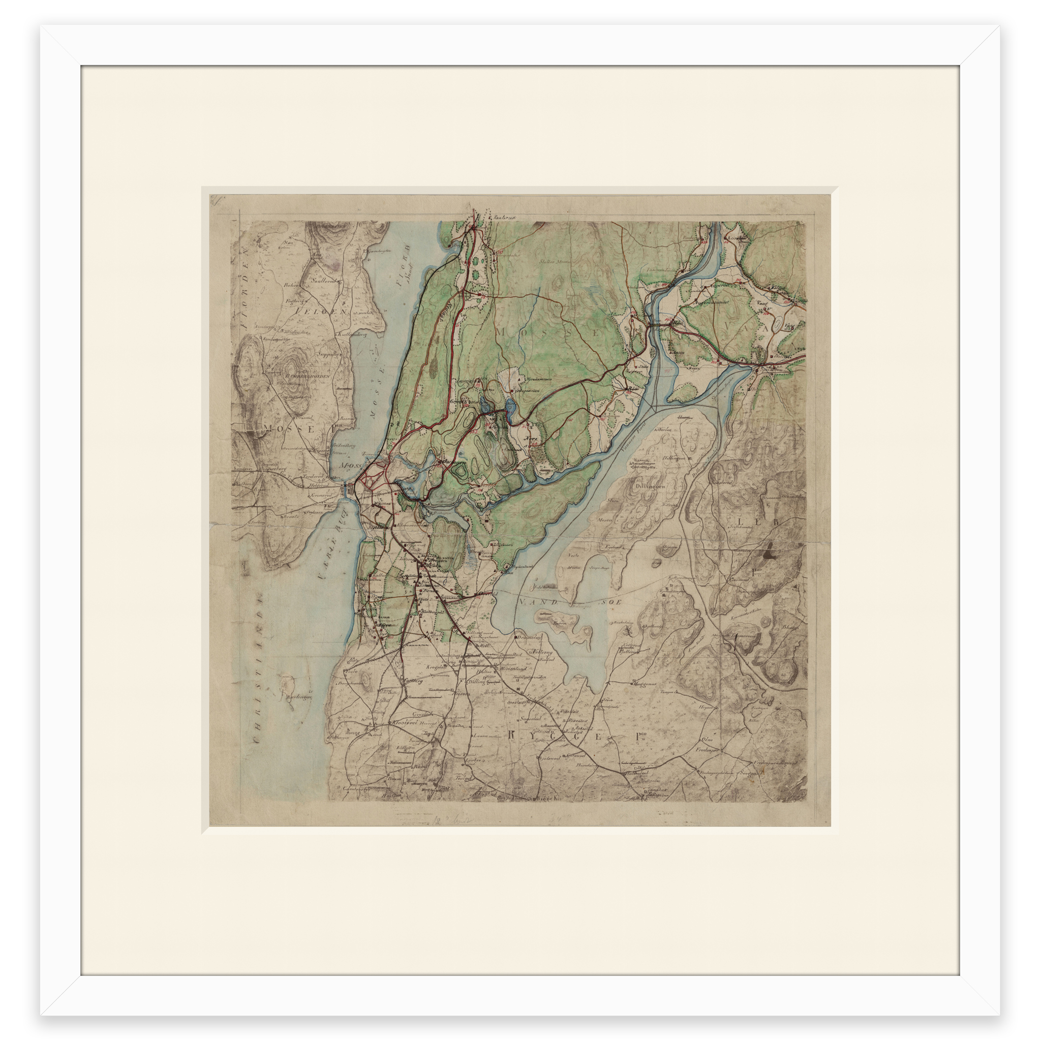
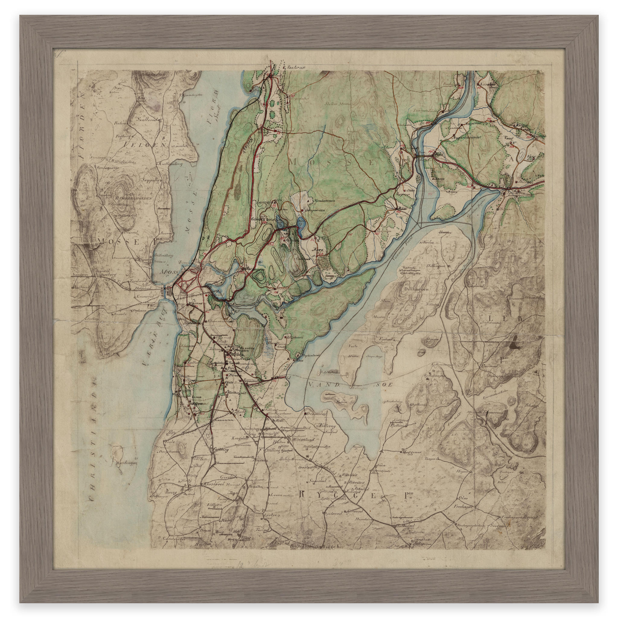
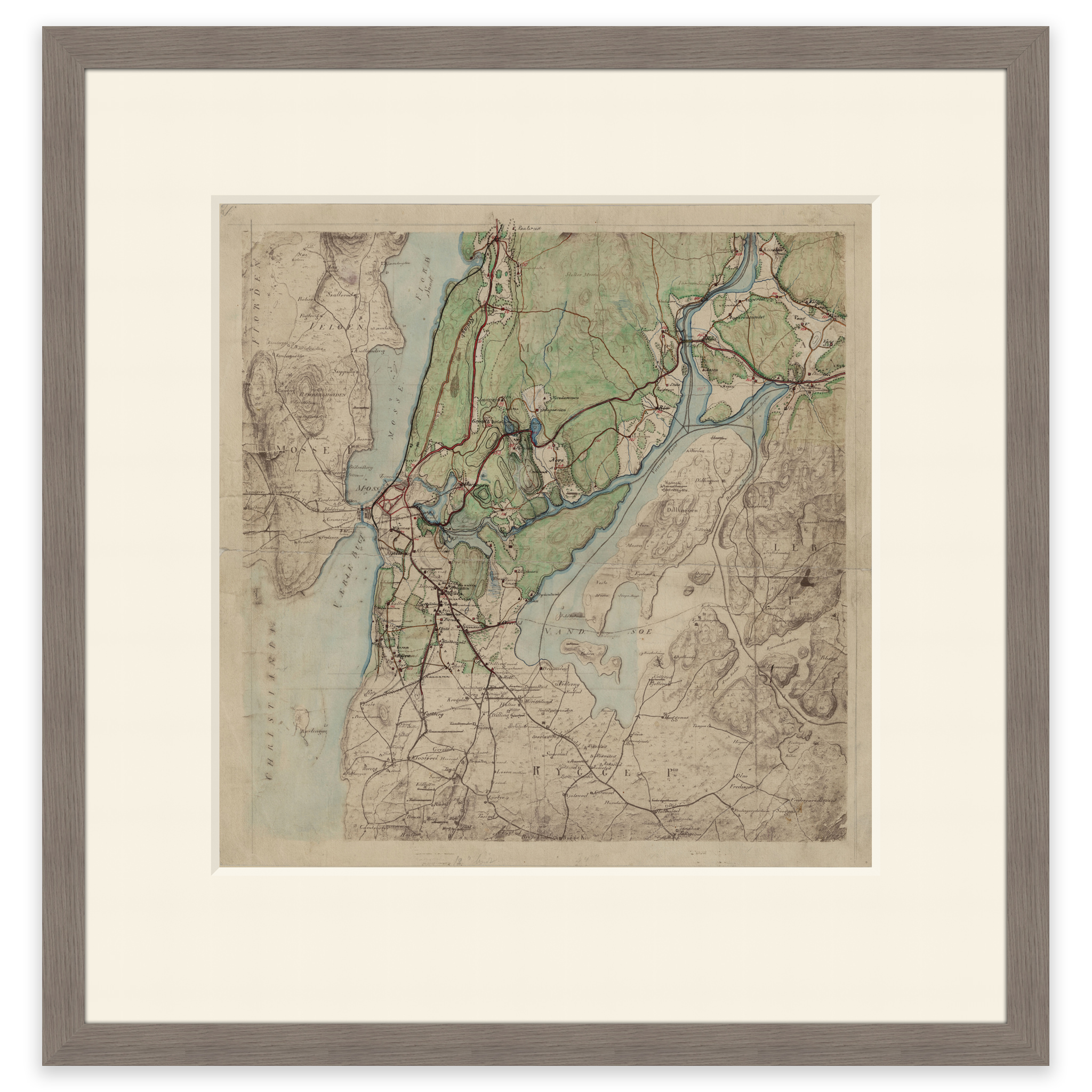
Jeløya 1822
Hand-drawn map of parts of Østfold. The area of Jeløya, Moss and Dilling-øya. The map is hand-drawn by L. A. The original size of the map is 30.9 x 31.4 cm. The size with frame and passe-partout is 46.9 x 48.4 cm. Do you want the map in a different size? Just get in touch – we’ll be happy to give you a quote for customization.