Description
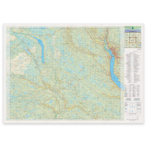
Kartverket Landkart N50 is Norway’s most detailed and proven topographic map series, developed for precise orientation, hiking and planning. This edition has been updated in May 2025 and is based on the Norwegian Mapping Authority’s latest map data, produced by Norway’s official map authority.
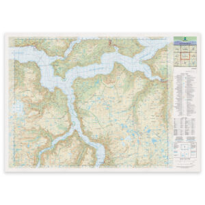
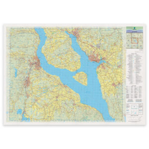
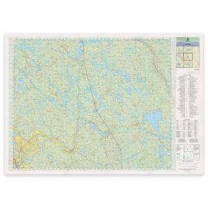
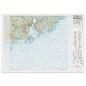
The map provides a detailed and clear representation of the landscape and terrain, with clear markings of buildings, contours, forests, cultivated land, coastal contours, rivers, streams, water, marshes and glaciers. In addition, roads, paths, railways, airports, municipal boundaries and protected areas are shown. In coastal areas, the map also includes detailed depth and navigation information taken from nautical charts, making the map particularly useful in transition zones between land and sea.
The 1:50,000 scale provides an optimal balance between detail and overview, making the map suitable both for active use in the field and for analysis, teaching and wall mounting at home, in the cabin or in the office.
The map can be delivered on several materials and in different designs, depending on the area of use. Standard delivery is maps on rolls in size 103 × 73 cm, produced on professional map plotters approved by the Norwegian Mapping Authority. It can be supplied on uncoated matt map paper in both thin and thick quality, on water- and tear-proof Tyvek® for rough use, or on exclusive cotton-based art paper if the map is to be framed.
For wall use, the map can also be supplied pre-assembled on a 2 mm aluminum composite board, which provides a stable, flat and durable map ready for hanging. The sheets are supplied with profile strips on the back and are available in both standard versions and with glass film. The glass film gives shaded maps a clear three-dimensional look, provides an extra durable surface and makes it possible to draw on the map with whiteboard markers. This solution is also suitable for outdoor installation.
The map can alternatively be delivered pre-framed, with or without passepartout. The passepartout is 1.8 mm thick and manufactured by Canson, giving the map a more exclusive and airy look. The map is framed with float glass without spacers, and the fully framed size is 124 × 93 cm.
This is the latest available and updated edition of the map sheet, produced by the Norwegian Mapping Authority for reliable use in both private, professional and public contexts.