

 Kristiansand 1802
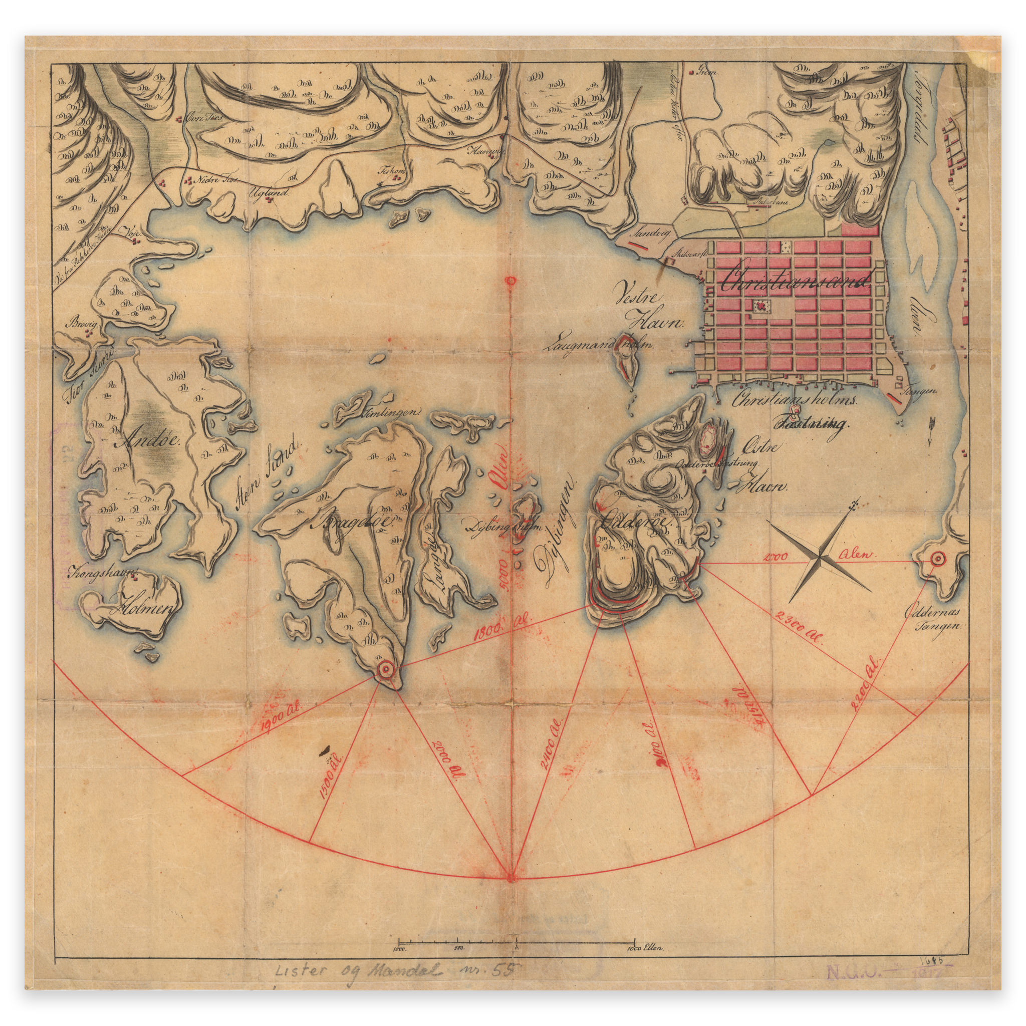


Kristiansand 1802
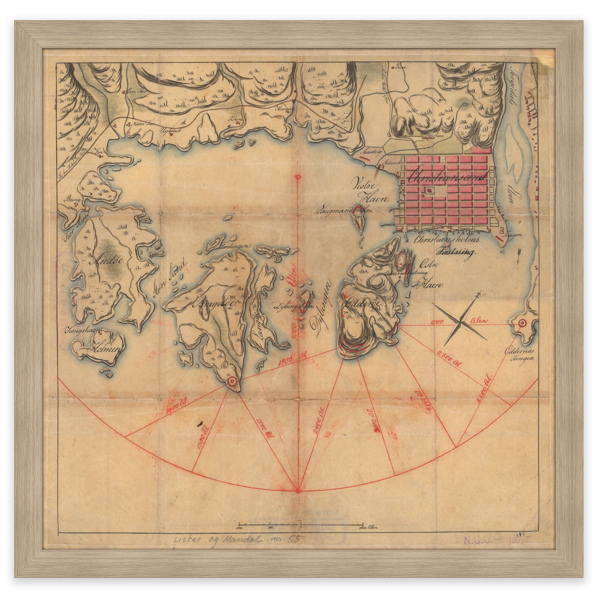
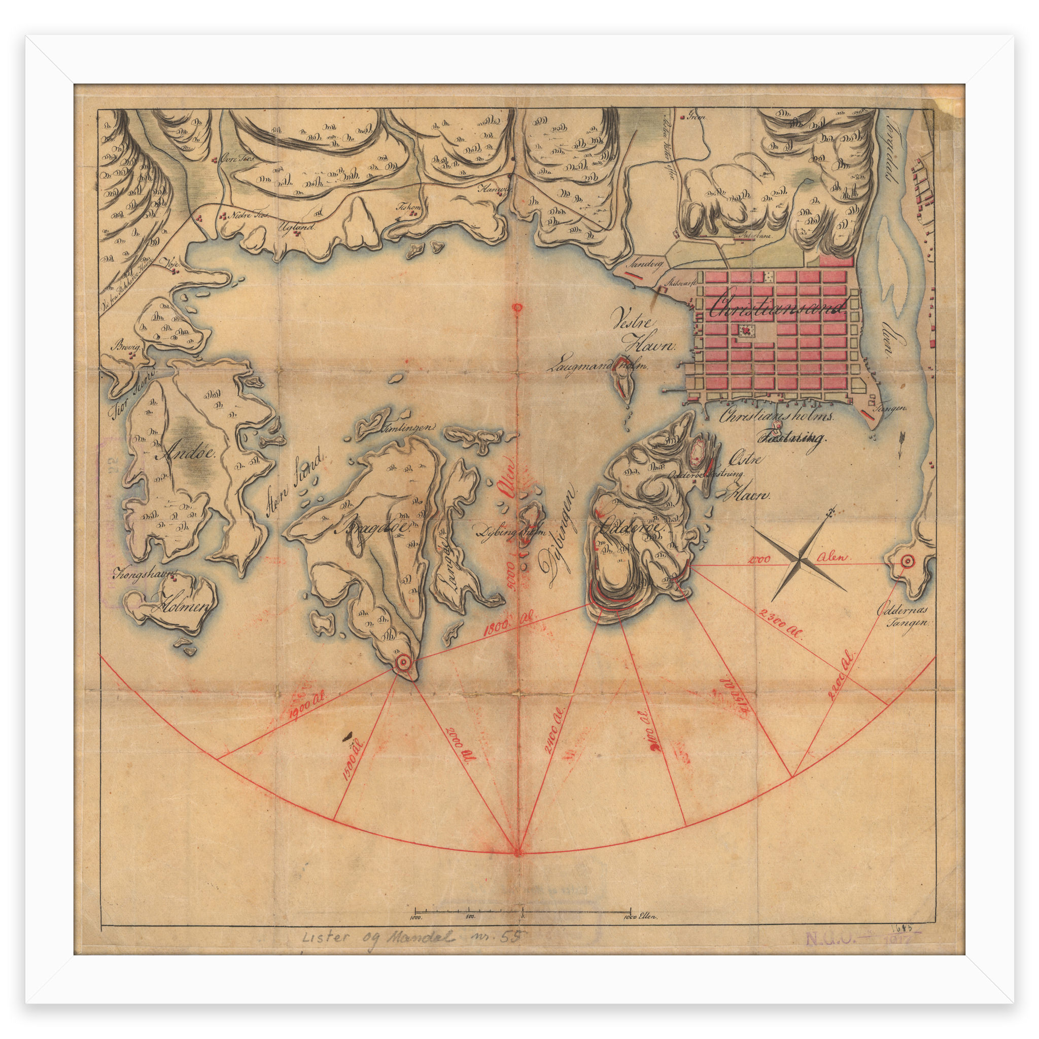
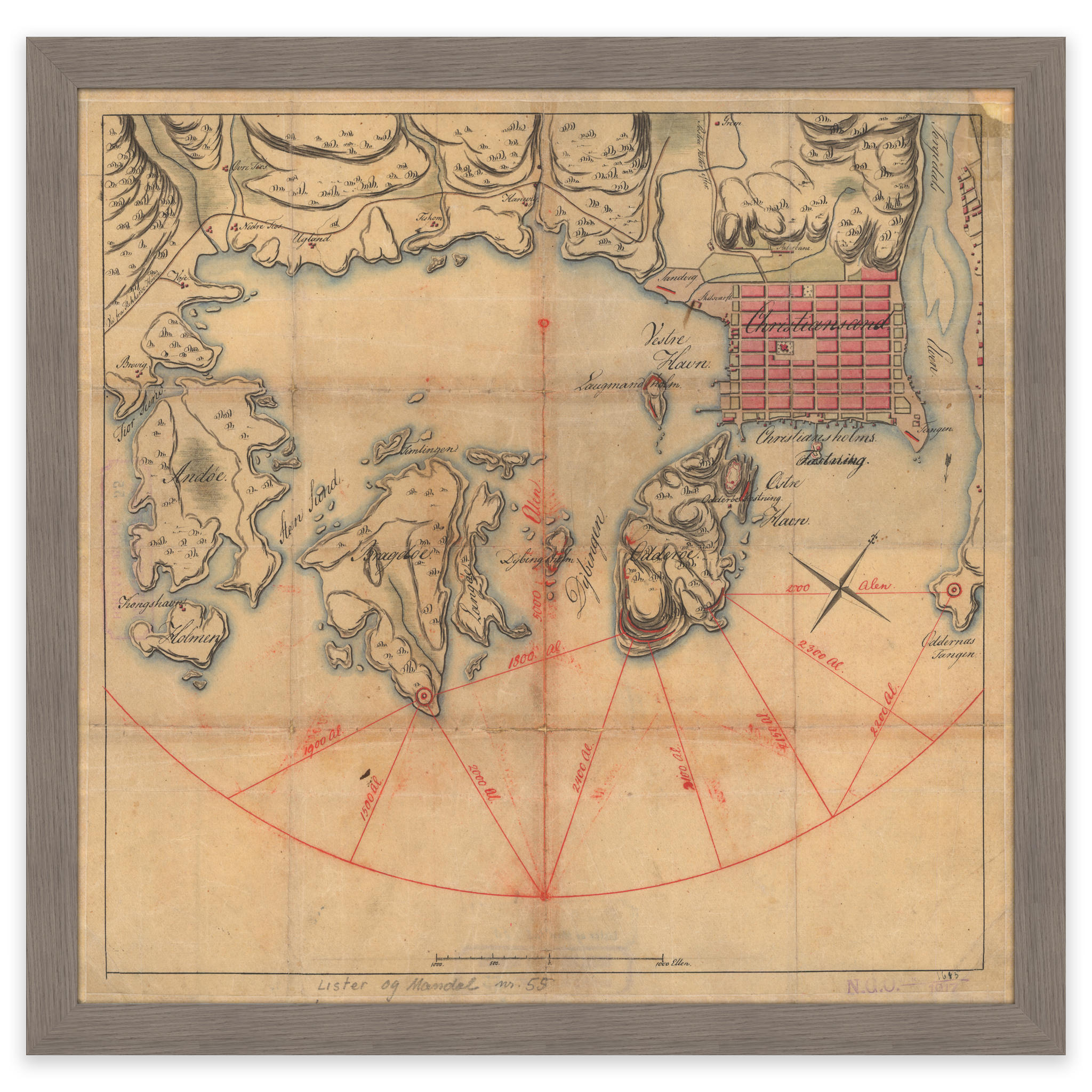
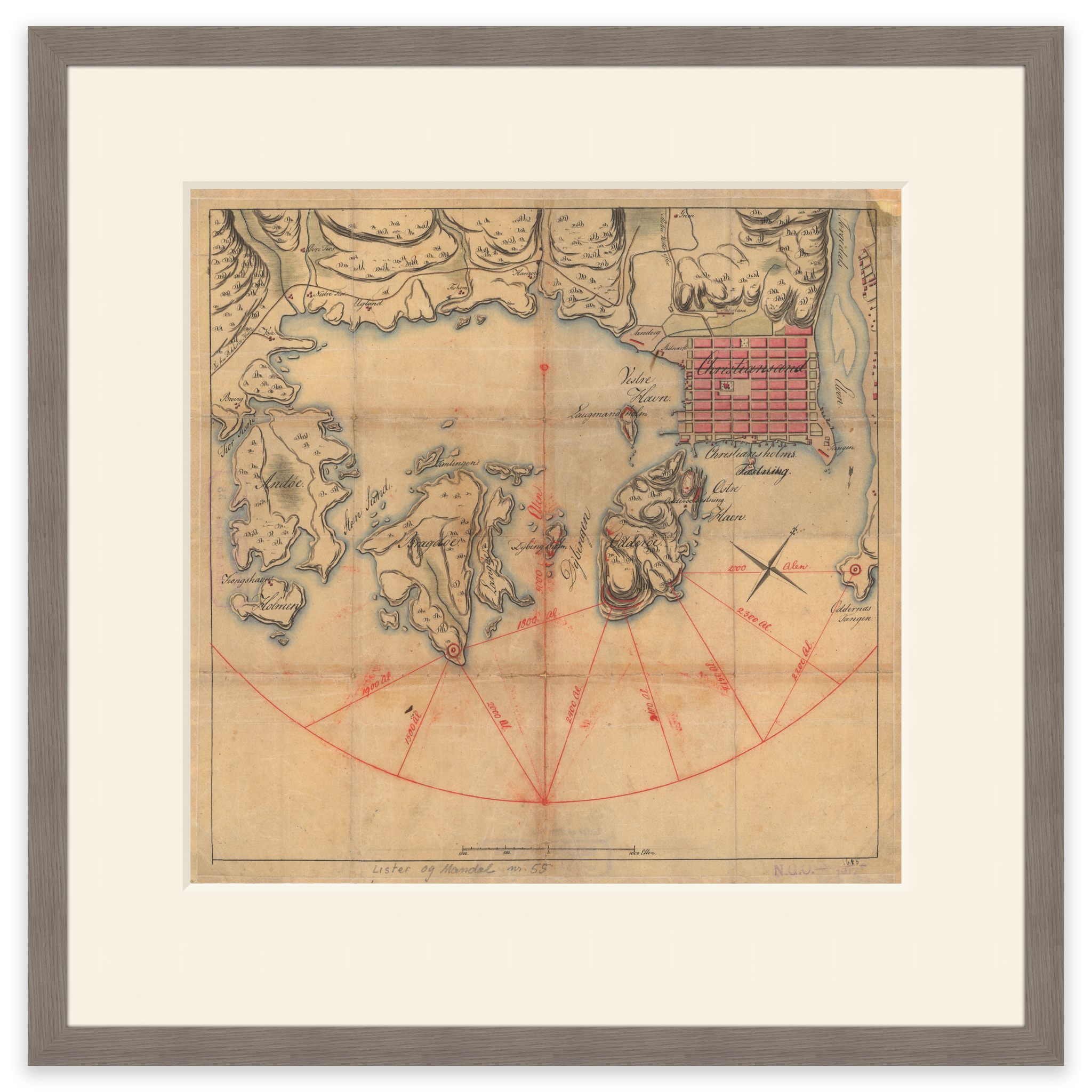
Map of the entrance to Kristiansand from 1802, with course lines to beacons on both Bragdøy and Odderøya. With the help of these course lines, accurate cross bearings could be made to navigate safely to port. The map comes in its original size of 36.7 x 35.8 cm. The size with frame and passe-partout is 52.7 x 52.8 cm. Would you like the map in a different size? Just get in touch – we’ll be happy to give you a quote for customization.