


 Kristiansund 1790
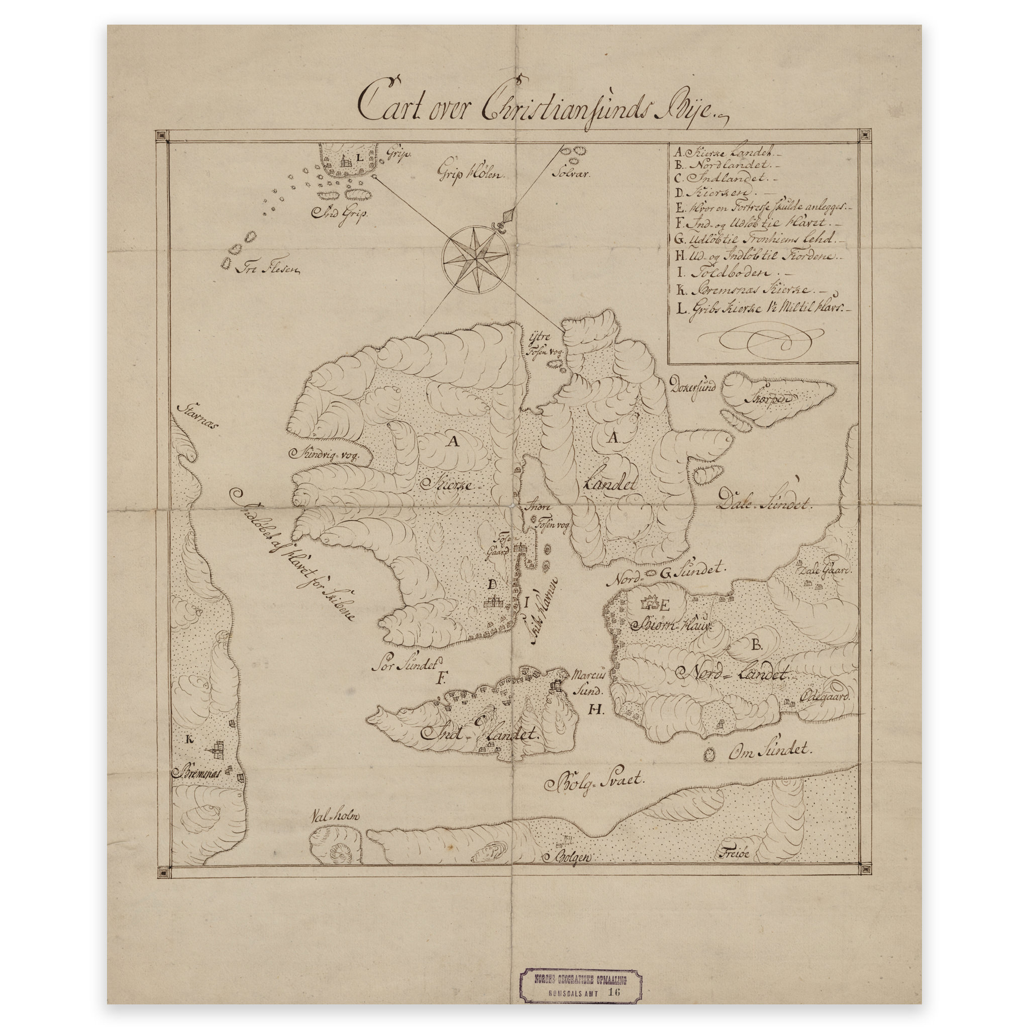


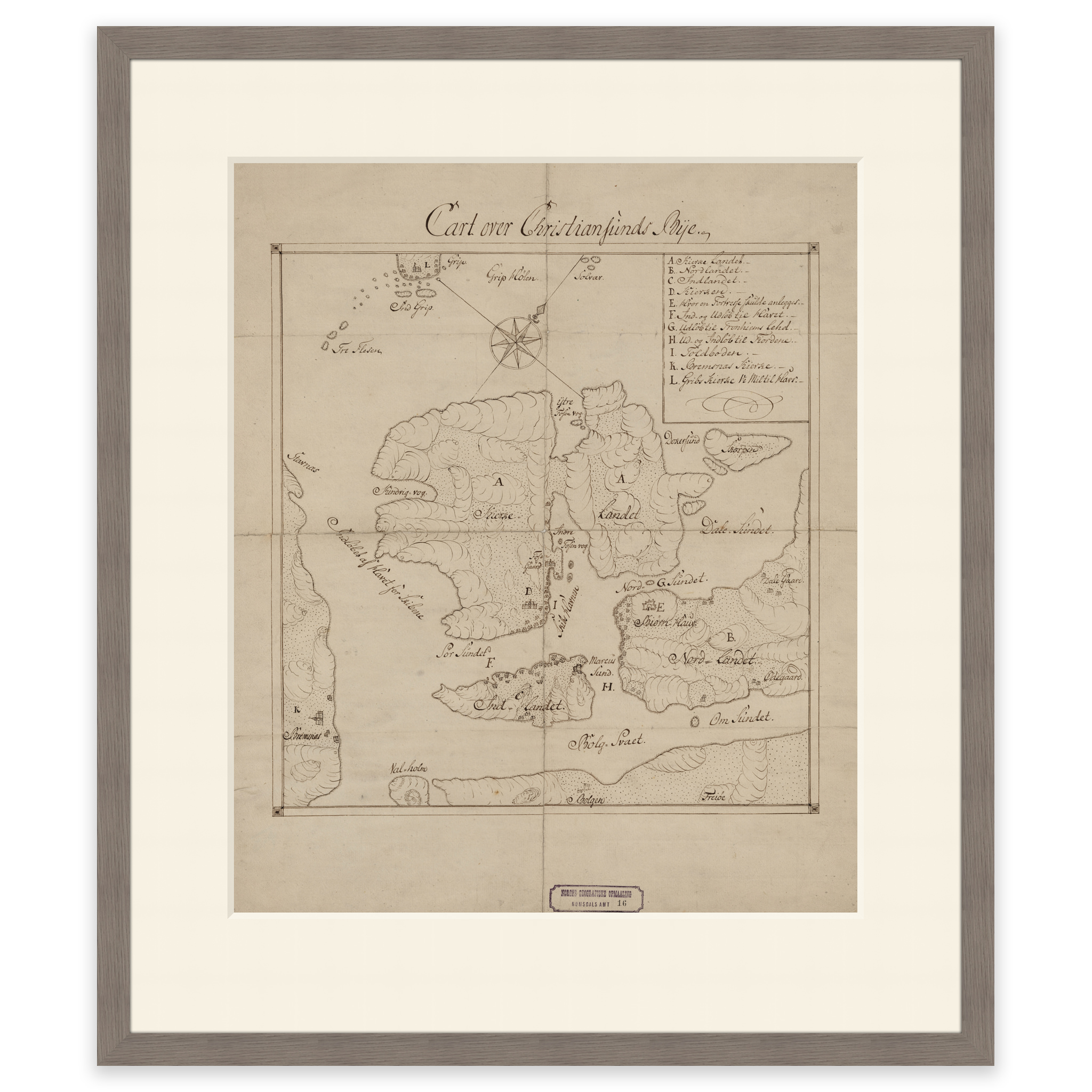
Kristiansund 1790
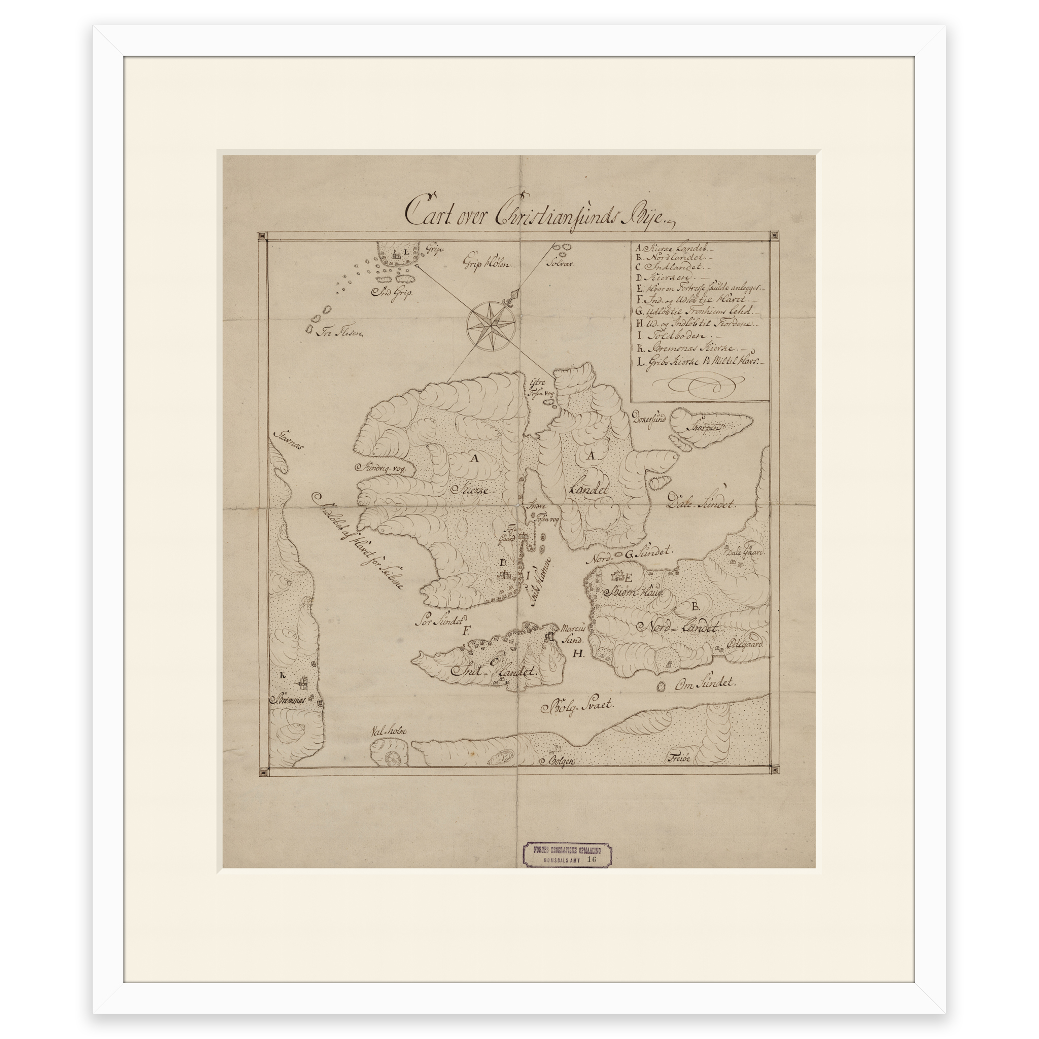
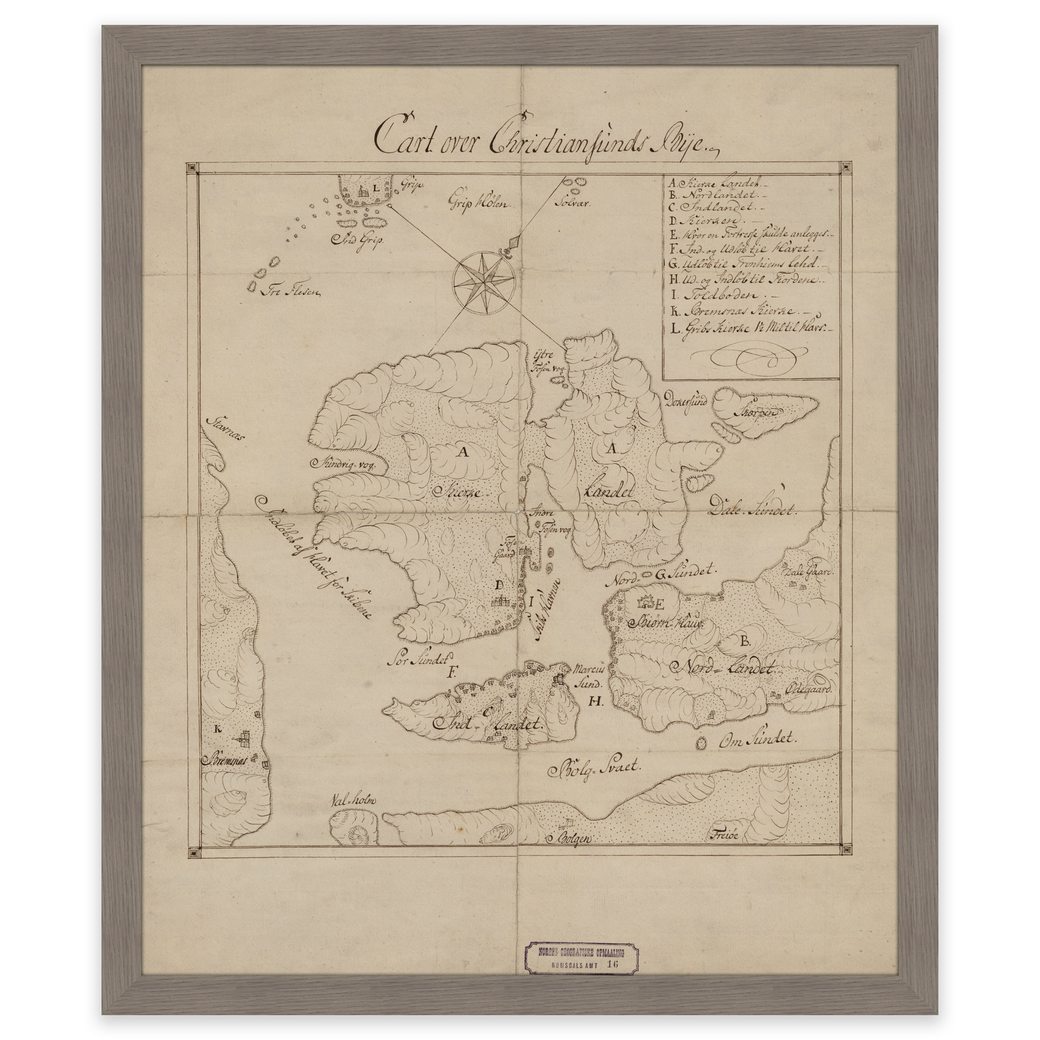
This is a hand-drawn map of Kristiansund from 1790, showing Innlandet, Kirklandet, Nordlandet and Skorpa. The map is delivered in original size 38.2 x 45.9 cm. The size with frame and passepartout is 54.2 x 62.9 cm. Would you like the map in a different size? Just get in touch – we’ll be happy to give you a quote for customization.