Description
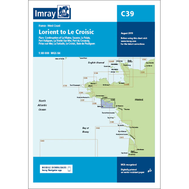
This boating map covers the French Atlantic coast from Lorient in the north to Le Croisic in the south. The map includes detailed plans and approaches to key ports and harbors such as Lorient, Île de Groix, Port Haliguen, La Trinité-sur-Mer, Port de Crouesty, Piriac-sur-Mer, La Turballe, Le Croisic and Baie de Pouliguen.
The chart is well suited for leisure boats and sailboats traveling along this part of Brittany’s south coast, either as part of inshore sailing or in preparation for further travel south along the Bay of Biscay. The area offers complex tidal conditions, currents and shallows, and the chart provides a solid basis for safe navigation and route planning.
Imray is a recognized British chart manufacturer with extensive experience in nautical cartography for leisure and long-distance sailing. The charts are developed with a focus on good readability, practical use and clear presentation of navigation-relevant information.