

 Map of Norway 1761
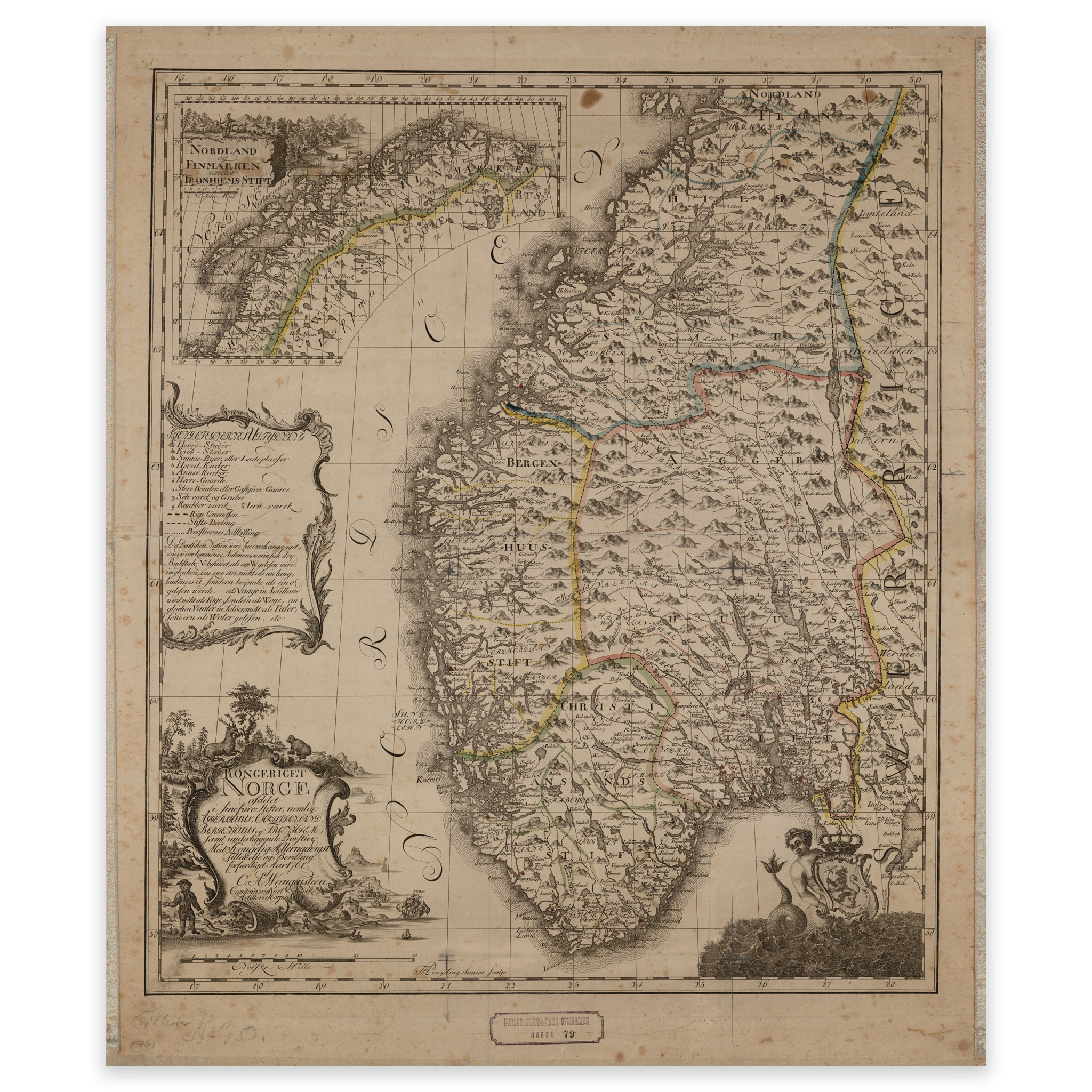
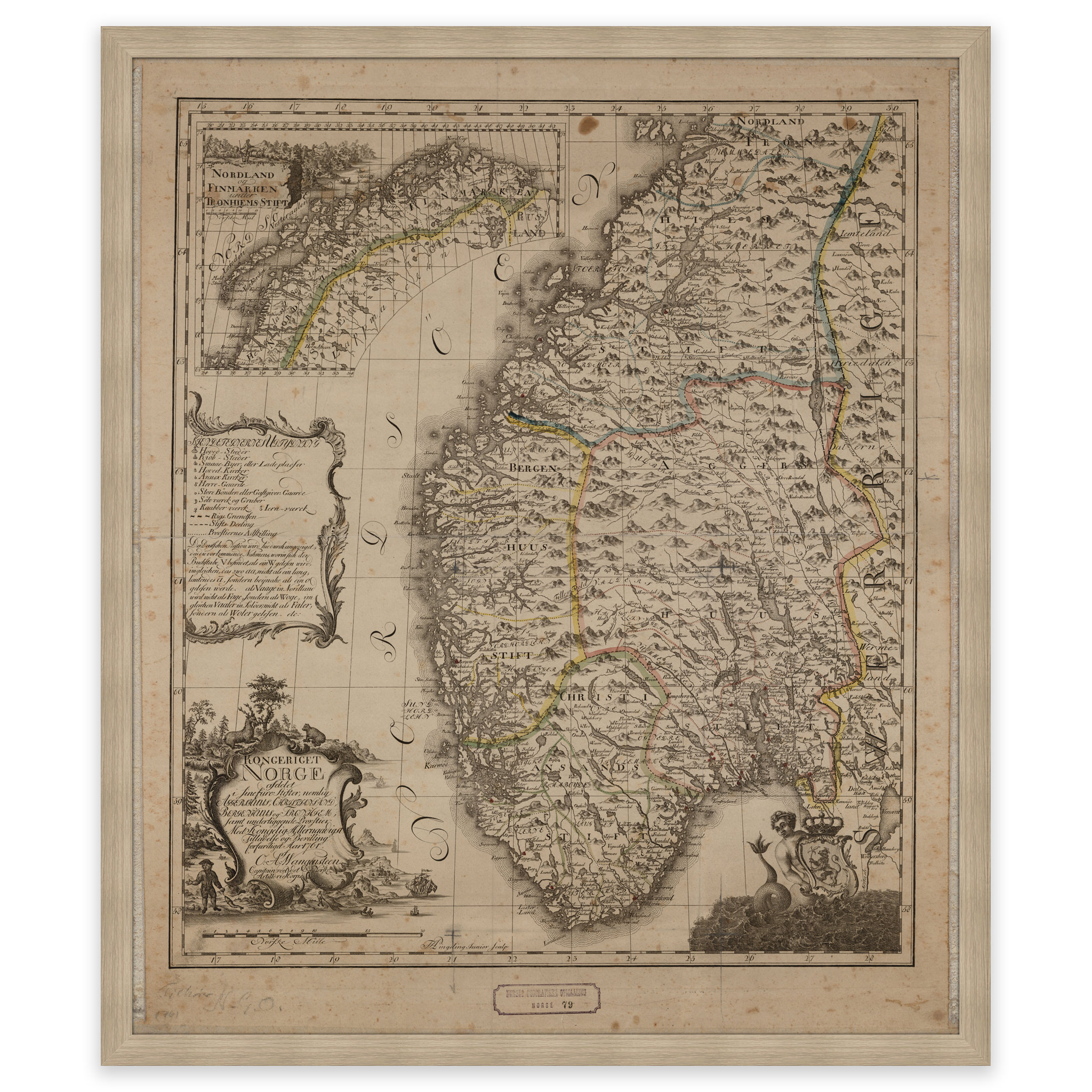


Map of Norway 1761
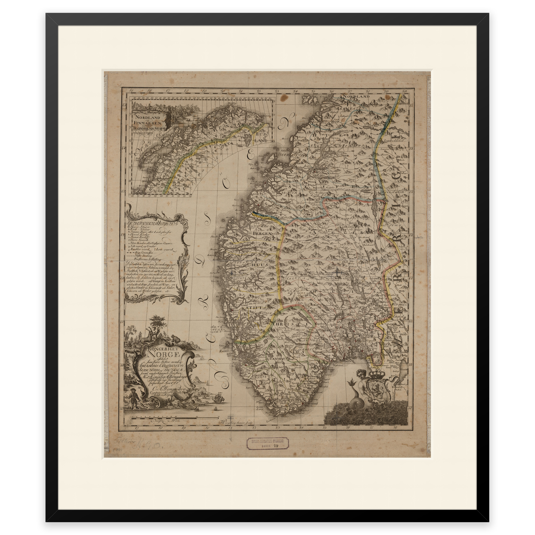
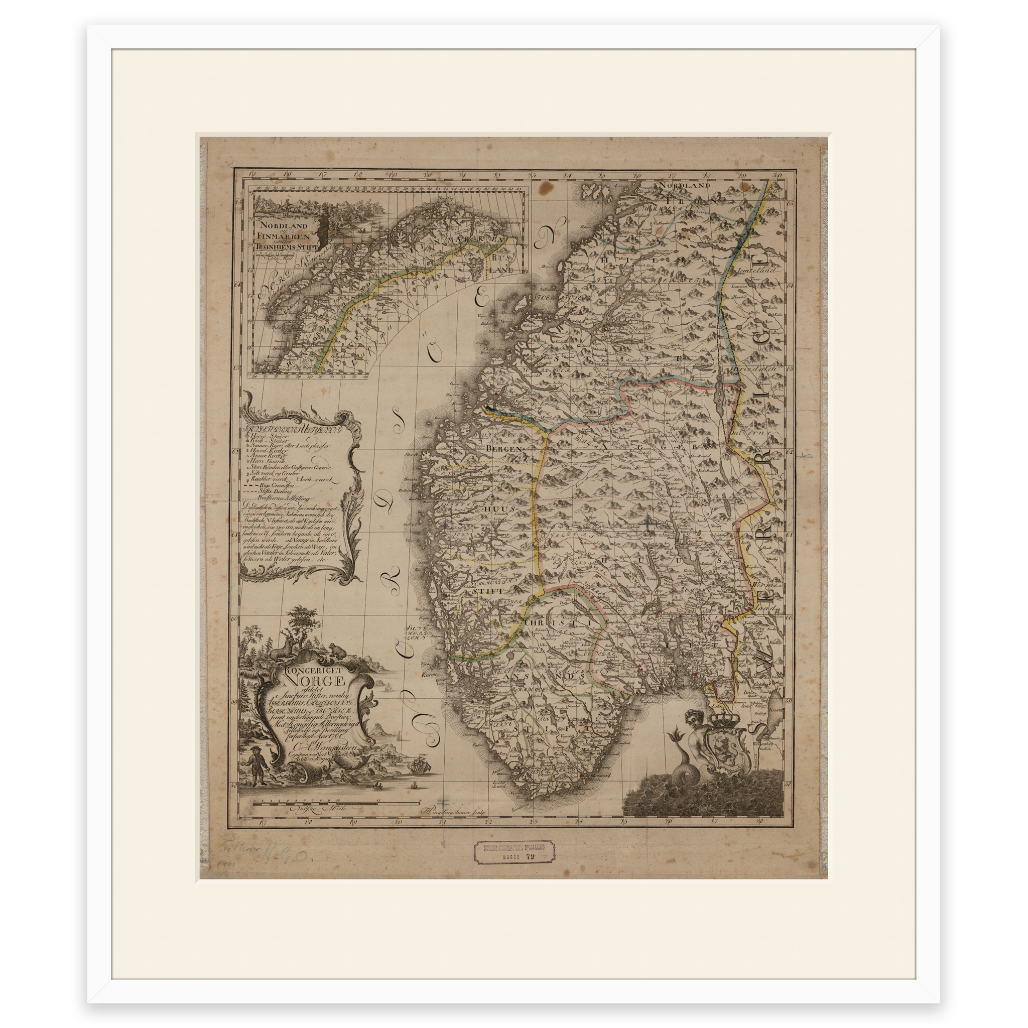
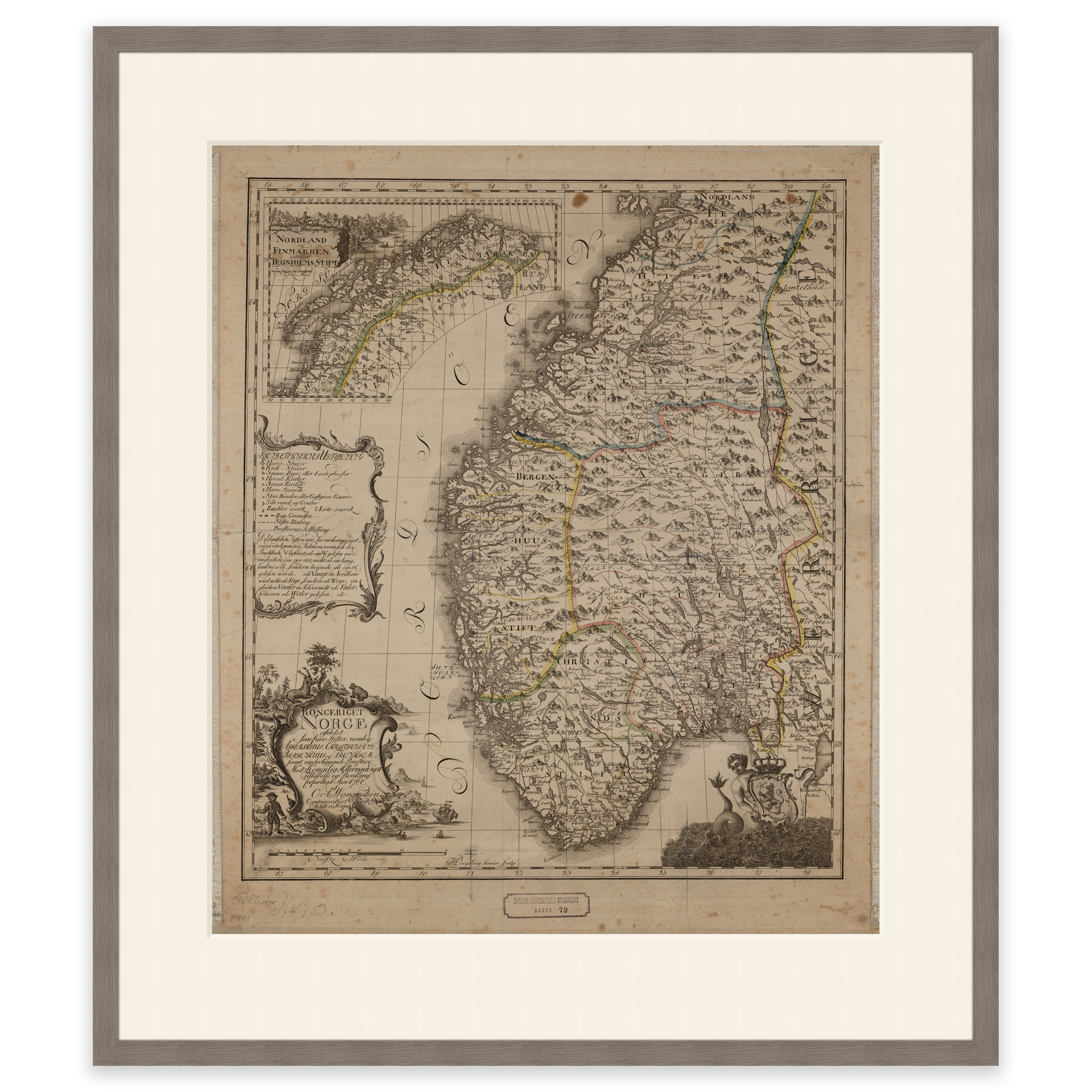
Ole Andreas Wangensteen’s map from 1761, one of the first printed maps of Norway drawn by a Norwegian cartographer. He used hand-colored copperplate engraving as a technique to create this map showing the four regions Norway was divided into. The map comes in its original size of 52.6 x 62.2 cm. The size with frame and passe-partout is 70.6 x 81.2 cm. Would you like the map in a different size? Just get in touch – we’ll be happy to give you a quote for customization.