

 Map of the Norwegian Sea 1728
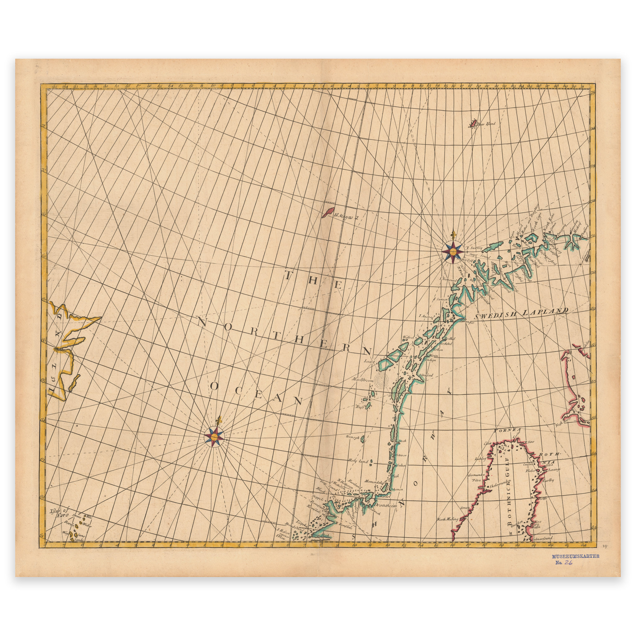


Map of the Norwegian Sea 1728
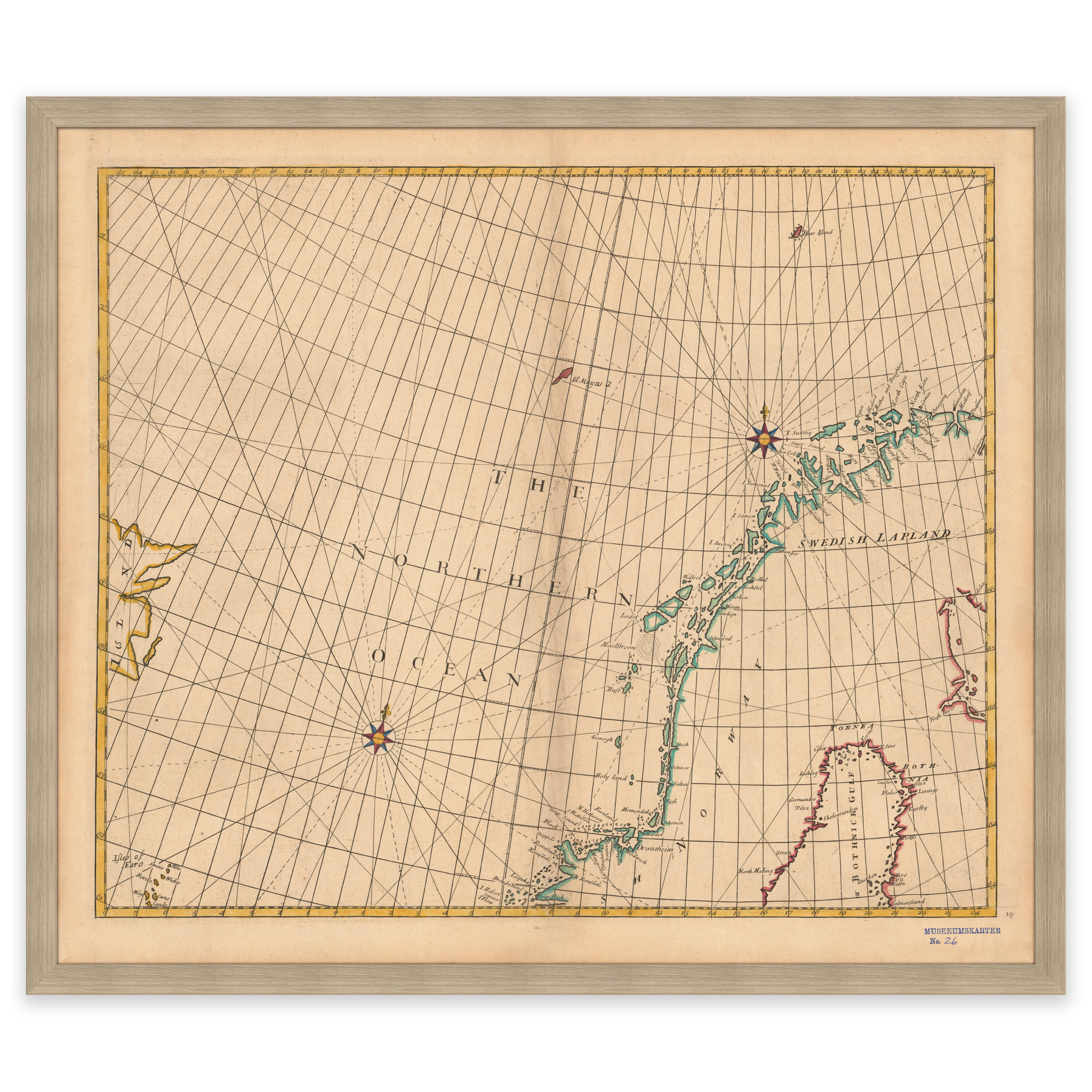
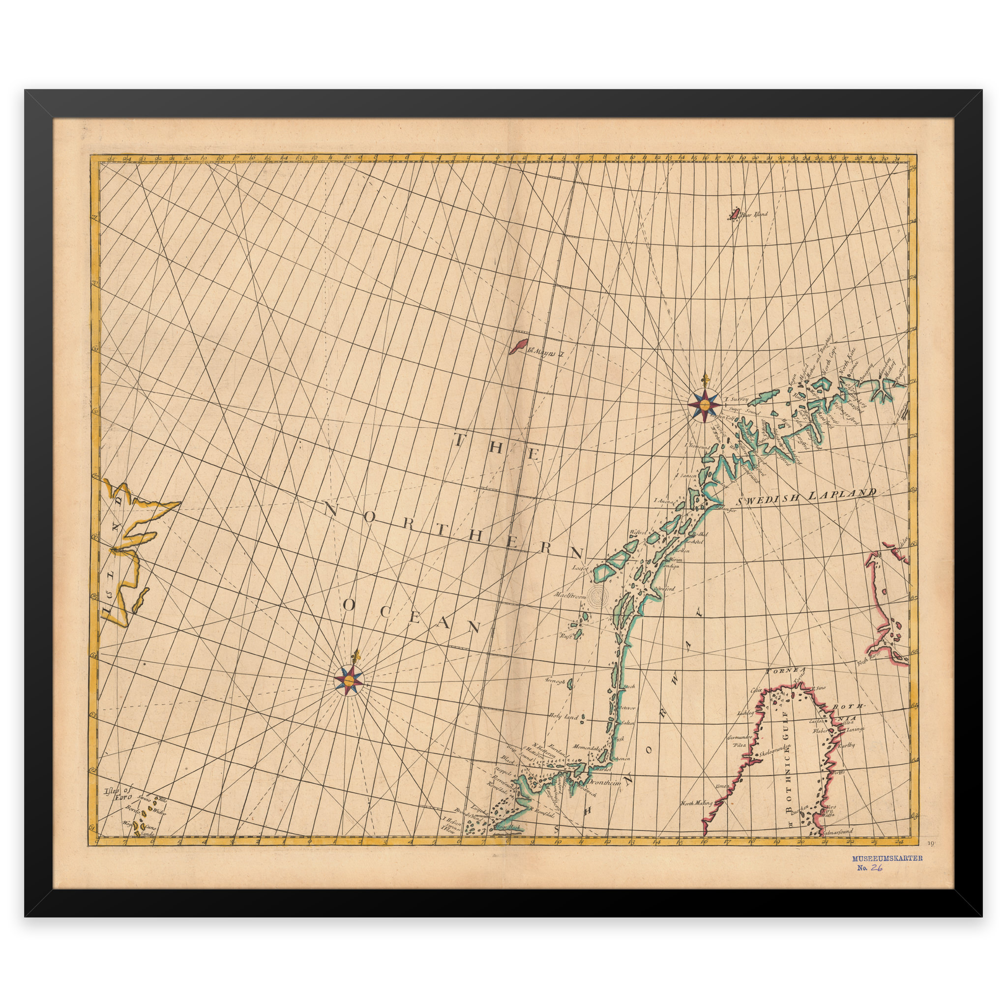
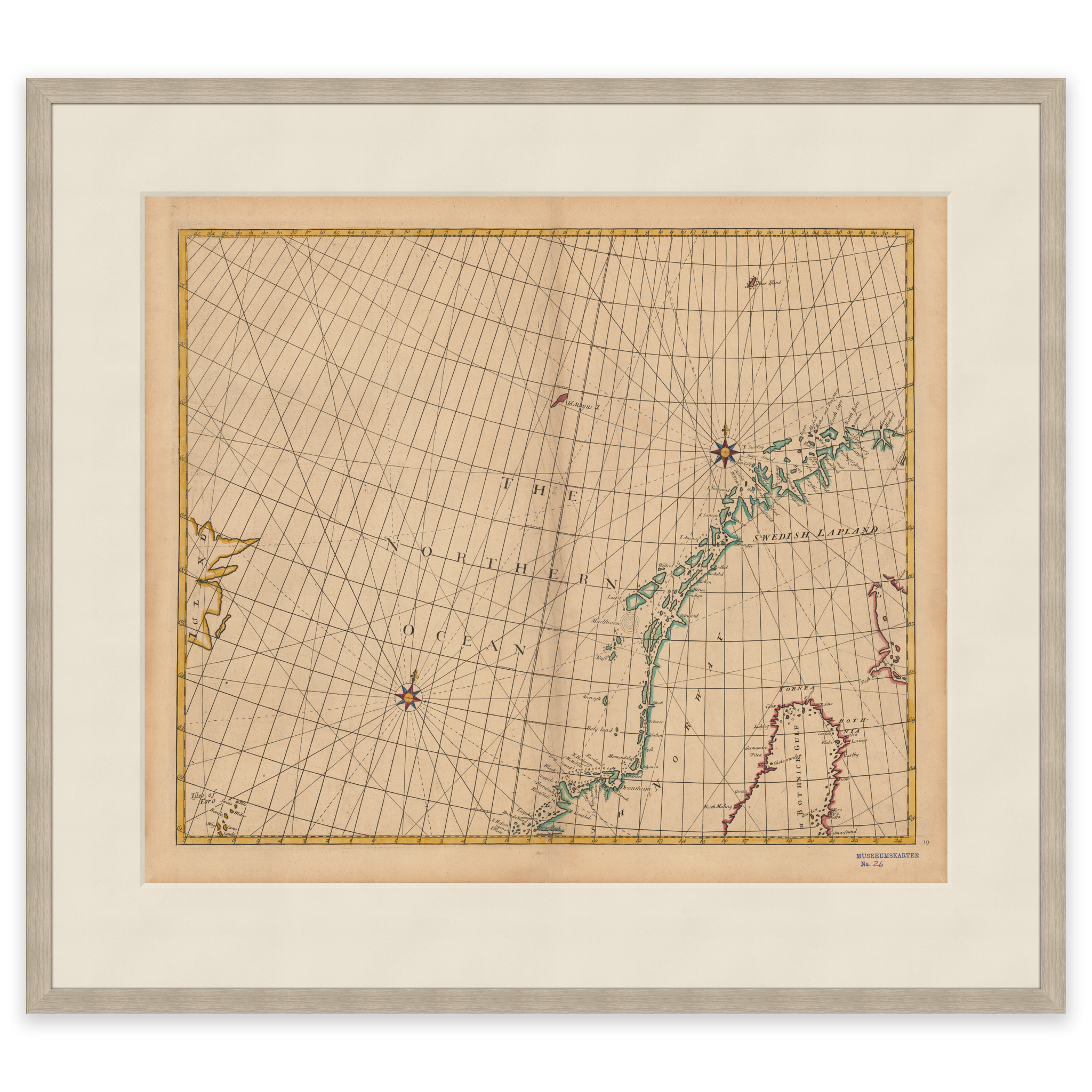
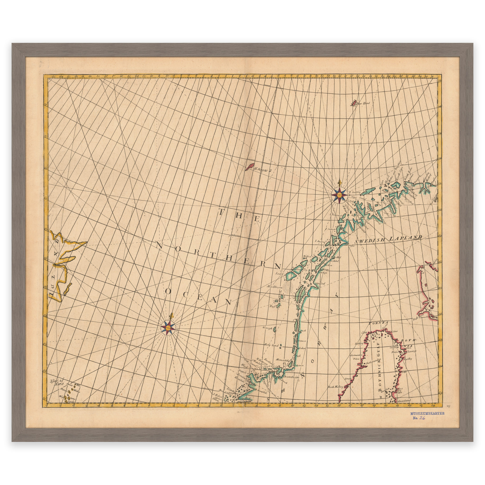
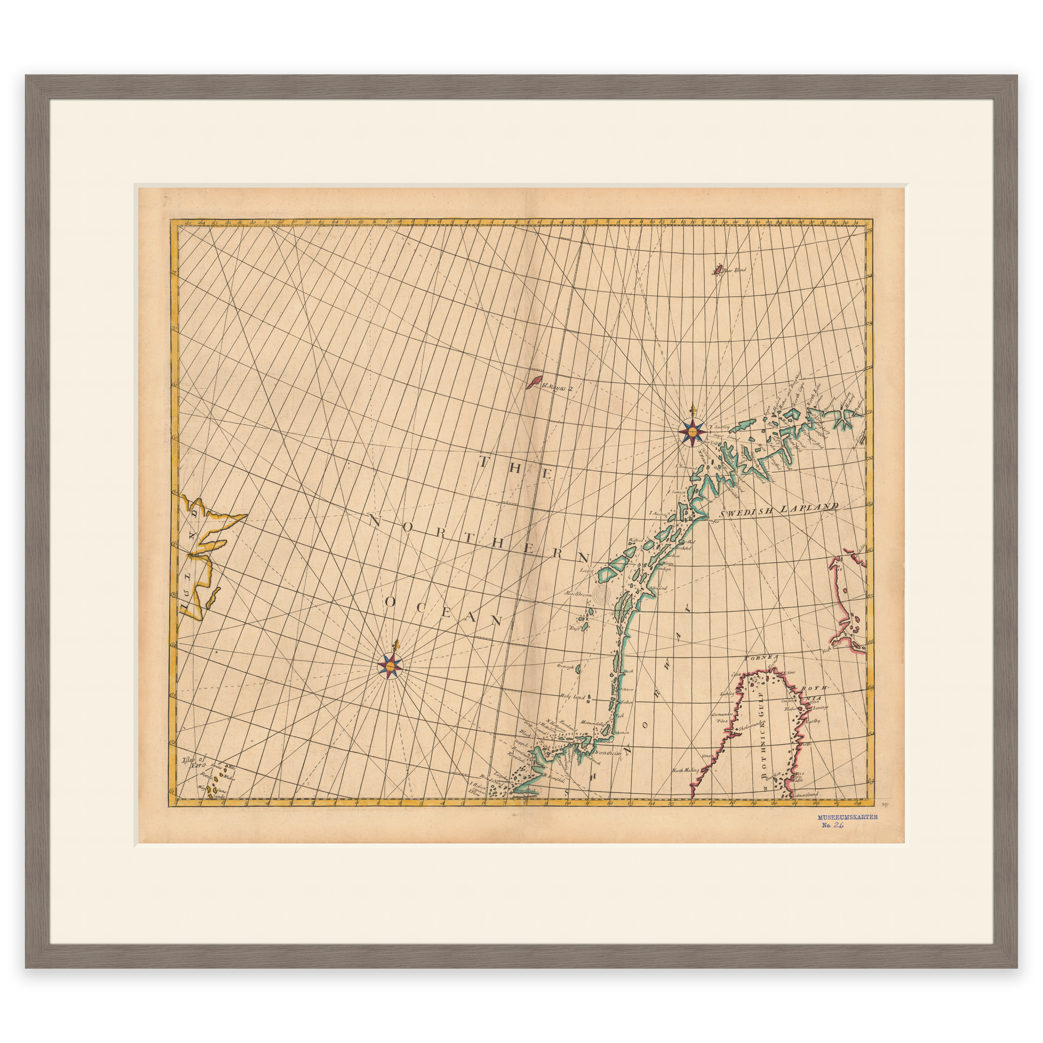
Historical nautical chart of the Norwegian Sea from 1728. The map covers the sea north of the 62nd parallel approximately, and covers the area of the Norwegian coast, the Faroe Islands, Iceland and Jan Mayen. The map is delivered in its original size of 63.6 x 54.4 cm. The size with frame and passe-partout is 81.6 x 73.4 cm. Do you want the map in a different size? Just get in touch – we’ll be happy to give you a quote for customization.