Description
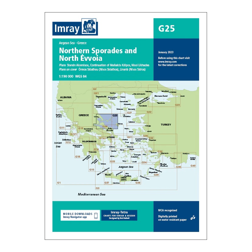
Covering the northern Sporades and northern parts of Evvoia, this overview chart from Imray provides a comprehensive regional overview of an important sailing area in the northern Aegean. The chart is designed for route and passage planning between mainland Greece and the northern Aegean islands.
The map includes plan views and approaches to Skiáthos, Skópelos, Alónnisos, Skiros, as well as coastal and harbor areas along northern Evvoia, among others. It is particularly useful for sailors moving between Pagasitikos Bay, the Volos area and Sporades, or planning longer legs south to the Cyclades.
Printed on water-resistant paper and manufactured to MCA approved standards, with support for digital updates via the Imray Navigator app.