
 Northwest country 1908


Northwest country 1908
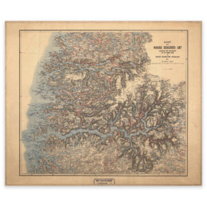
Map of Western Norway from Stad up to and including Fensfjorden, and with Sognefjorden and Stryn in the east. The map is delivered in its original size of 64 x 53.6 cm. The size with frame and passepartout is 82 x 72.6 cm. Do you want the map in a different size? Just get in touch – we’ll be happy to give you a quote for customization.