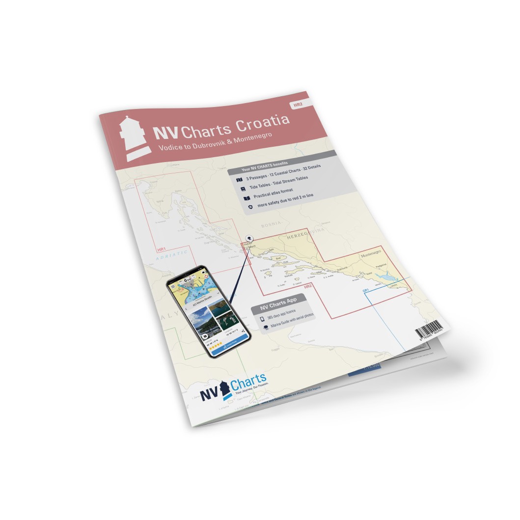
Description
NV Charts Croatia HR2 Vodice-Dubrovnik & Montenegro is a comprehensive chart package of paper and digital charts covering the southern Adriatic Sea from Vodice in Croatia to Dubrovnik and on into Montenegrin waters. The chart set is designed for safe and precise navigation in one of Europe’s most popular and complex sailing areas.
The charts provide detailed information about coastal waters, archipelagos, canals, straits, approaches, harbors and anchorages along the Dalmatian coast. The area is characterized by dense archipelagos, high traffic in high season and many narrow passages, making up-to-date and reliable charts essential for safe sailing.
The map pack first contains overview and passage maps that provide the basis for planning longer stages, including Adriatic Sea (C1, 1:1,750,000), Blitvenica to Mljet (C2, 1:350,000) and Mljet to Albania (C3, 1:350,000).
Also included are detailed coastal maps at a scale of 1:100,000 covering the entire sailing area, including Vodice to Rogoznica (C4), Rogoznica to Split (C5), Split to Hvarski Kanal (C6), Vis and Svetac (C7), Hvar West (C8), Neretvanski Kanal (C9), Lastovski Kanal (C10), Lastovski and Mljetski Kanal (C11), Mljetski Kanal to Dubrovnik (C12), Dubrovnik to Rt. Oštra (C13), Rt. Oštra to Hr. Katici (C14) and Hr. Katici to Rt. Mentra (C15).
For precise navigation in harbors, approaches and narrow waters, the atlas contains a large number of detailed maps and harbor plans in larger scales. These include Šibenik – Approach (C16, 1:50,000), Split (C17A, 1:30,000), Trogirski Zaljev (C17B, 1:30,000), Split – Zenta (C18A, 1:6,000), Maslinica (C18B, 1:30,000), Splitska Vrata (C18C, 1:30,000), Viška Luka (C18D, 1:20 000), Vrboska (C19A, 1:30 000), Pakleni Kanal (C19B, 1:30 000), Ploče (C20A, 1:15 000), Makarska (C20B, 1:10 000), Luka Slano (C20C, 1:15 000), Šipanska Luka (C20D, 1:15 000) and Stonski Kanal (C21, 1:20 000).
Furthermore, detailed maps are included for Korčula (C22A, 1:30 000), Lastovo (C22B, 1:30 000), Dubrovnik – Lokrum (C22C, 1:15 000), Dubrovnik port (C23, 1:15 000), Rijeka Dubrovačka (C24A, 1:10 000), Tivat (C24B, 1:10 000), Šibenik port (C24C, 1:20 000), Cavtat (C25A, 1:15 000) and Barsko Sidrište in Montenegro (C25B, 1:25 000).
The chart set is delivered in atlas format combined with digital access via the NV Charts app and for PC/Mac. The digital charts can be used offline and are well suited for both route planning and active navigation on board. Legend and general navigation notes are included.
Always delivered in the latest available edition from NV Charts. If a new and updated edition is launched within 30 days of purchase, the map can be exchanged for a new edition free of charge.