Description
NV Charts DE10 Nordfriesland Sylt-Helgoland & Eider is a comprehensive chart package with both paper and digital charts for the northern parts of the German North Sea coast, including Nordfriesland, the islands of Sylt and Helgoland and the river Eider. The charts are professionally designed for recreational sailing and provide detailed information on water conditions, approaches, tides, currents, harbors and sailing routes in this challenging water area. :contentReference
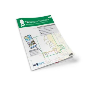
The package comes in a convenient atlas format (A2 open / A3 closed) with paper charts, combined with access to digital charts via the NV Charts app and compatible navigation applications. The digital charts can be used offline on multiple devices, giving you access to up-to-date nautical data both on board and ashore. :contentReference
Characteristics
Paper map in atlas format with clear and detailed cartography.
Includes digital nautical charts for the NV Charts app with 365-day license.
Tidal calendar and current data included in the maps.
Port plans with associated details for approaches.
Navigation instructions and explanations in both German and English :contentReference
Map overview
C1 Nordfriesland (1:375 000).
C2 Rømø to Süderoogsand (1:150 000).
C3 Helgoland to Süderoogsand (1:150 000).
C4 Lister Tief Nord (1:50 000).
C5 Lister Low South (1:50 000).
C6 Front step (1:50 000).
C7 Hörnumtief (1:50,000).
C8 Rütergat (1:50 000).
C9 Norderaue-Süderaue (1:50 000).
C10 Norderhever Nord (1:50 000).
C11 Norderhever & Heverstrom (1:50 000).
C12 Rütergat to Mittelhever (1:50 000).
C13 Norderhever South (1:50 000).
C14 Süderhever & Heverstrom (1:50 000).
C15 Norderpiep to Eidersperrwerk (1:50 000).
C16 Norder- & Süderpiep (1:50 000).
C17 Meldorf bay (1:50 000).
C18 Tideeider (1:25 000).
C19 Eider – Wollersum to Nordfeld (1:25 000).
C20 Eider – Nordfeld to Lexfähre (1:50 000).
C21 Arrival at Helgoland (1:50 000).
Detailed maps for ports and harbors such as Büsum, Dagebüll, Schlüttsiel, Husum, Gieselau lock, Helgoland, Amrum, Pellworm, Hörnum, Rømø, List and Wyk (varying scales). :contentReference
Updates
Always delivered in the latest available edition from NV Charts. If a new and updated edition is launched within 30 days of purchase, the map can be exchanged for a new edition free of charge.