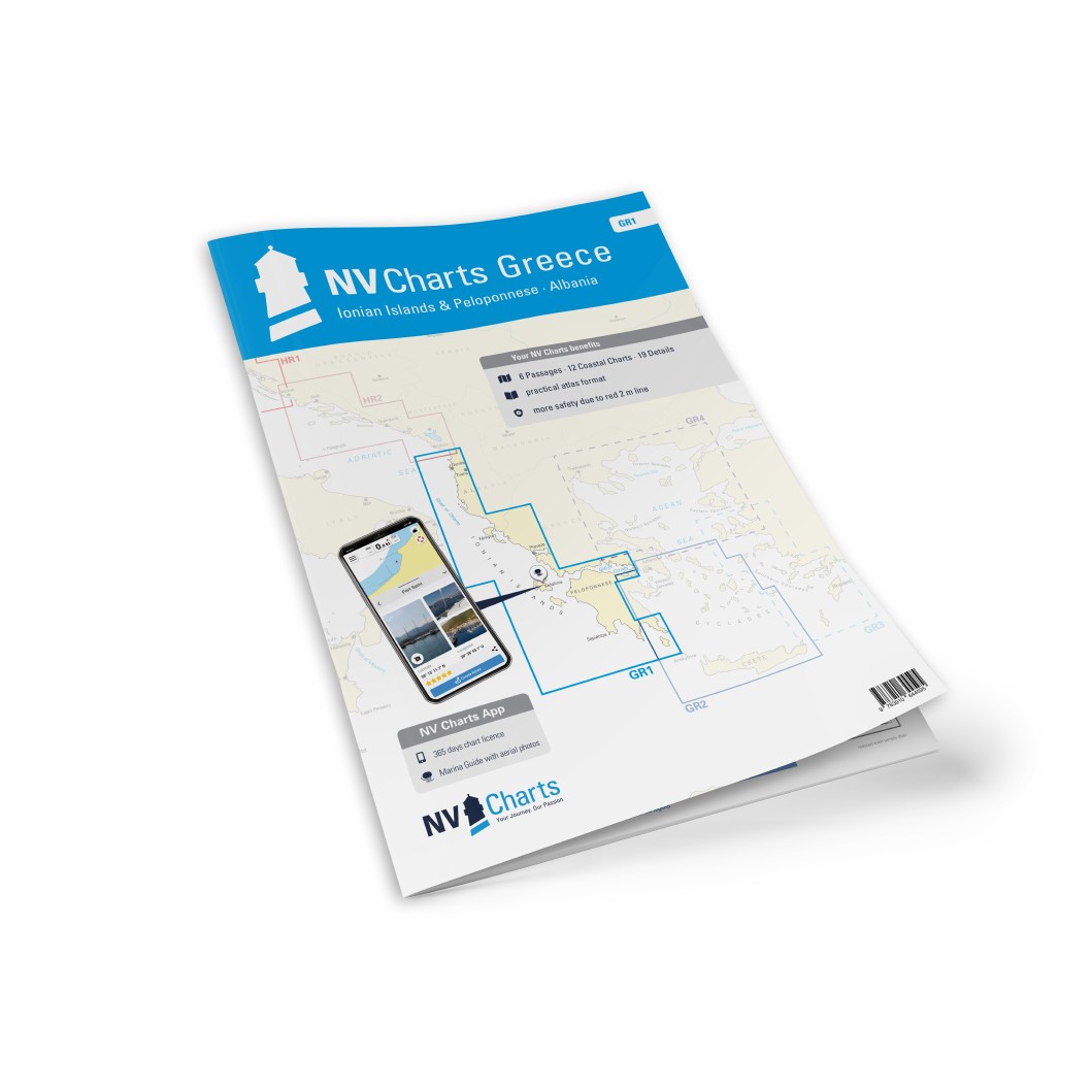
Description
NV Charts Greece GR1 Ionian Islands & Peloponnese to Albania is a comprehensive chart package of paper and digital nautical charts covering the waters from the coast of Albania via the western Ionian Islands to the southwestern part of the Greek mainland at the Peloponnese. The charts provide detailed navigational information on water conditions, approaches, coral reefs, bays, harbors and anchorages in this popular sailing area of the Ionian Sea.
The foundation for planning longer voyages is laid with overview and passage charts that cover the coastal areas with a broad perspective: Dubrovnik to Crete at a scale of 1:1,750,000 provides a comprehensive overview, while Albania to the Ionian Islands (1:950,000) and Shëngjin to Vlorë in Albania (1:350,000) provide a more detailed overview of initial route segments. The map from Vlorë to Lefkas and Kérkira (1:350,000), Lefkas to Strofades (1:350,000) and Strofades to Kýthira (1:350,000) provides a broad picture of the region’s main waters.
Detailed coastal maps at medium scales provide accurate coverage of the main coastal stretches and island passages. These include Othonoí to Kérkyra (1:150,000), Kérkyra to Antípaxoí (1:150,000), Antípaxoí to Lefkás (1:150,000), Lefkás to Kefallinía and Itháki (1:150,000), Kefallinía to Zákynthos (1:150,000) and Kefallinía to Kólpos Pátraikos (1:150,000). Maps for Amvrakikós Kólpos – Kólpos Pátraikos and Korinthiakós Kólpos (Gulf of Corinth) in medium scale also provide a good overview of larger bays and straits in the area.
For precise navigation in ports, inlets and more complex waters, the atlas includes an extensive range of detailed maps at larger scales. These cover Prevéza and Amvrakikós Kólpos (1:20,000), Alykionídes – Gulf of Corinth (1:50,000), Vlorës in Albania (1:80,000), Durrés – Albania to Vlorës (1:40,000), the approach to Kérkyra (1:40,000), Dióryga Lefkádos – Lefkás (1:20,000), Nidríon & Meganísi – Lefkás (1:40,000), Órmos Frikes & Kioní – Itháki (1:15,000), Vathý – Kólpos Aetou – Itháki (1:30,000), Vóreino Stenó Kérkyras (1:15,000), Opéra Pigádia – Itháki (1:15,000) and Argostolíon – Kefallinía (1:20,000).
Additional detailed maps provide support for ports, canal passages and lakes, including Stenó Ríon Bridge (1:20,000), Dióryga Korínthou – Corinth Canal (1:25,000), Órmos Navarínou – Pylos (1:30,000), Methóni & Ns. Oinoúses – Sapiéntza (1:80 000) as well as coastal details in Krissaíos Kólpos – Itéa (1:55 000), Kólpos Antikýron – Antíkyra (1:55 000) and Mesolongíon – Kólpos Pátraikos (1:30 000).
The chart set is delivered in atlas format combined with digital access via the NV Charts app and for PC/Mac, allowing you to use the charts offline on multiple devices. The digital charts provide up-to-date navigational data, port information and anchorage details that are useful for both planning and sailing. Legend and general navigation notes are included for increased usability.
Always delivered in the latest available edition from NV Charts. If a new and updated edition is launched within 30 days of purchase, the map can be exchanged for a new edition free of charge.