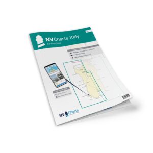
Description
NV Charts Italy IT4 Sardinia West is a complete chart package of paper and digital charts covering the west coast of Sardinia from the area south of Costa Paradiso along the coast through the Gulf of Asinara and down to Cagliari. The charts provide detailed navigational information on water conditions, approaches, ports, anchorages and sailing routes along this scenic and varied coastline, which offers rich opportunities for sailing, anchoring and exploring.
The map pack contains overview and passage charts that provide good general orientation for planning longer legs, including Mallorca to Sicily (C0, 1:1,750,000), Sardinia (C1, 1:650,000), Sardinia North (C2, 1:350,000), Sardinia Southwest (C3, 1:350,000) as well as a broad overview map of the Mediterranean (C22, 1:6,000,000). These provide a holistic view of the area and help the navigator to plan routes between major stretches of sea.
Detailed medium scale coastal maps cover the western coastline of Sardinia. This includes Golfo dell’Asinara (C4, 1:150 000), Capo dell’Argentiera to Capo Mannu (C5, 1:150 000), Capo Mannu to Punta Nai and Oristano (C6, 1:150 000), Punta Nai to Capo Spartivento (C7, 1:150 000), Capo Spartivento to Capo Ferrato (C8, 1:150 000), Golfo dell’Asinara and Porto Torres (C9, 1:60 000), Golfo di Oristano (C10, 1:75 000), Canale di San Pietro (C11, 1:60 000), Golfo di Palmas to Capo Teulada (C12, 1:60 000), Capo Teulada to Capo Spartivento (C13, 1:60 000) and Golfo di Cagliari (C14, 1:60 000). These maps provide a good overview of the entire coastline, focusing on shipping lanes and coastal details.
For detailed approaches, harbor plans and smaller waters, a number of detailed maps at larger scales are included. This includes Passaggio dei Fornelli (C15B, 1:25 000), Stintino (C15C, 1:10 000), Isola Rossa (C16A, 1:6 000), Castelsardo (C16B, 1:12 000), Porto Torres (C16C, 1:25 000), Fertilia (C16D, 1:6 000), Alghero (C16E, 1:12 000), Bosa Marina (C16F, 1:12 000), Rada di Alghero (C17, 1:30 000), Oristano (C18A, 1:25 000), Portovesme (C18B, 1:12 000), Carloforte (C18C, 1:12 000), Canale di San Pietro (C19, 1:30 000), San Antioco (C20A, 1:12 000), Calasetta (C20B, 1:12 000), Perde’e Sali (C20C, 1:6 000), Marina di Teulada (C20D, 1:12 000), Capo Malfatano (C20E, 1:12 000) and Cagliari (C21, 1:20 000). These charts provide accurate details of port areas, approaches and local conditions that are important for safe navigation.
The chart set is delivered in atlas format combined with digital access via the NV Charts app and for PC/Mac. The digital charts can be used offline and provide up-to-date navigation data directly on board. Legend and general navigation notes are included for increased usability and safer sailing.
Always delivered in the latest available edition from NV Charts. If a new and updated edition is launched within 30 days of purchase, the map can be exchanged for a new edition free of charge.