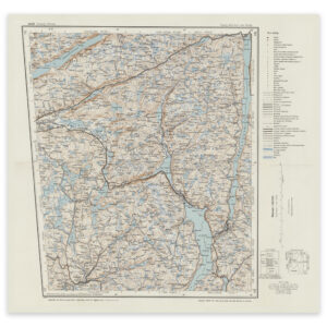

 Oslo 1900


Oslo 1900
Map of Oslo, the Oslofjord, Drammen and up to Tyrifjorden from 1900. The map is made by Ole Engh and Johan Gulbrandsen Natrud using the heliogravure technique. The map is delivered in its original size of 60.7 x 50.2 cm. The size with frame and passe-partout is 78.7 x 69.2 cm. Do you want the map in a different size? Just get in touch – we’ll be happy to give you a quote for customization.