Description
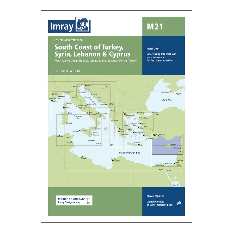
This passage chart from Imray covers the Eastern Mediterranean, focusing on the southern coast of Turkey, as well as the coastal stretches along Syria, Lebanon and Cyprus. The map provides a regional overview of the sailing routes between the Levant and Anatolia, and includes plan views and approaches to key ports such as Alanya, Mersin, Larnaca, Beirut and Tripoli.
Developed for long passages and route planning, the chart serves as an important link between the eastern Imray charts in the Mediterranean. It is an ideal complement to more detailed coastal and harbor charts for sailors planning longer voyages in the region.
Printed on water-resistant paper and produced to MCA-approved standards, with support for digital updates via the Imray Navigator app.