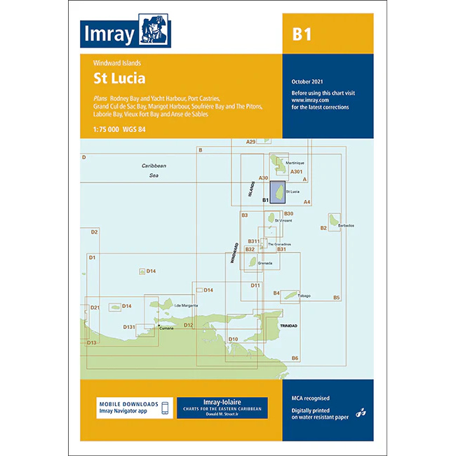
Description
This boating chart covers St Lucia in the Windward Islands of the Caribbean and provides detailed plans for coastal waters, harbors and anchorages around the island. The chart is designed for convenient navigation for yachts and sailboats sailing locally around St Lucia or using the island as a stopover during longer voyages in the region.
The map includes detailed plans for Rodney Bay and Yacht Harbour, Port Castries, Grand Cul de Sac Bay, Marigot Harbour, Soufrière Bay and The Pitons, as well as Laborie Bay, Vieux Fort Bay and Anse des Sables. St Lucia offers varied sailing conditions, with both sheltered bays and more exposed stretches of coastline, and the chart provides a solid foundation for safe navigation.
Imray is a recognized British chart manufacturer with extensive experience in nautical cartography for leisure and long-distance sailing. Their charts are developed with a focus on high readability, practicality and clear presentation of navigation-relevant information, especially adapted to tropical sailing areas.