Description
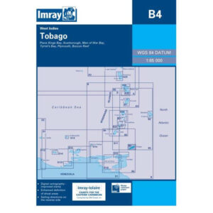
This boating chart covers Tobago in the southern Caribbean, providing detailed plans of the coastline and key harbor and anchorage areas around the island. The chart has been developed for convenient navigation for leisure boats and sailboats operating locally around Tobago or as part of island hopping in the region.
The map includes detailed map sections for Kings Bay, Scarborough, Man of War Bay, Tyrrel Bay, Plymouth and Buccoo Reef. Known for its excellent anchorages, coral reefs and varied sailing conditions, the map provides a solid foundation for safe navigation in coastal waters.
Imray is a recognized British chart manufacturer with extensive experience in nautical cartography for leisure and long-distance sailing. Their charts are designed with a focus on high legibility, clear symbols and practical information, and are well suited for use on board in tropical sailing areas.