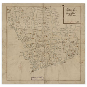


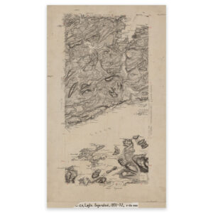
 Trondheimsleia 1872

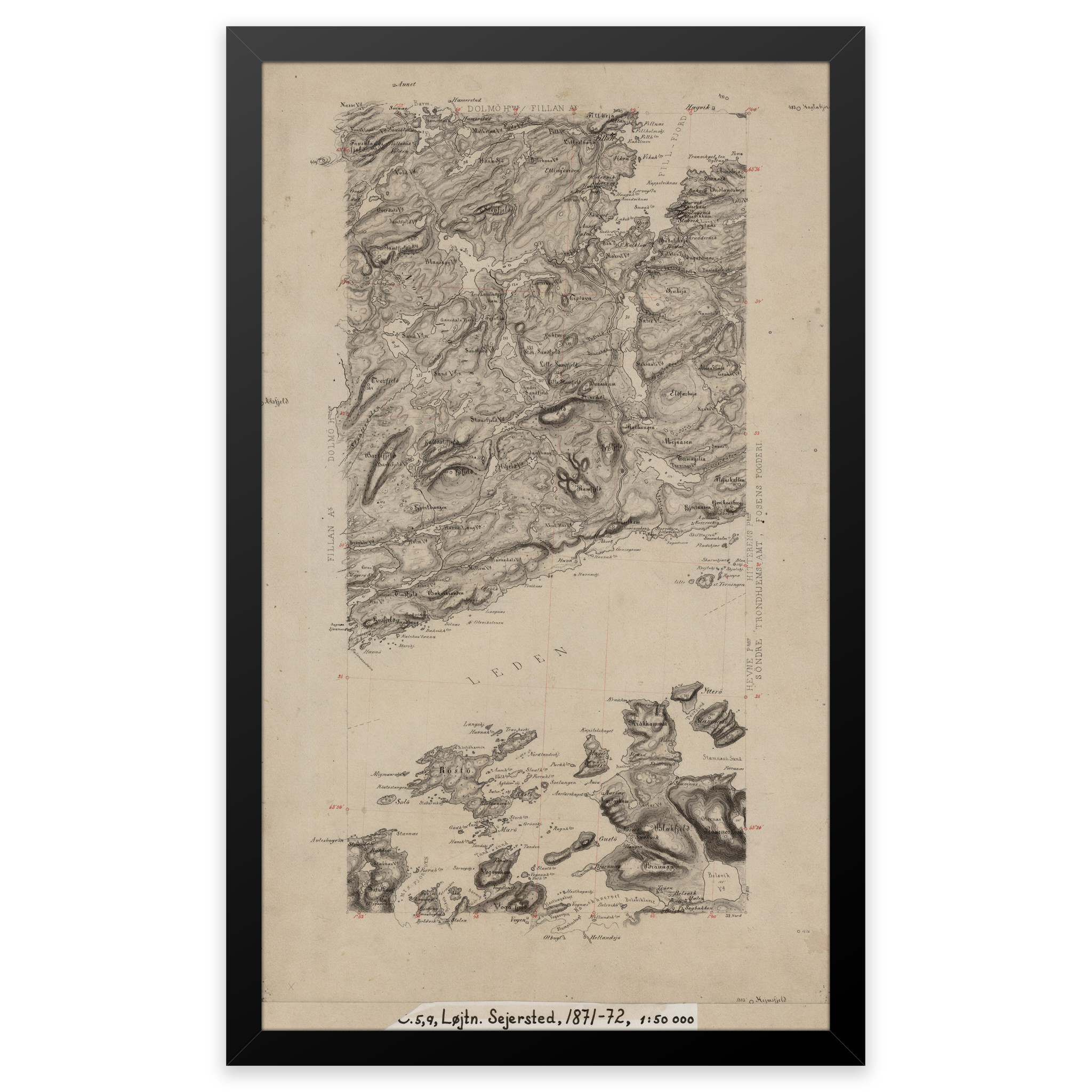
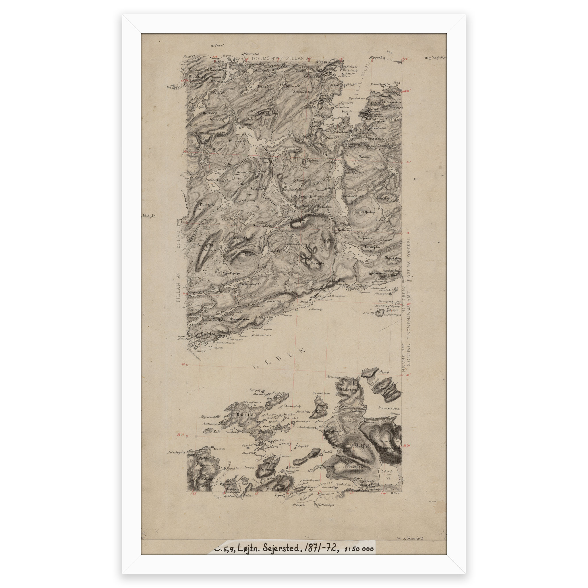
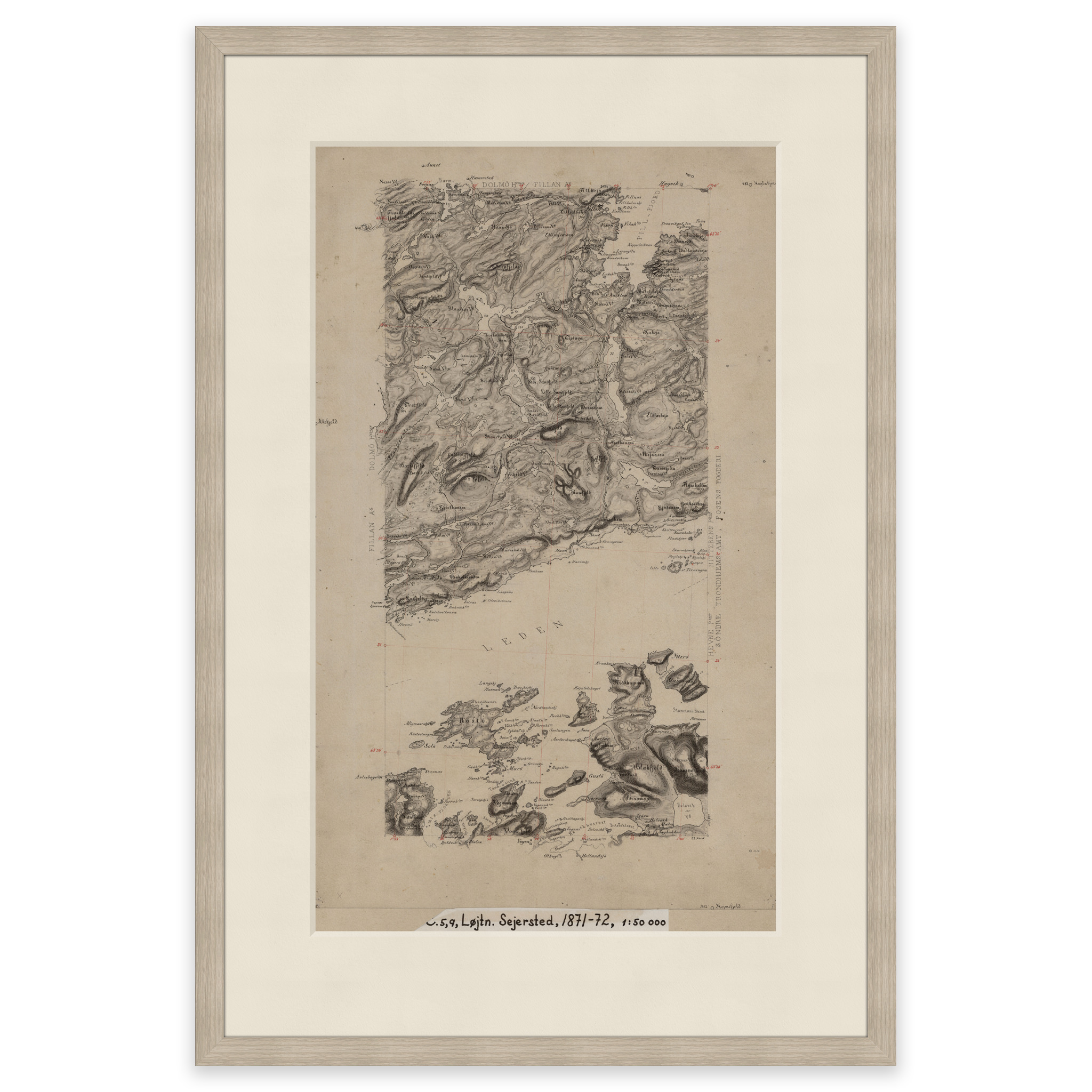
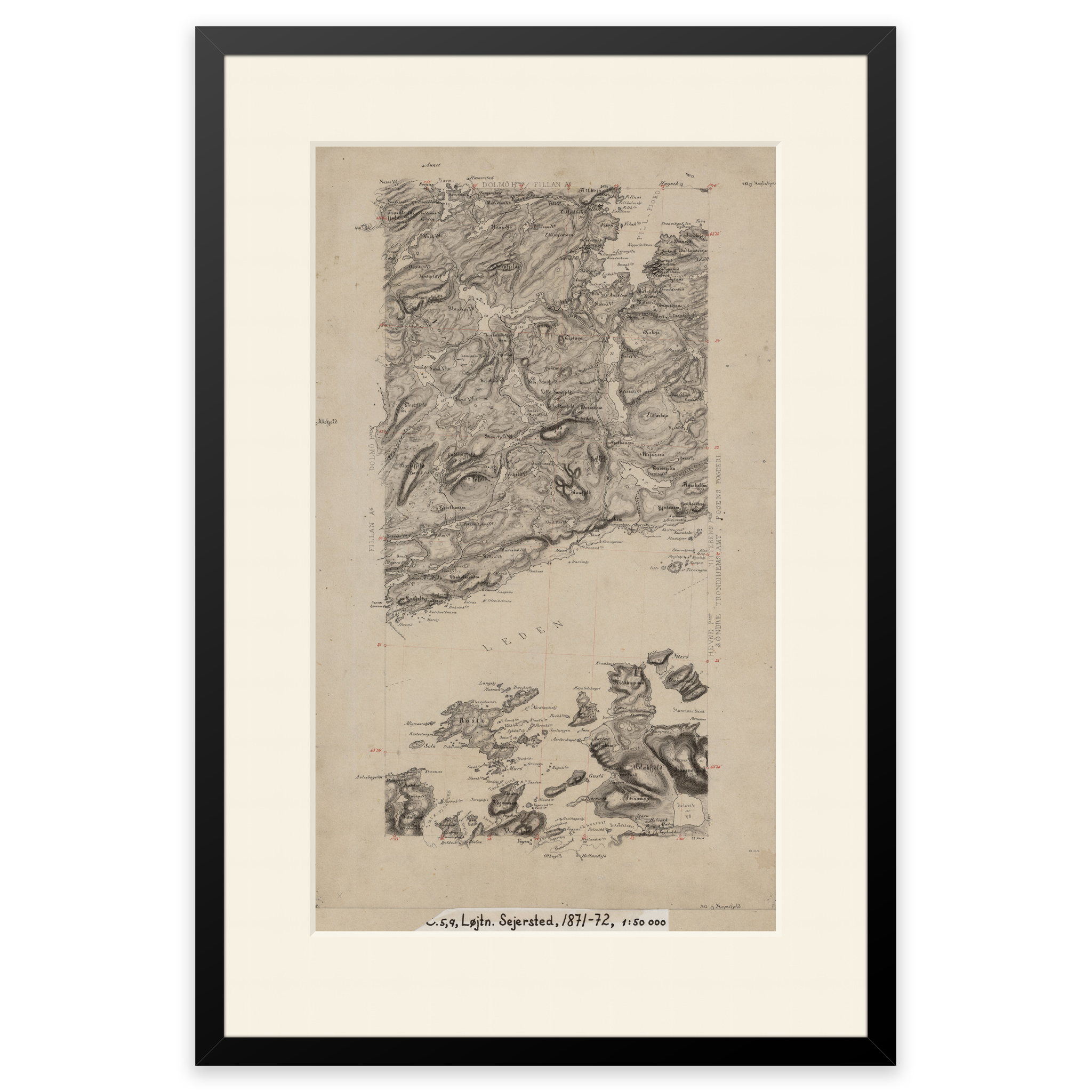
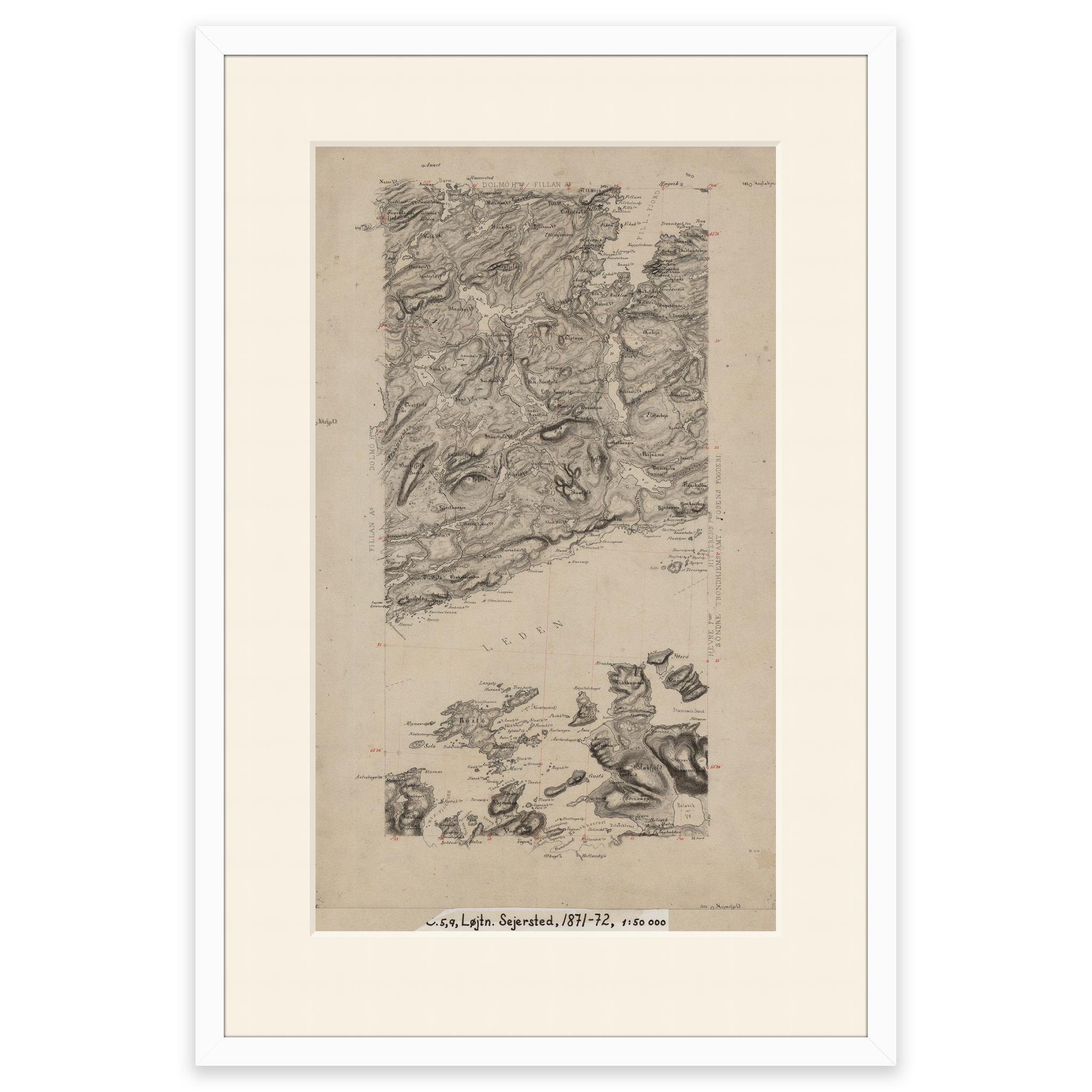


Trondheimsleia 1872
Hand-drawn map of parts of Hitra and Trondheimsleia in Trøndelag from 1872. The map covers the area Fillan, Terningen fyr, Magerøya and Røstøya. The map is delivered in original size 32.1 x 54.7 cm. The size with frame and passepartout is 48.1 x 71.7 cm. Would you like the map in a different size? Just get in touch – we’ll be happy to give you a quote for customization.