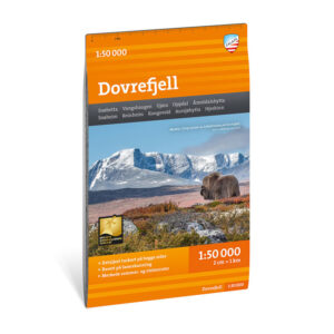
Description
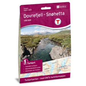
Turkart Dovrefjell covers the entire high-mountainous area of Dovrefjell, with map sections on both the front and back. The map includes key hiking destinations such as Vangshaugen, Snøheim and Snøhetta (2286 m), which is Norway’s highest mountain outside Jotunheimen. The area offers vast high mountain plains, marked peaks and long continuous hiking opportunities.
The map provides a precise representation of terrain shapes, contours and water, and shows both marked hiking routes and cabins run by DNT and other operators. It is adapted for use throughout the year, with marked winter routes and groomed ski trails where applicable. The map has a format of 70 × 100 cm and provides a good overview of a large and open mountain area.
The map is at a scale of 1:50,000, which is the most common scale for longer mountain hikes. At this scale, 2 cm on the map corresponds to 1 km in the terrain. The terrain information is based on detailed elevation data and provides a clear and precise representation of the landscape.
Calazo Förlag is a Swedish publishing house specializing in maps and books for outdoor life in the Nordic region.
Here you can see the area the map covers:
The map is released in 2022.