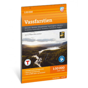
Description
Turkart for Vassfarstien at a scale of 1:50,000. The map covers Vassfaret, a scenic valley between Buskerud and Innlandet, known for its woodlands, water and varied wildlife.
Vassfarstien is a 116-kilometer marked hiking trail that runs from Hønefoss to Fønhuskoia. The route is divided into seven stages, with accommodation options along the way, making it suitable for longer hikes.
The map shows marked trails, relevant hiking destinations and accommodation, including Storekrakkoia, Vassfarkoia and Fønhuskoia. The map has been developed in collaboration with DNT Ringerike and provides a good basis for planning and carrying out trips in the area.
The map is printed on durable and water-repellent material (Tyvek), which can withstand use in varied weather and terrain.
The map is released in 2026.