

 Vorma/Glomma, unknown year
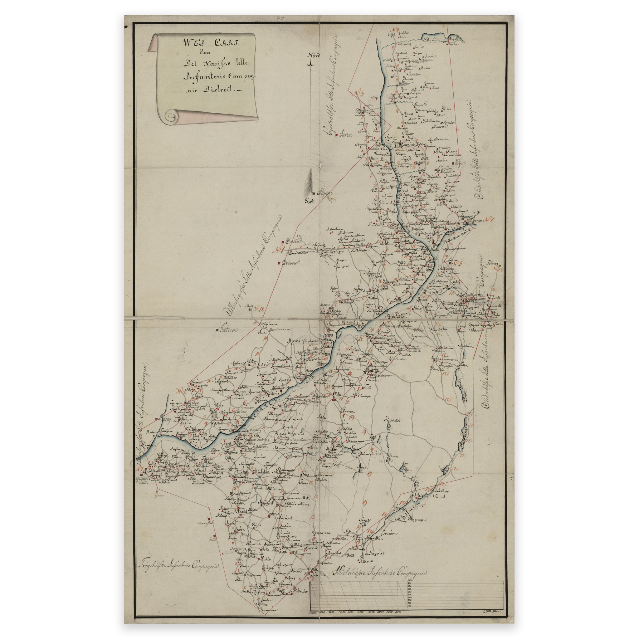

Vorma/Glomma, unknown year
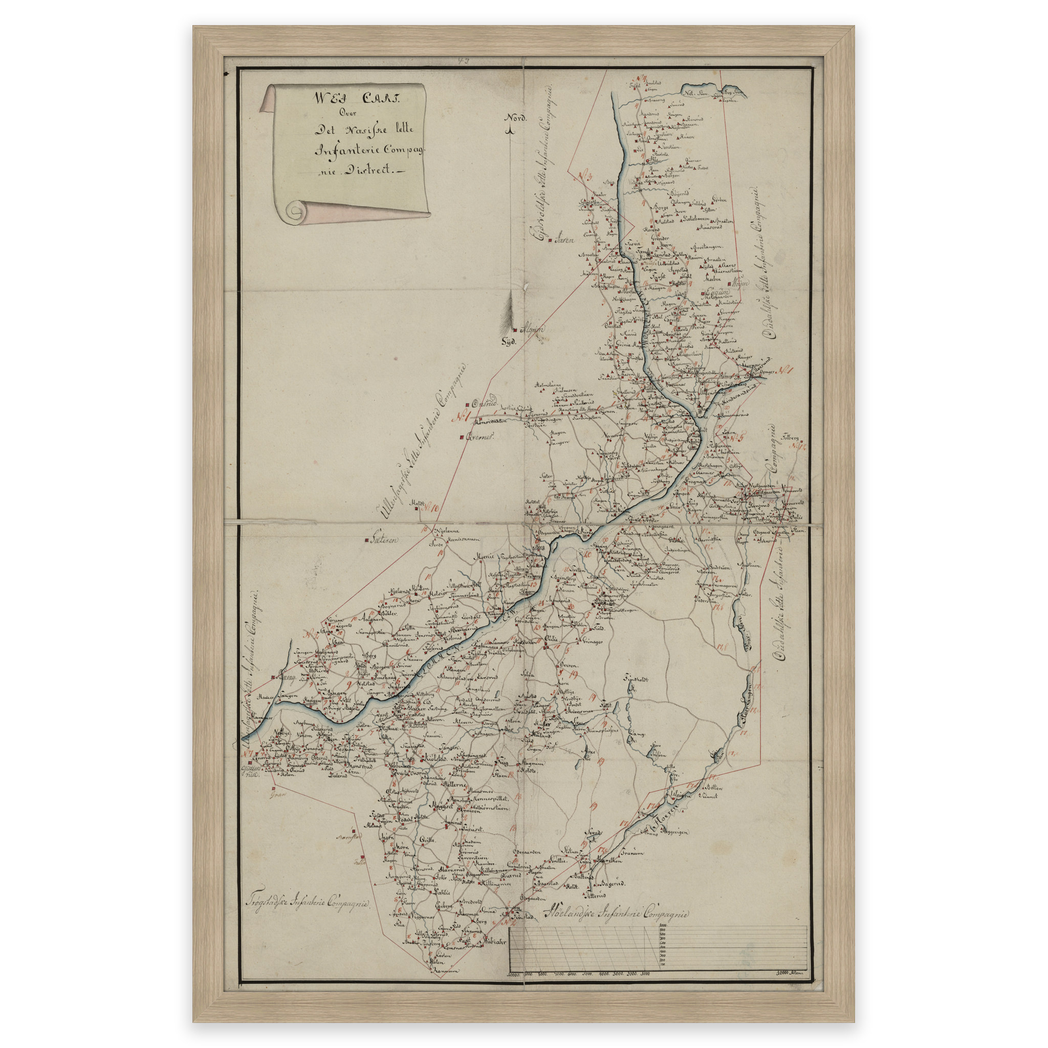
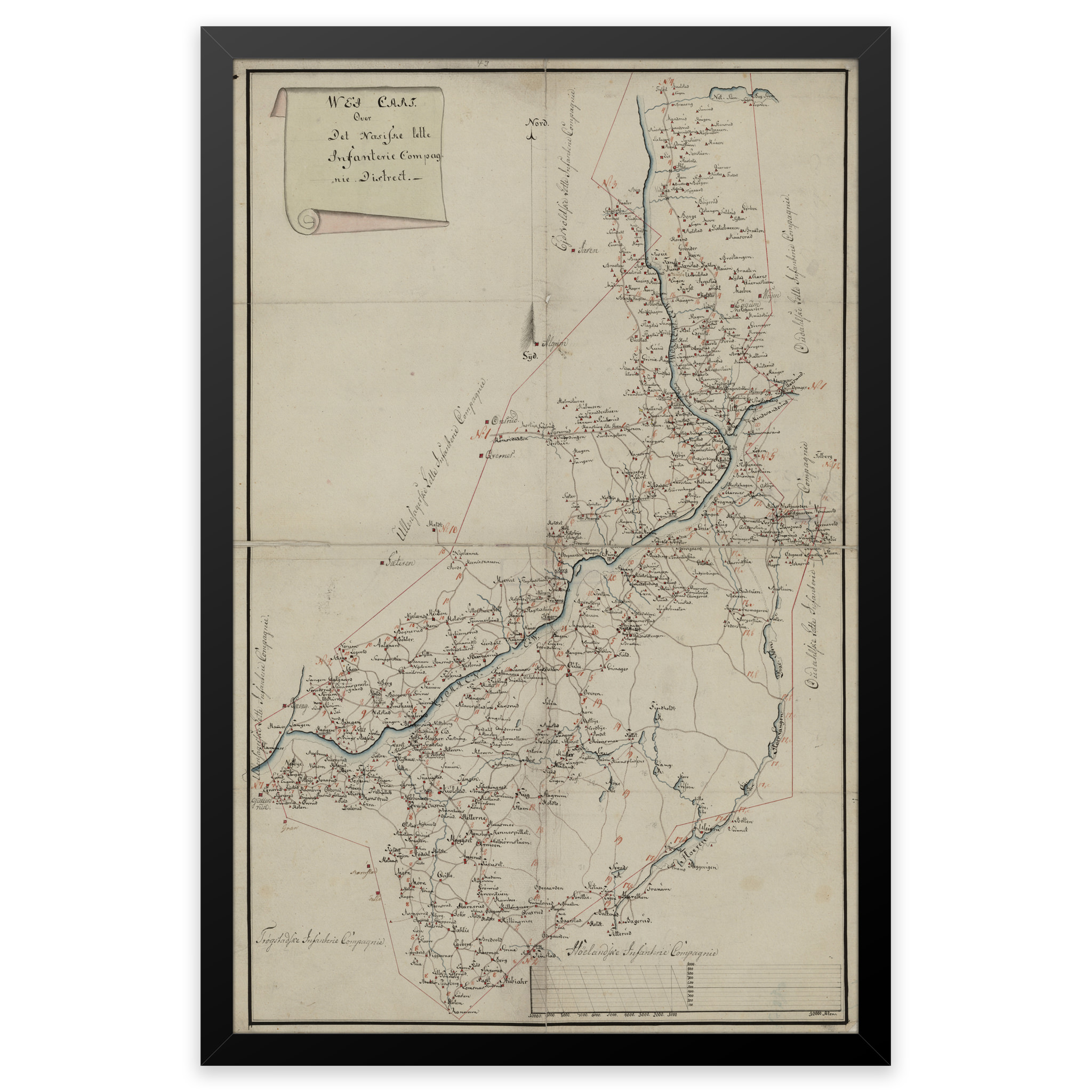
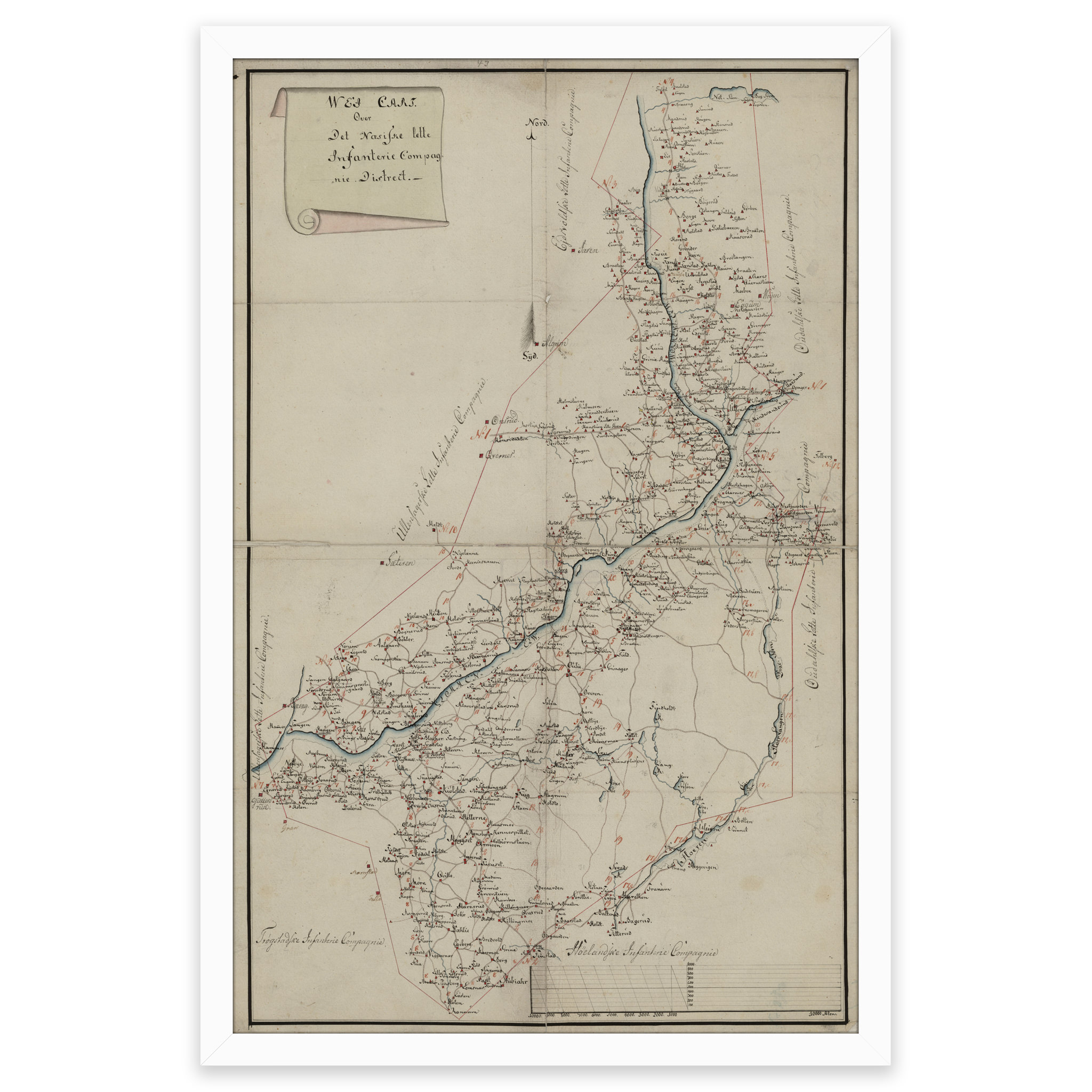
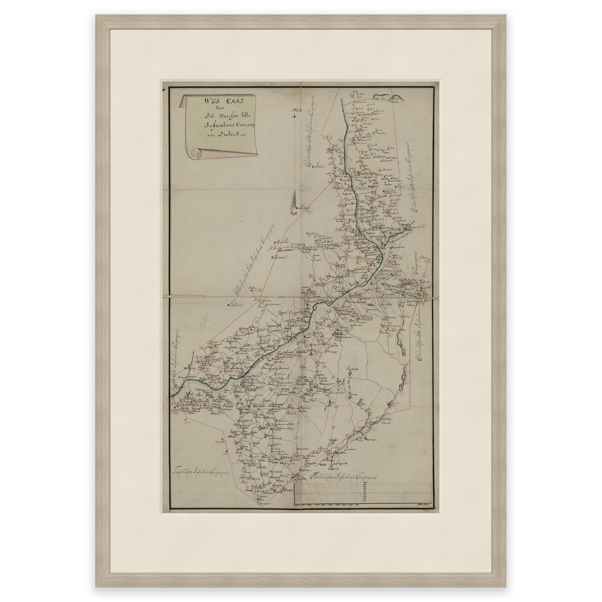
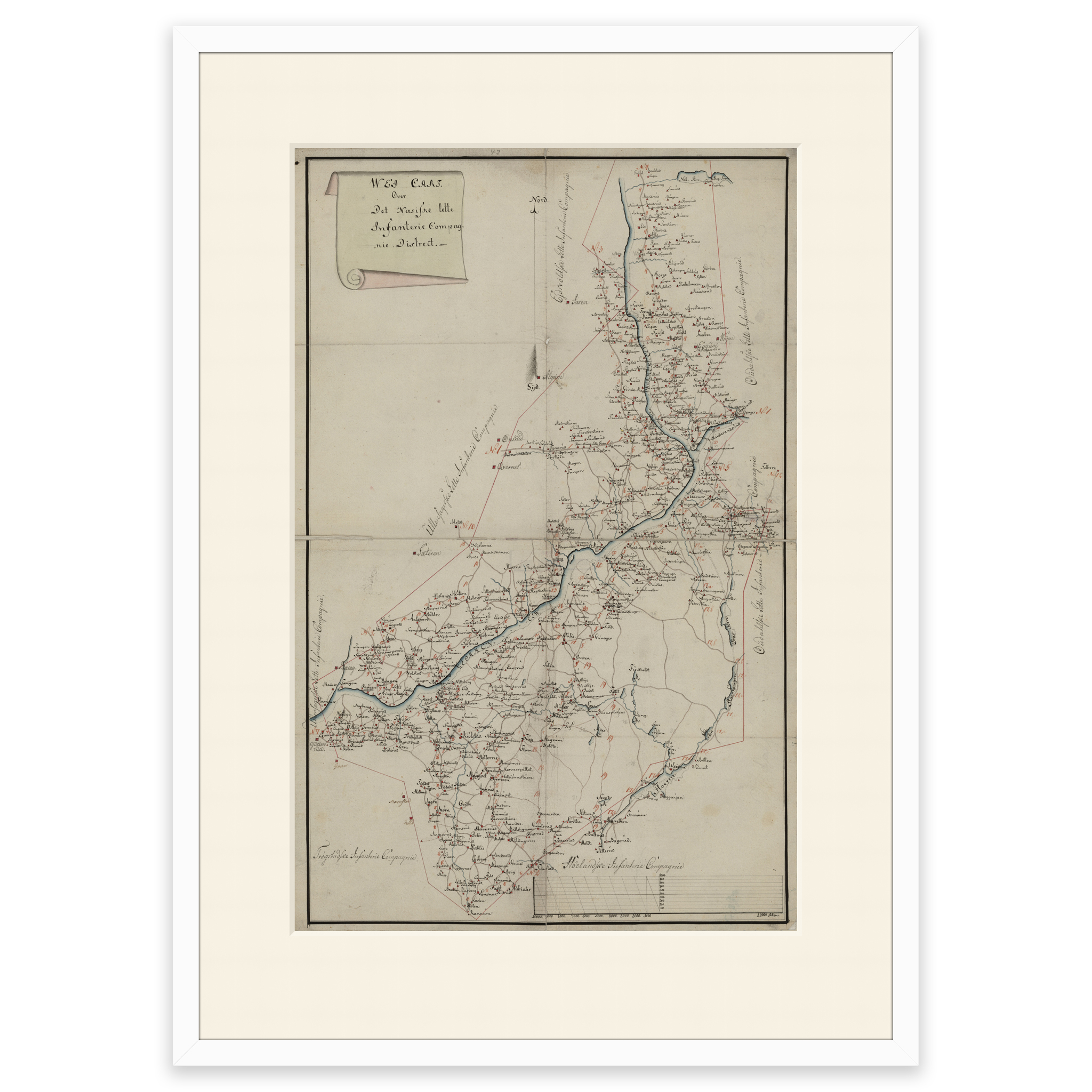
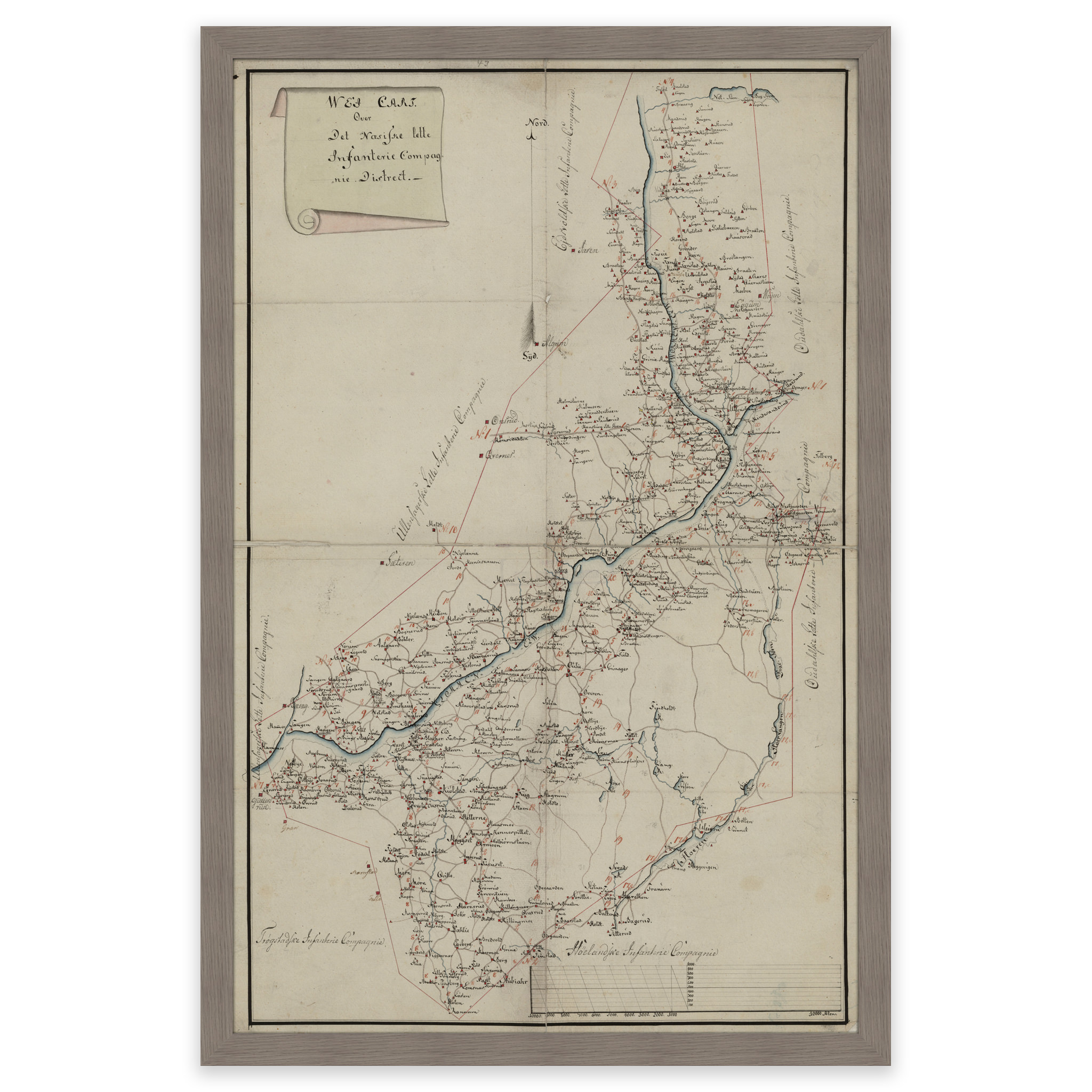
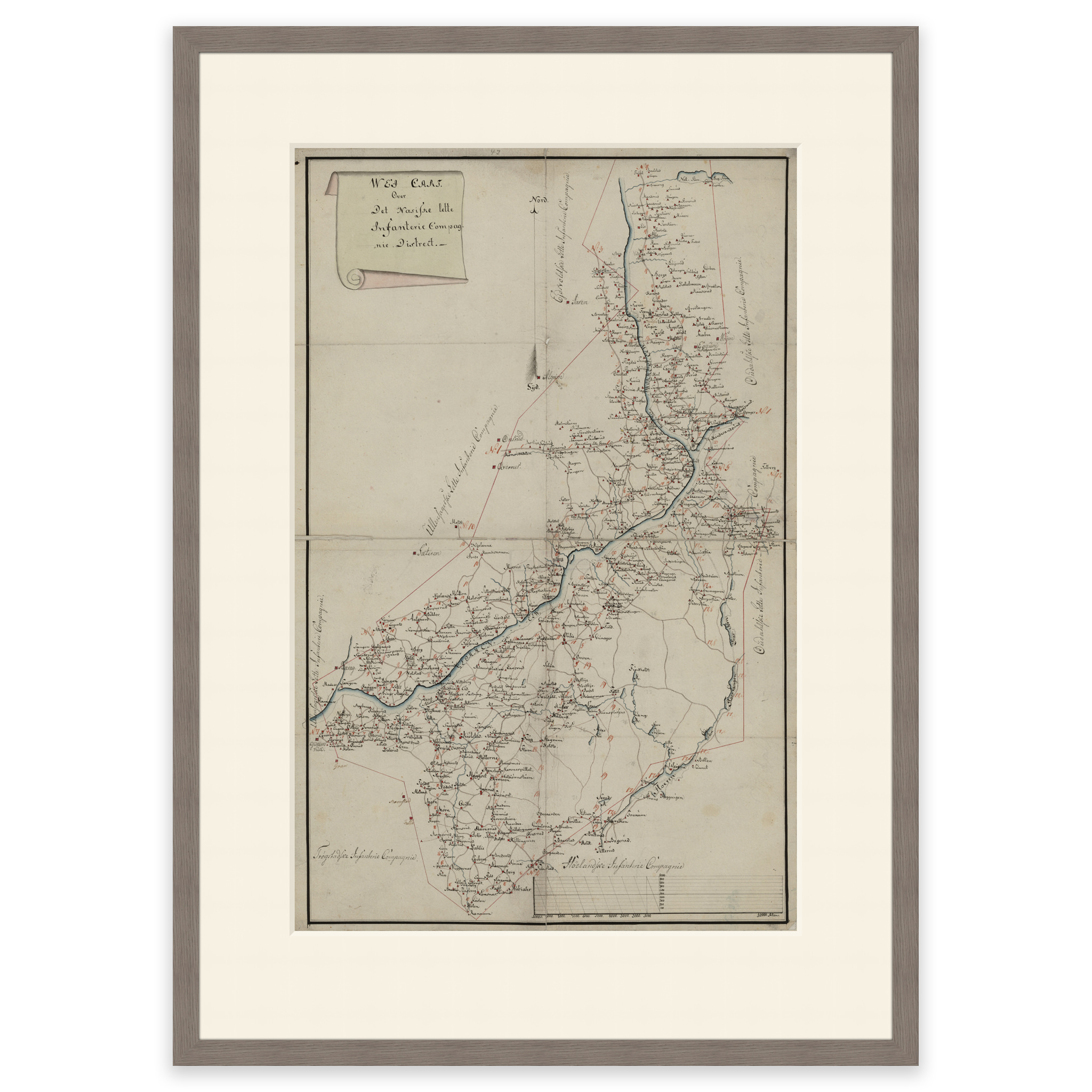
Hand-drawn map of the area where the river Vorma meets Glomma. From Rud in the north to Sørumsand in the south and lake Floen in the east. The map is delivered in its original size of 38.7 x 60.3 cm. The size with frame and passe-partout is 56.7 x 79.3 cm. Would you like the map in a different size? Just get in touch – we’ll be happy to give you a quote for customization.