Description
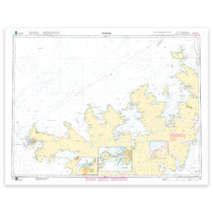
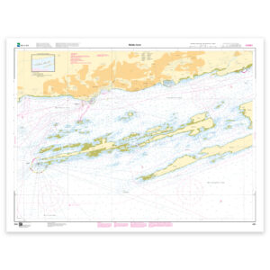
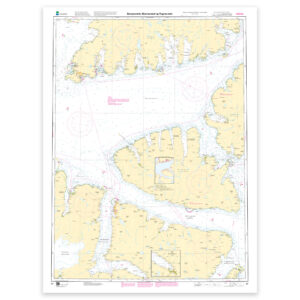
Nautical chart covering the waters of Sørøysundet, Stjernsundet and Rognsundet. Map sheet 97 in the Norwegian Mapping Authority’s main map series. The map is 115 x 87 cm and has a scale of 1:50,000. Can also be delivered on a plate or framed. Size with passepartout and frame is 136 x 107 cm.
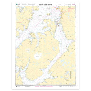
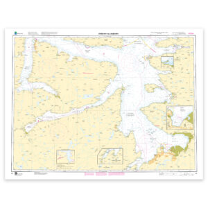
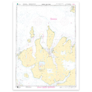
The map covers Sørøysundet, Stjernsundet and Rognsundet and is designed for those who need an up-to-date nautical chart for active use along the coast. The place names in the map area make it easy to find the right coverage for this particular part of the coast, whether you use the map actively on board or want it as an overview map.
Map sheet 97 in the Norwegian Mapping Authority’s main map series. The map has a scale of 1:50,000 and size 115 x 87 cm. The map is produced as print-on-demand and is printed when ordered. This means that you get an updated nautical chart based on the latest available data and corrections from the Mapping Authority.
The nautical chart is based on official data from the Norwegian Mapping Authority and is designed for those who want quality, precision and up-to-date map information.
The choice of material can be adapted to the application. 125 gram map paper is thin, matt and space-saving, and is ideal as a spare map. 180-gram map paper is a carefully selected, matt and sturdy paper that is ideal for active map use on board. Tyvek is made for rough conditions and can withstand both water and rough handling. Art paper is a good choice when the chart is to be framed or used as a wall chart, and gives a more exclusive finish.
In addition, the map can be delivered with a frame or on an aluminum plate, ready to hang up as a practical and decorative map. Size with passepartout and frame is 136 x 107 cm.