Description
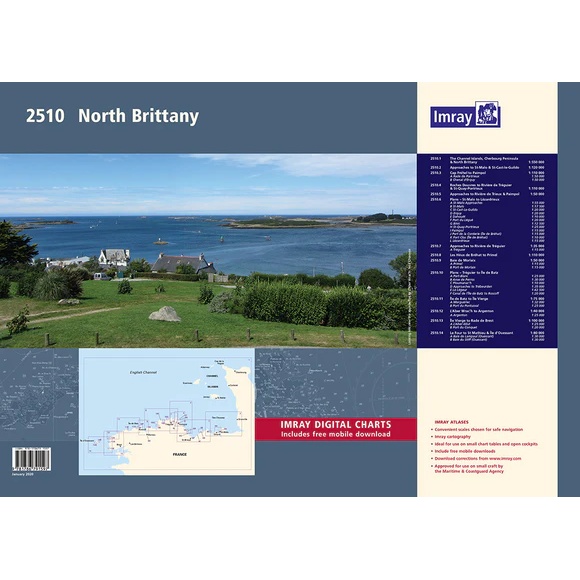
The Imray 2510 is a comprehensive chart package covering northern Brittany, the Channel Islands and the northwest French Atlantic coast. Delivered in a practical A2 format in a sturdy plastic folder, the chart pack is designed specifically for leisure boats, cruisers and smaller vessels.
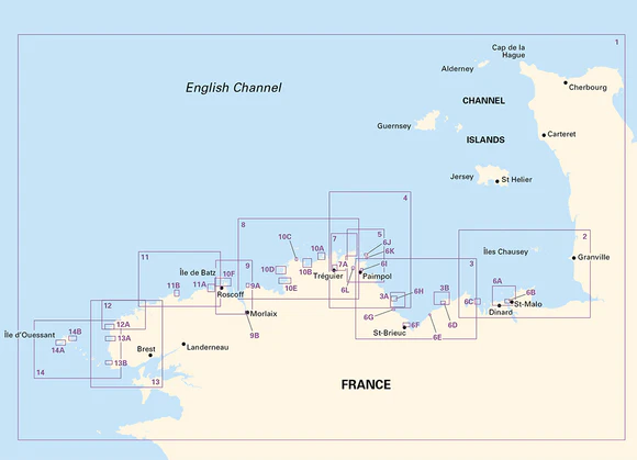
The atlas covers the area from the Cherbourg Peninsula and the Channel Islands in the northeast to Brest and the island of Ouessant in the west. Known for its strong tidal currents, challenging navigation and spectacular coastal landscapes, the map pack provides detailed information for safe navigation between ports, archipelagos and anchorages.
This updated edition includes the latest depth measurements, updated tidal data and contact information for marinas, harbors and coast guard stations. A separate page with tidal currents has also been added.
The map pack contains the following maps:
2510.1 The Channel Islands, Cherbourg Peninsula & North Brittany – 1:550 000
2510.2 Approaches to St-Malo & St-Cast-le-Guildo – 1:120 000
2510.3 Cap Fréhel to Paimpol – 1:110 000, with plans for Rade de Portrieux and Chenal d’Erquy
2510.4 Dover Rocks to Rivière de Tréguier & St-Quay-Portrieux – 1:110 000
2510.5 Approaches to Rivière de Trieux & Paimpol – 1:50 000
2510.6 Port plans from Saint-Malo to Lézardrieux, including Saint-Cast-Le-Guildo, Erquy, Paimpol and Île de Bréhat
2510.7 Approaches to Rivière de Tréguier – 1:35 000
2510.8 Les Héux de Bréhat to Primel – 1:110 000
2510.9 Morlaix Bay – 1:50 000
2510.10 Port plans from Tréguier to Île de Batz, including Perros-Guirec, Trébeurden and Roscoff
2510.11 Batz Island to Virgin Island – 1:75 000
2510.12 L’Aber Wrac’h to Argenton – 1:40 000
2510.13 Île Vierge to Rade de Brest – 1:100 000
2510.14 Le Four to St Mathieu & Île d’Oussant – 1:80 000
The map pack also includes vouchers for digital Imray maps in the Imray Navigator app for iOS and Android.
Publication year: 2020
Updated to: January 2020
Format: A2, water-resistant maps in plastic folder