Denmark’s Official Nautical Charts – Geodatastyrelsen Print on Demand (POD)
Denmark’s official nautical charts from Geodatastyrelsen are delivered as Print on Demand (POD) and printed upon order with the latest available updates.
The charts cover Danish waters – including the North Sea, Kattegat, Øresund, and the Baltic Sea – and are used for both recreational sailing and professional navigation.
Kart.no is an official supplier of POD nautical charts from Geodatastyrelsen in Denmark.
Find the correct chart before ordering
Unsure which chart number you need? Use Geodatastyrelsen’s chart overview to find the correct chart, then order here at Kart.no.
Kart.no is an official supplier of Print on Demand (POD) nautical charts from Geodatastyrelsen.
Open Geodatastyrelsen’s chart overview
Opens in a new tab (experience.arcgis.com)
Approach and Passage Charts
Detailed charts for safe navigation when approaching, passing through, and in busy waters – with clear information on leading lines, depths, and marks.
Coastal Charts
Coastal charts adapted for sailing along the Danish coast and between harbors – suitable for planning and safe navigation in coastal waters.
Overview Charts
Charts of larger sea areas for overall route planning – useful for longer legs and for creating a comprehensive overview.
Special and Great Circle Charts
Charts for specific navigation purposes, including great circle charts for long-distance planning and other special editions from Geodatastyrelsen.
-

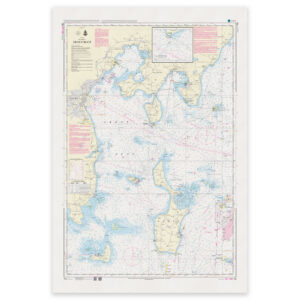
Denmark Chart 100 – Kattegat
32,80 € Add to cart -

Denmark Chart 100U – Teaching chart
9,64 € Add to cart -
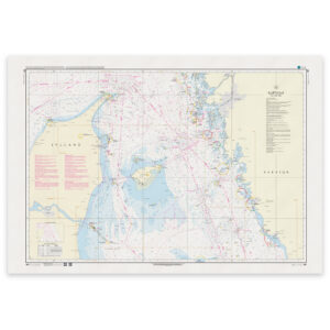
Denmark Chart 101 – Kattegat (Northern part)
32,80 € Add to cart -

Denmark Chart 102 – Kattegat (Southern part)
32,80 € Add to cart -

Denmark Chart 102U – Teaching chart
9,64 € Add to cart -

Denmark Chart 103 – Belt Sea (INT 1303)
32,80 € Add to cart -
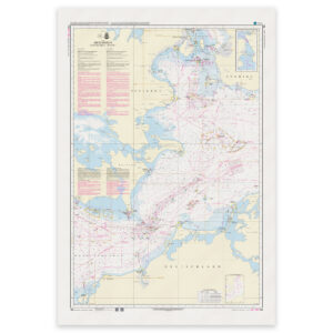
Denmark Chart 104 – Baltic Sea, Fehmarn Belt – Sound
32,80 € Add to cart -

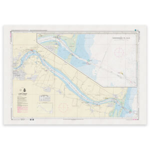
Denmark Chart 105 – Limfjorden, Aalborg-Løgstør (INT 1450)
32,80 € Add to cart -
Denmark Chart 106 – Limfjorden, Hals-Aalborg (INT 1382)
32,80 € Add to cart -
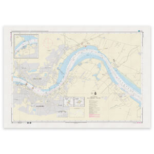
Denmark Chart 107 – Port of Aalborg (INT 1383)
32,80 € Add to cart -
Denmark Chart 108 – Limfjorden, Thyborøn-Mors (INT 1448)
32,80 € Add to cart -
Denmark Chart 109 – Limfjorden, Mors-Løgstør (INT 1449)
32,80 € Add to cart -
Denmark Chart 110 – Kattegat, Mariager Fjord
32,80 € Add to cart -
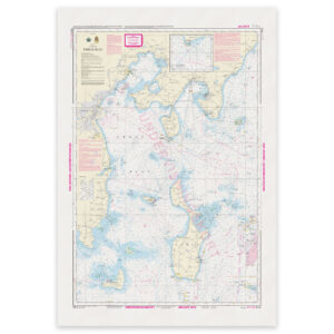
Denmark Chart 111 – Kattegat, Randers Fjord (INT 1381)
32,80 € Add to cart -
Denmark Chart 112 – Kattegat, Århus Bugt (INT 1380)
32,80 € Add to cart -
Denmark Chart 112U – Teaching chart
9,64 € Add to cart -
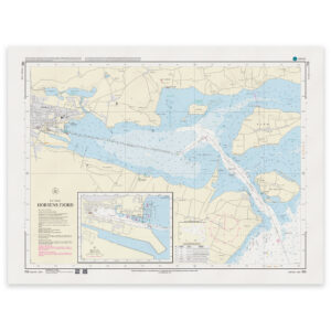
Denmark Chart 113 – Kattegat, Horsens Fjord
32,80 € Add to cart -

Denmark Chart 114 – Kattegat, waters north of Funen (INT 1377)
32,80 € Add to cart