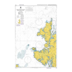
British Admiralty Chart 3281 – Shetland Islands, North-West Sheet

Official British Admiralty nautical chart covering the northwestern parts of the Shetland Islands, adapted for coastal navigation and transit.

Delivery is made in cooperation with StormGeo UK, official distributor of Admiralty maps. If the map is not in stock in Norway, it will be sent separately by DHL Express from the UK. Normal delivery time is 2-4 working days to most addresses in Norway. If delivery time is critical, please contact us and we will try to arrange the fastest possible delivery directly to the ship or port.

96,75 

British Admiralty

    Description

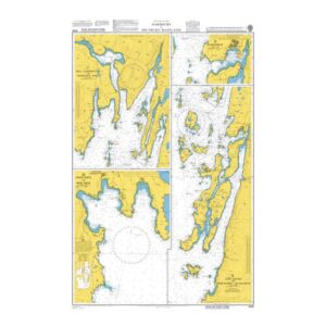
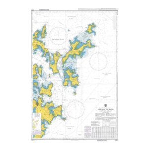
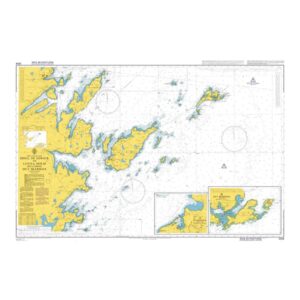
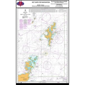
    This British Admiralty chart covers the northwestern parts of the Shetland Islands and adjacent waters in the North Atlantic. It provides a comprehensive overview of the coastline, islands, reefs, depths and navigation marks, and is adapted for navigation in an area characterized by exposure and challenging weather conditions.

    The chart is suitable for coastal navigation, transit and voyage planning around the North West of Shetland. Developed for professional navigators, it provides a reliable chart basis for safe navigation in both open and coastal waters.