

 Helgeland bailiffs 1826
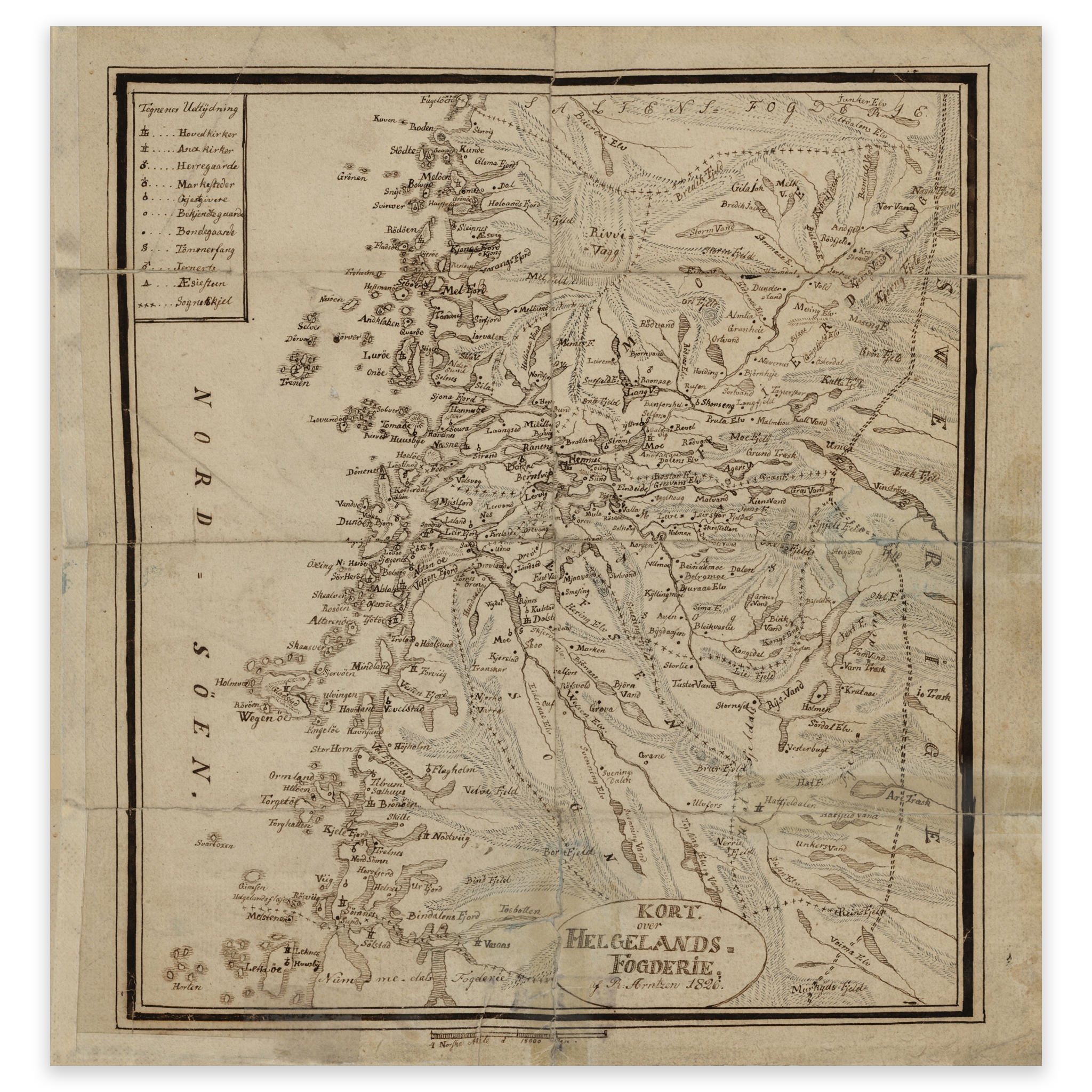

Helgeland bailiffs 1826
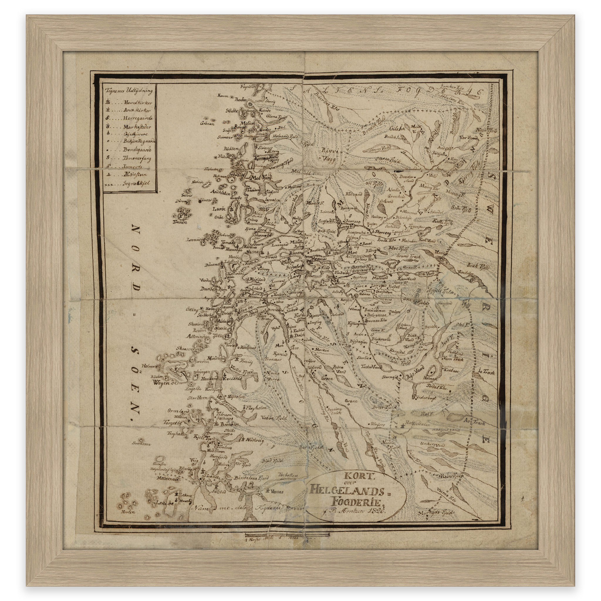
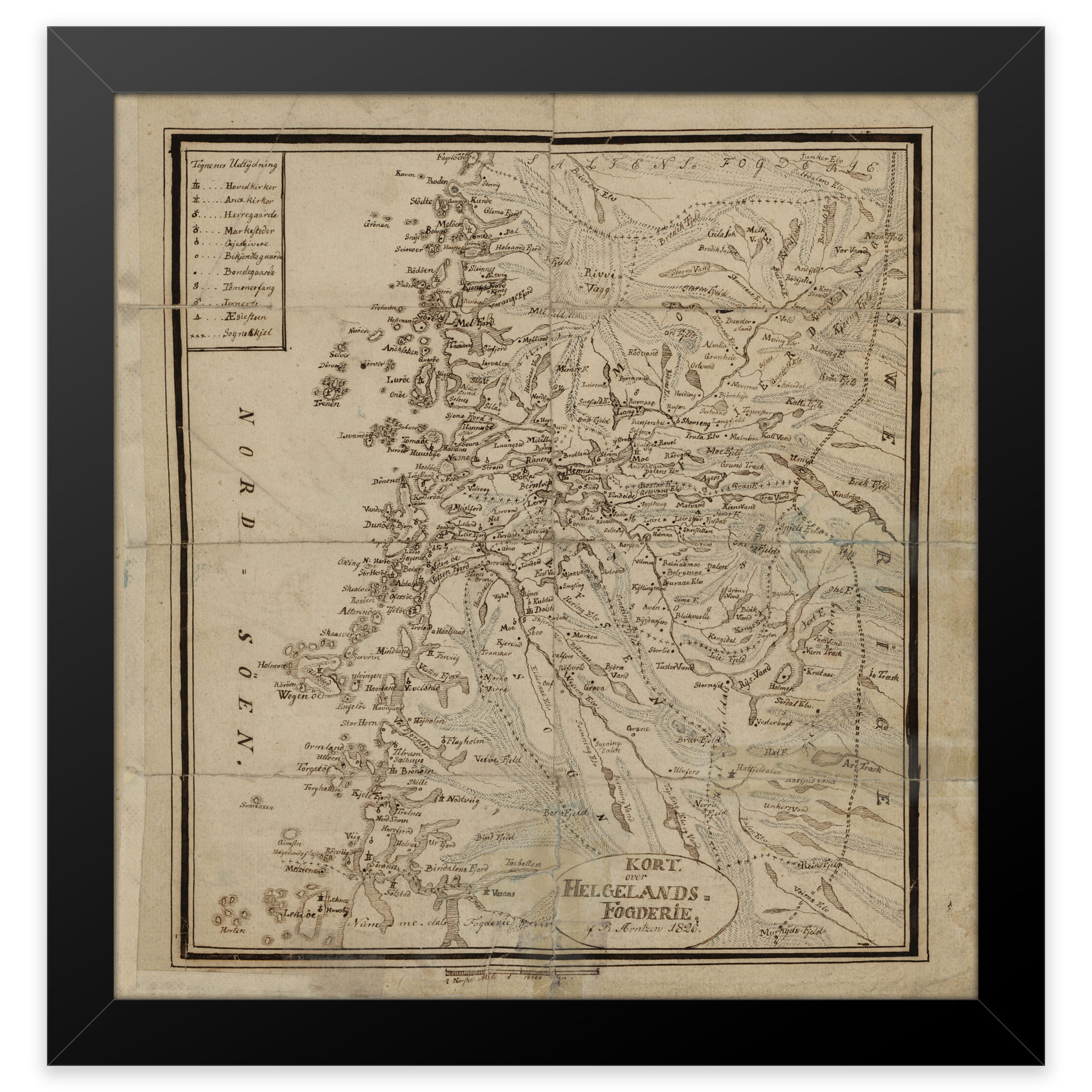
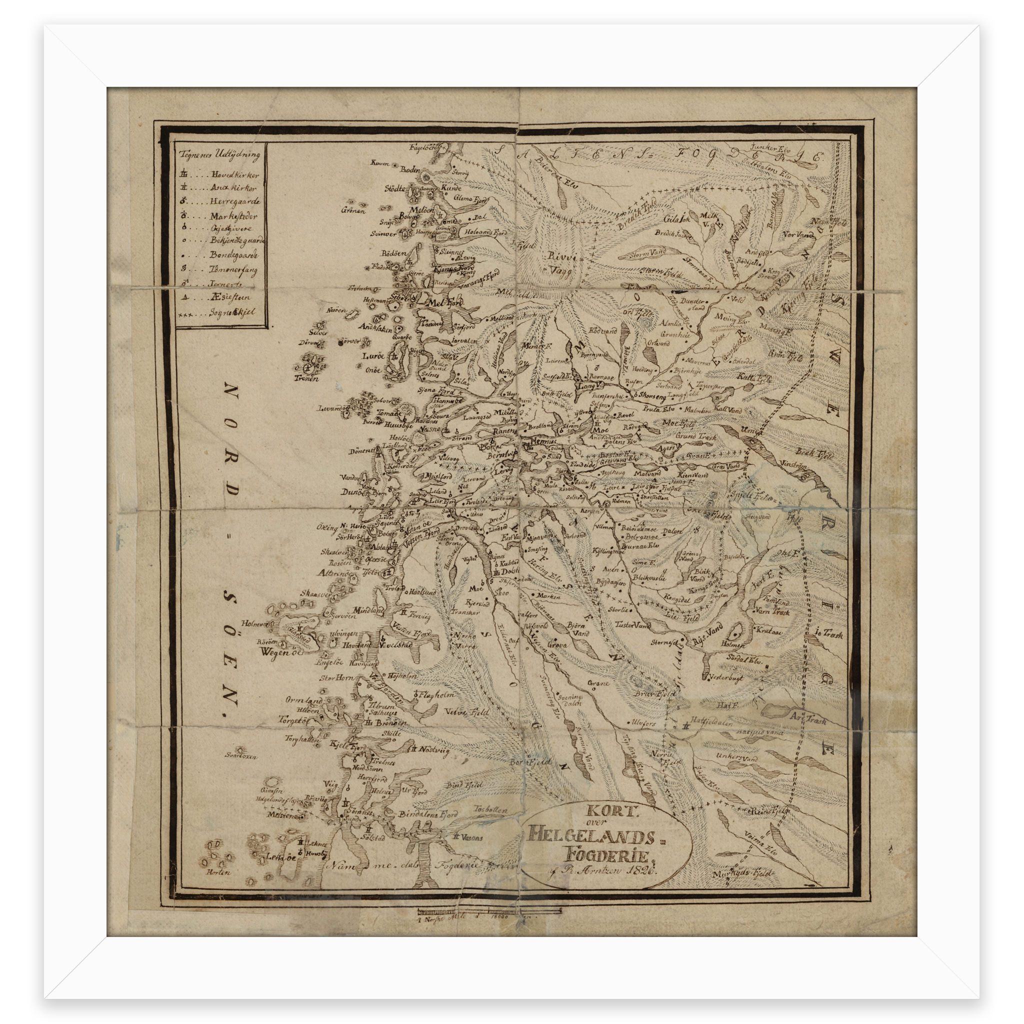
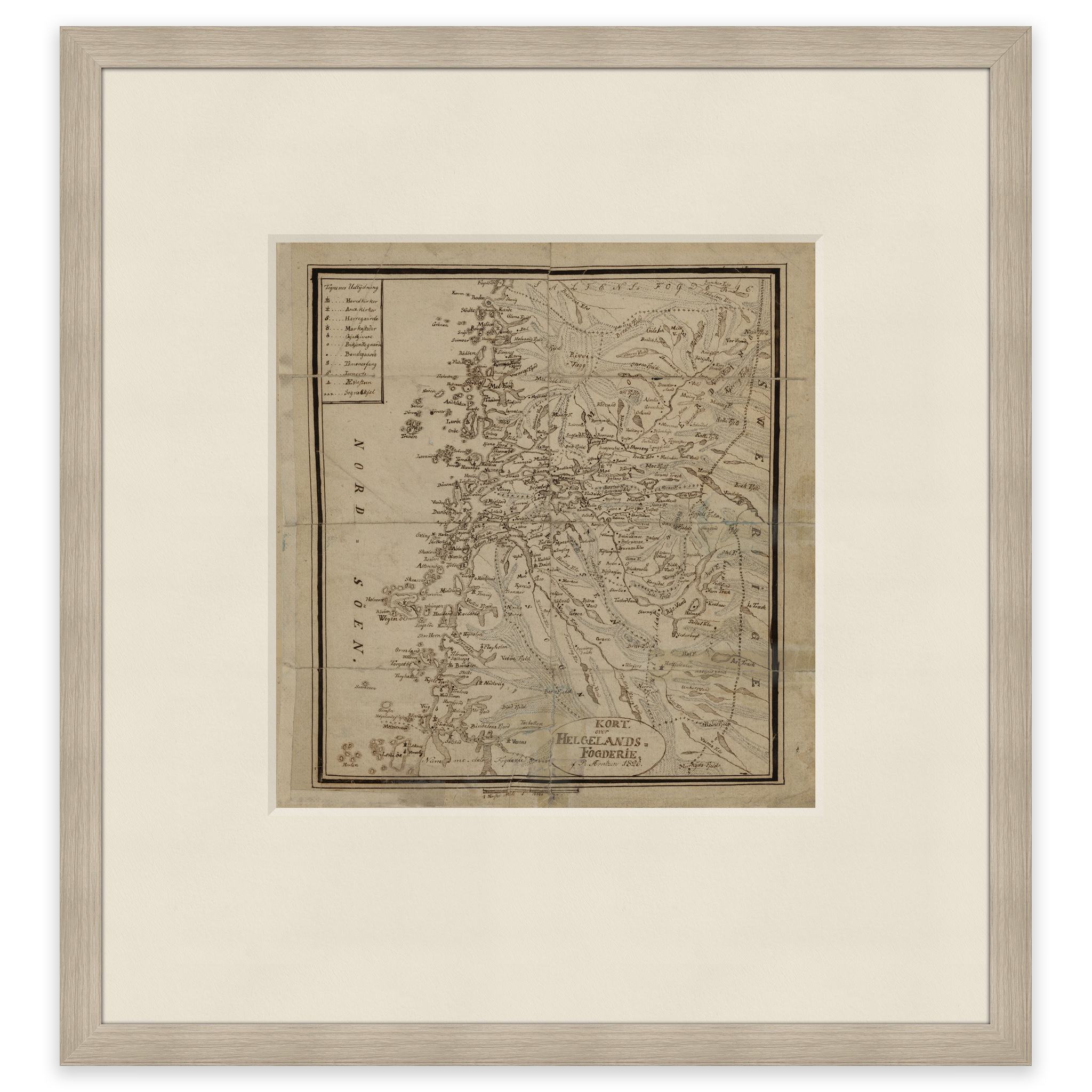
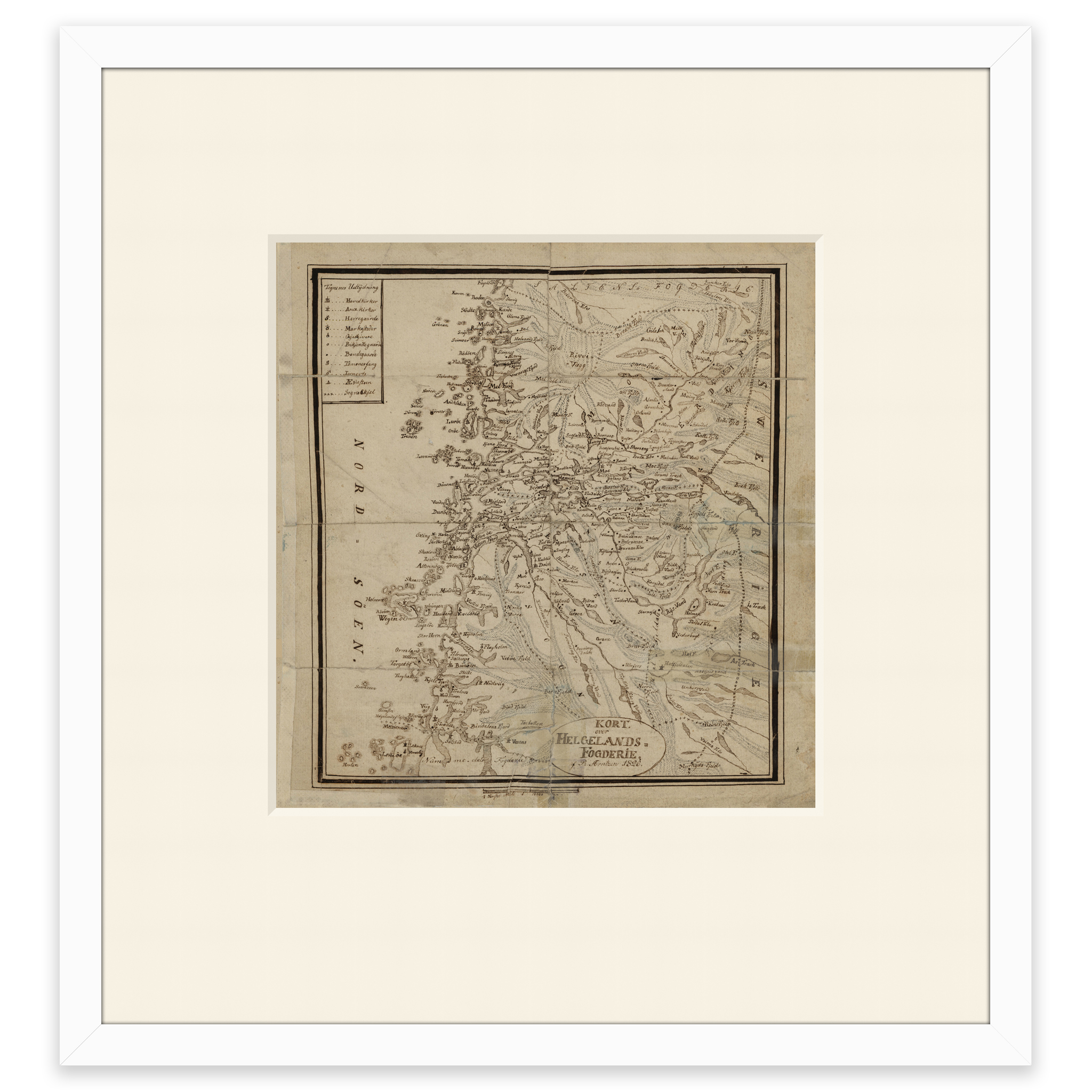
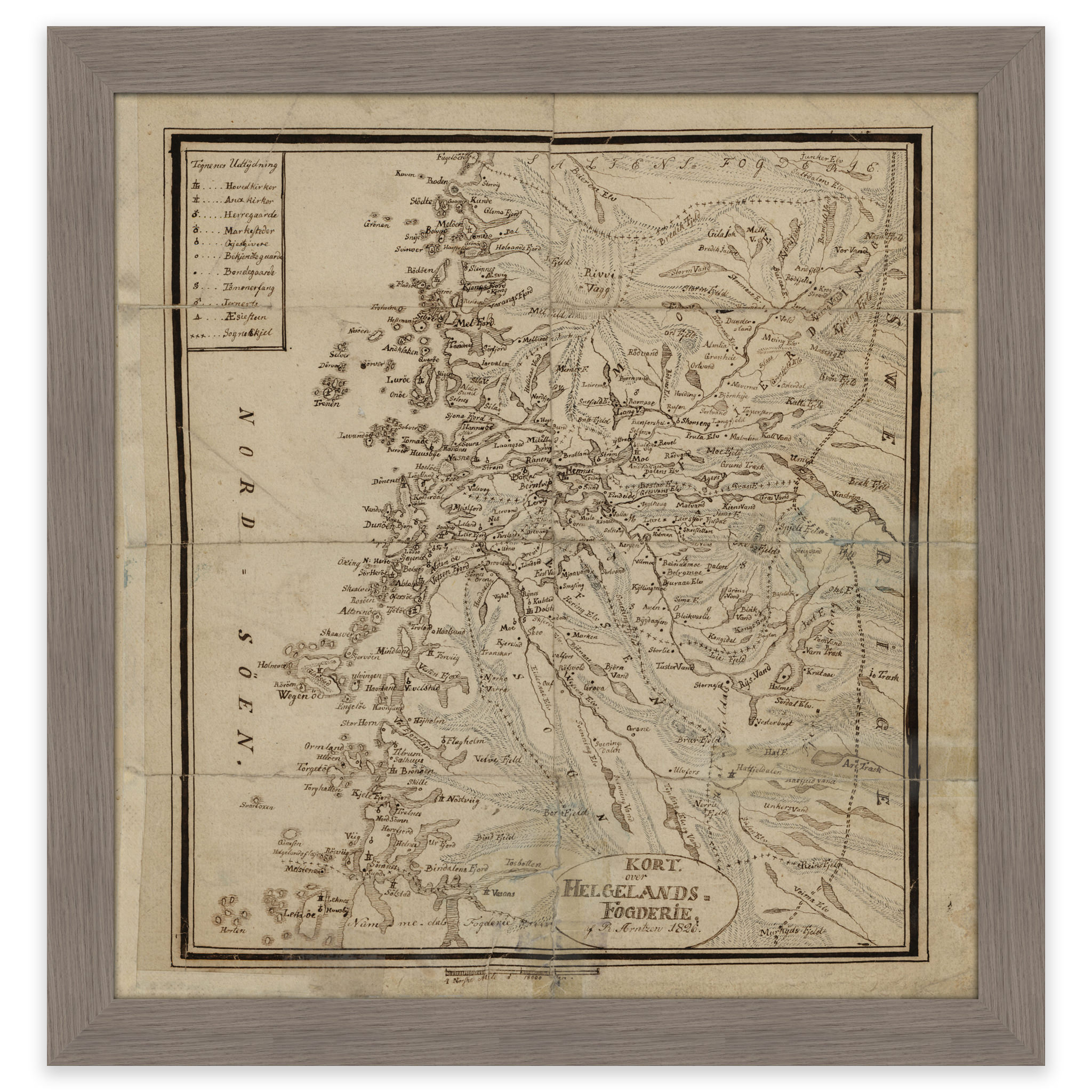
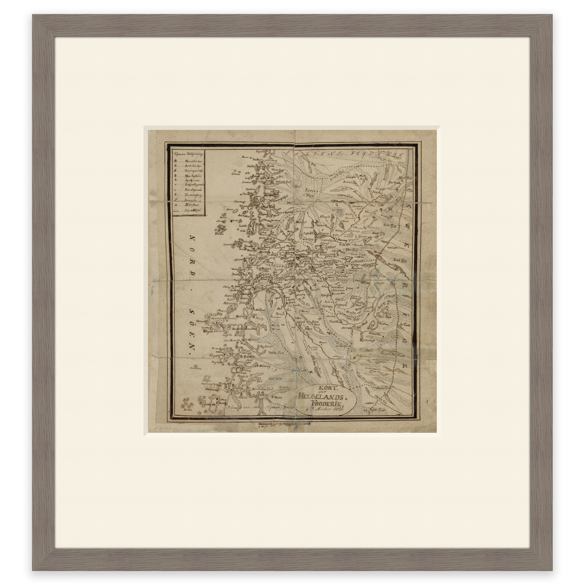
Map of Helgeland’s bailiwick in 1826. The map covers the area between Brønnøysund and Ørnes. The map is delivered in its original size of 25.9 x 27.2 cm. The size with frame and passepartout is 45.9 x 49.2 cm. Would you like the map in a different size? Just get in touch – we’ll be happy to give you a quote for customization.