

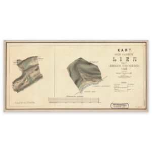
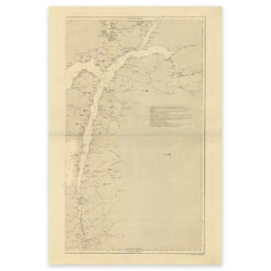
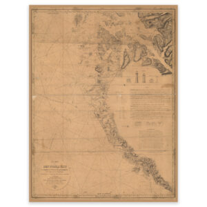
 Historical nautical chart of the area Egersund, Kvitsøy, Tau and Forsand
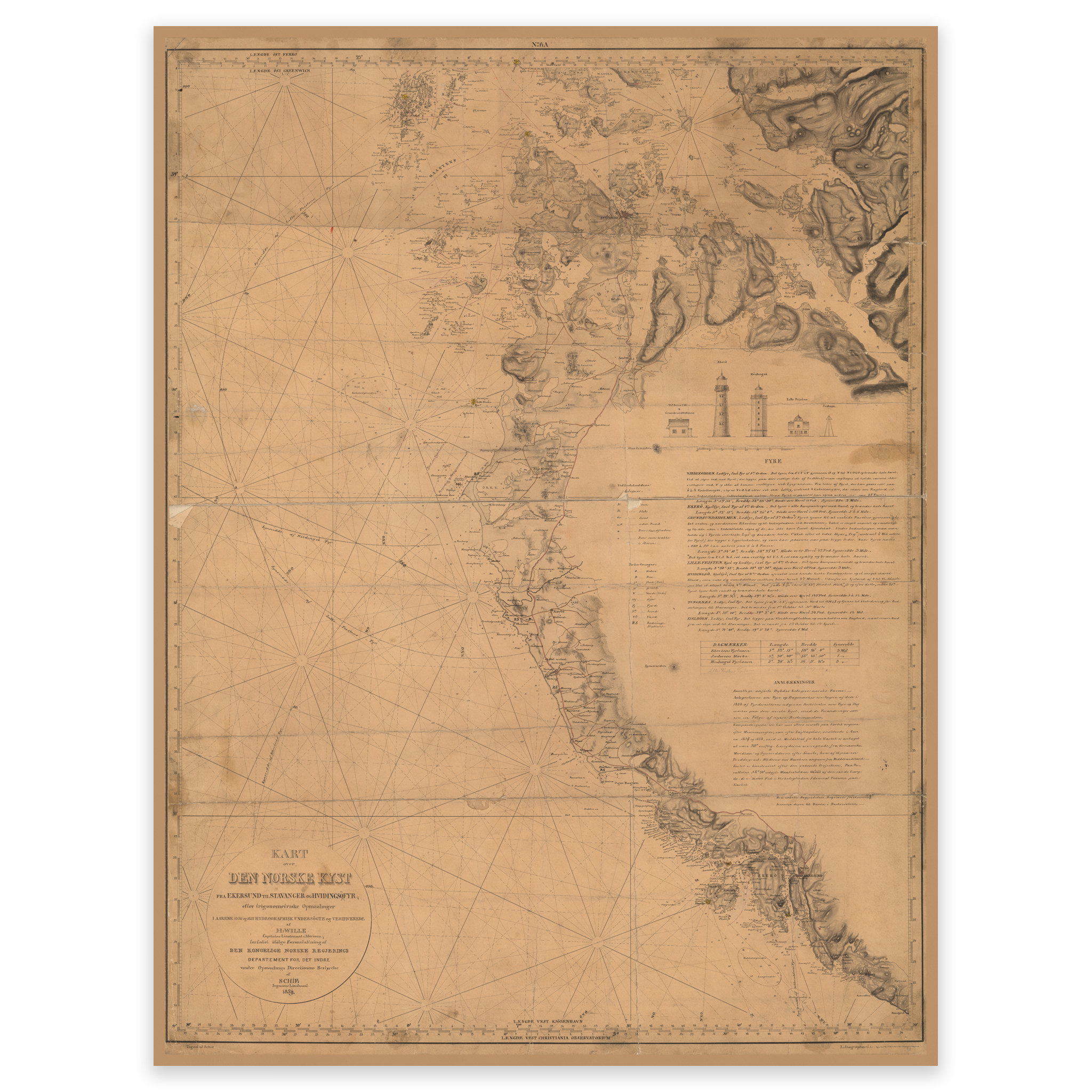
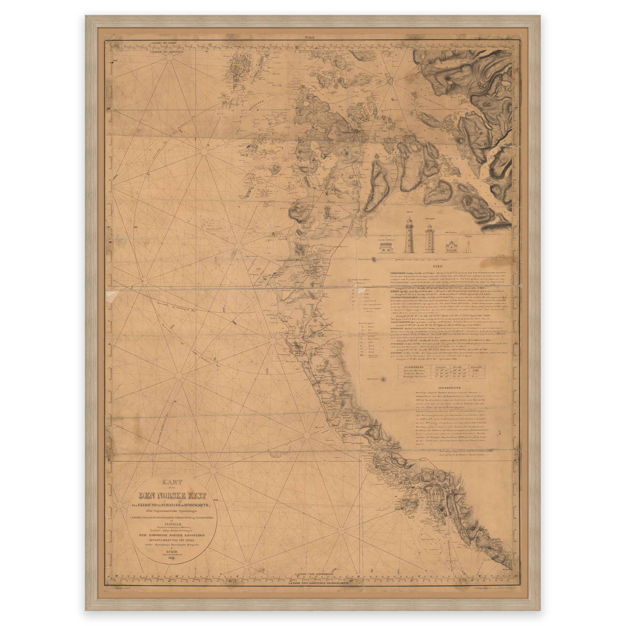
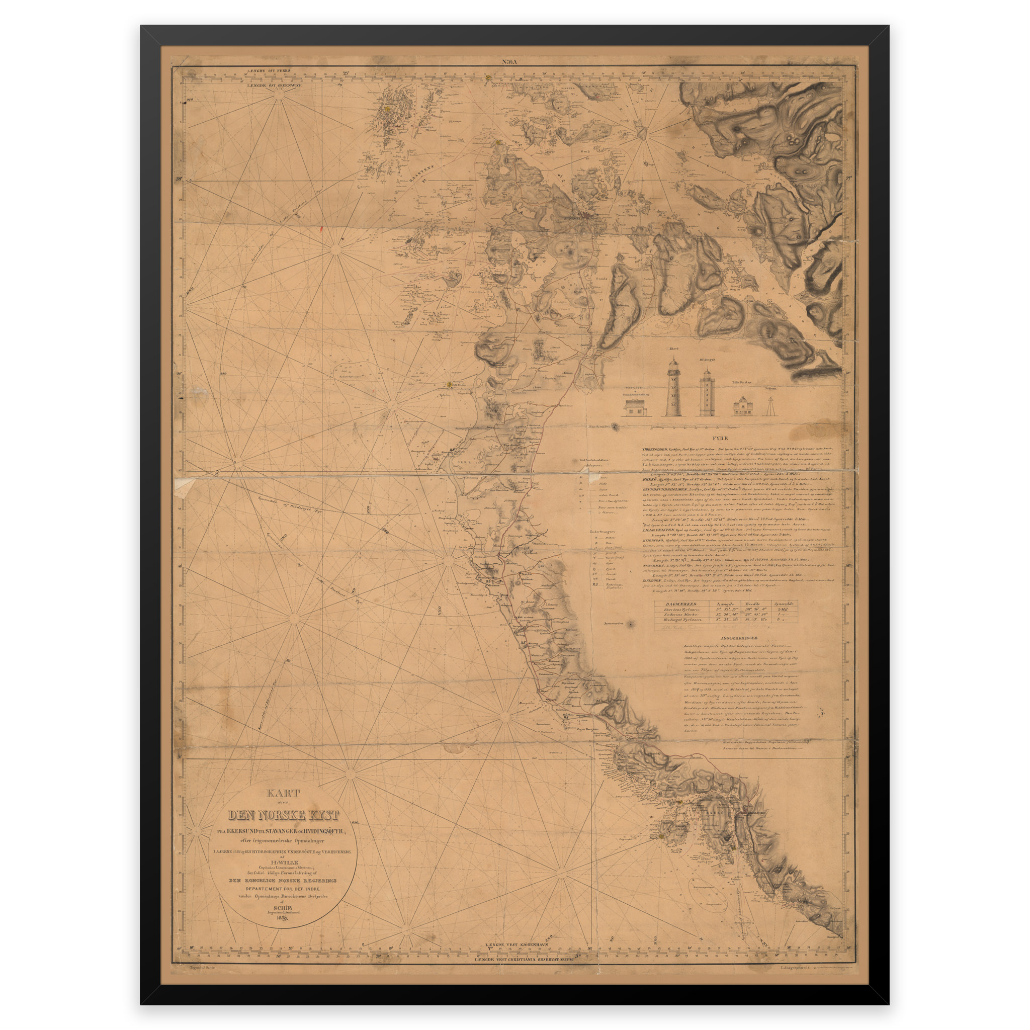
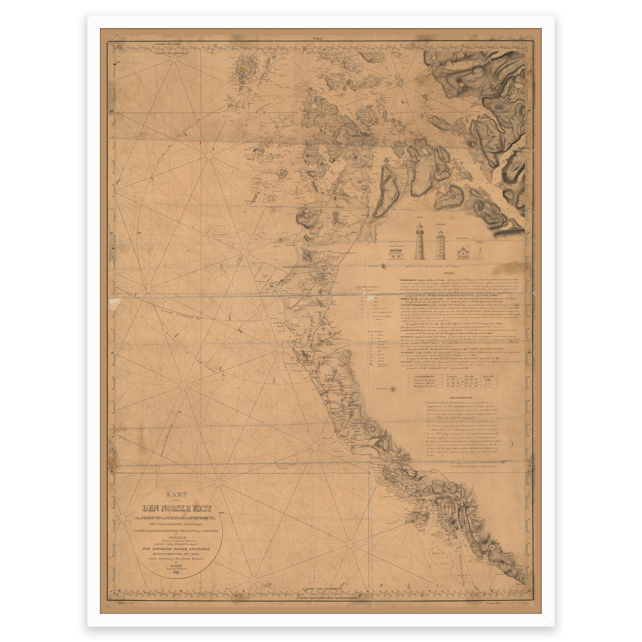
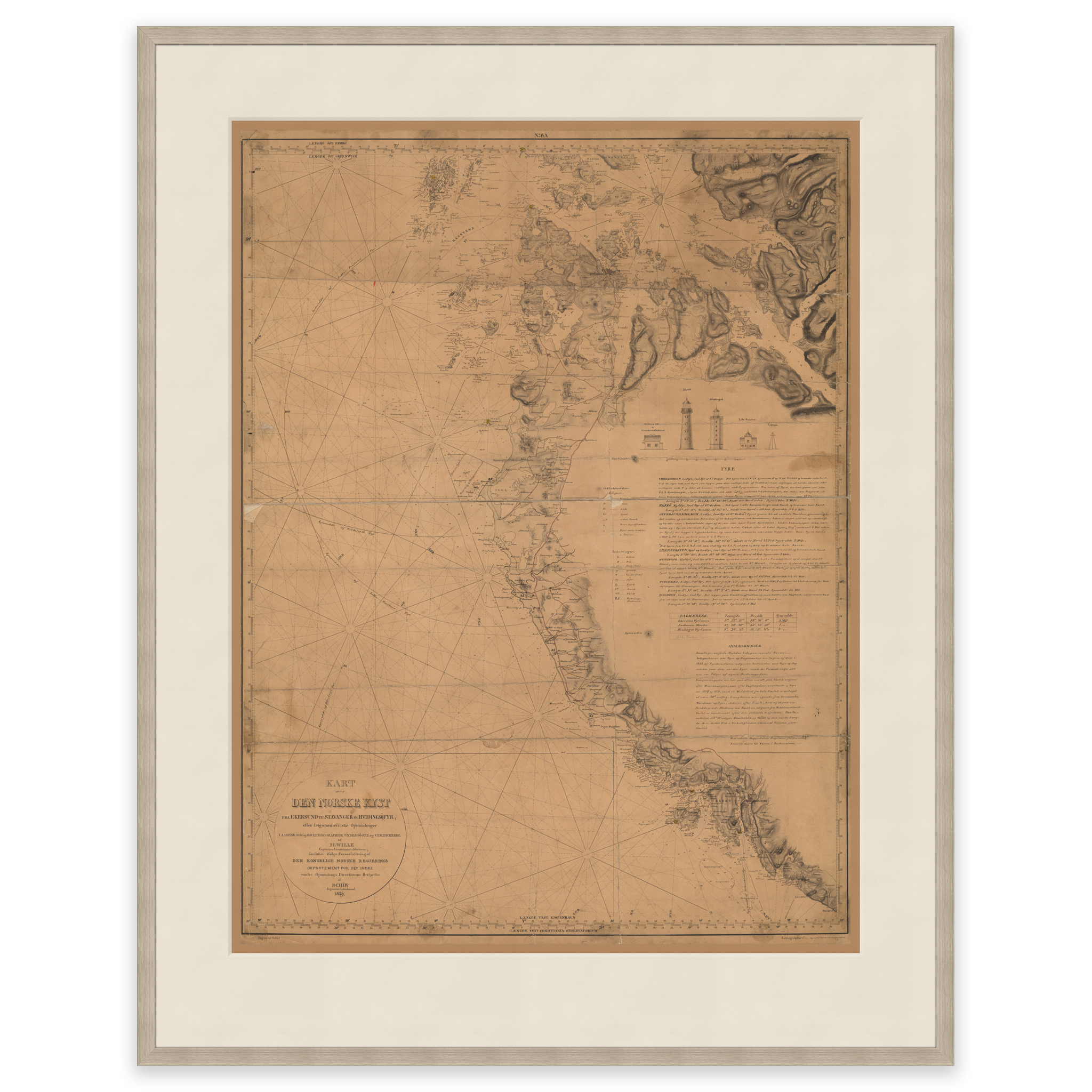
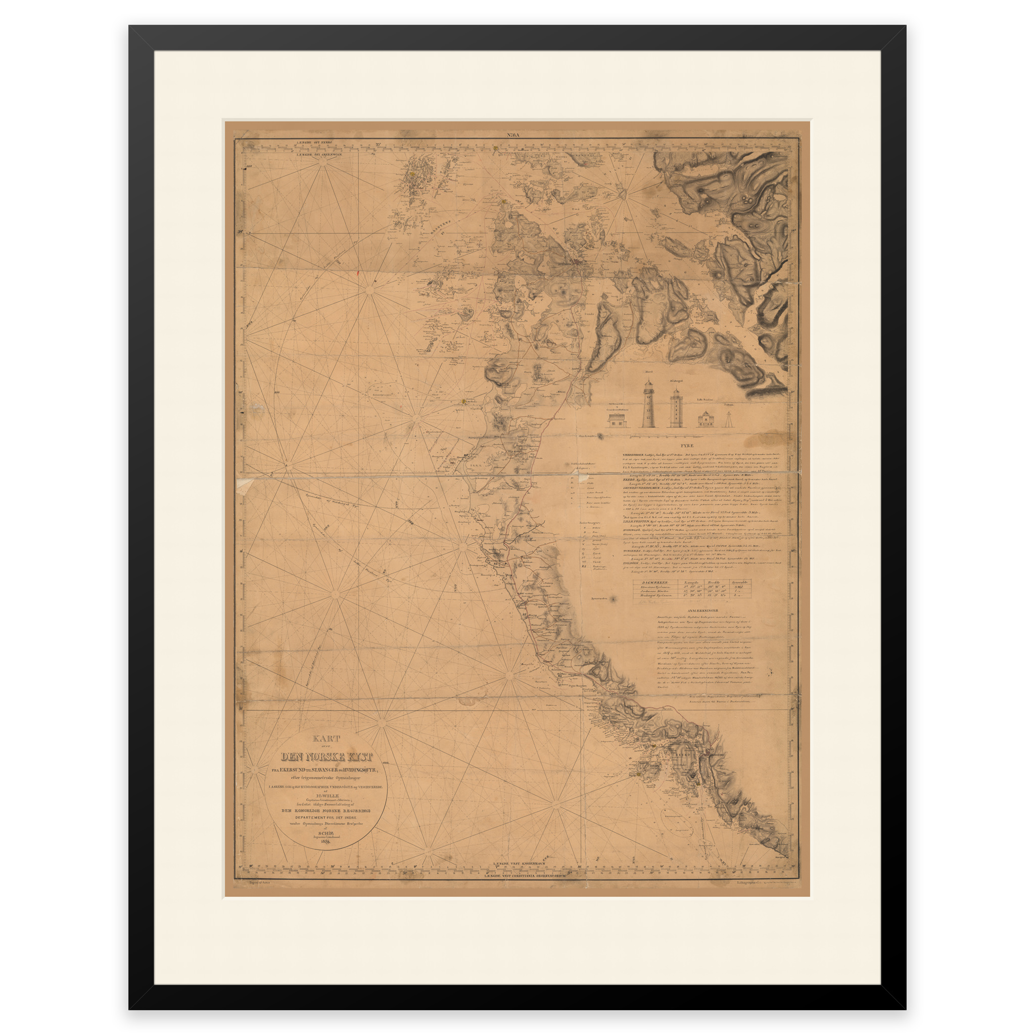
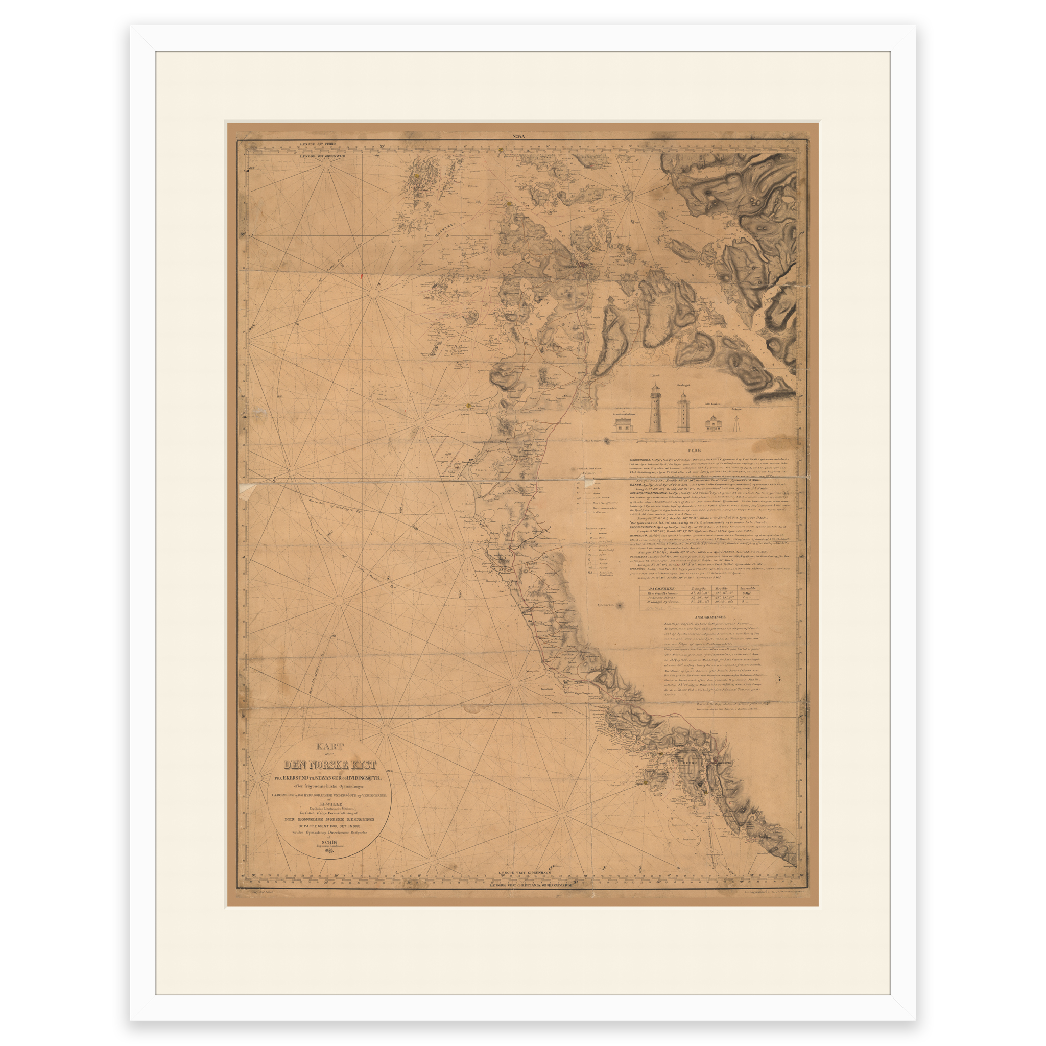
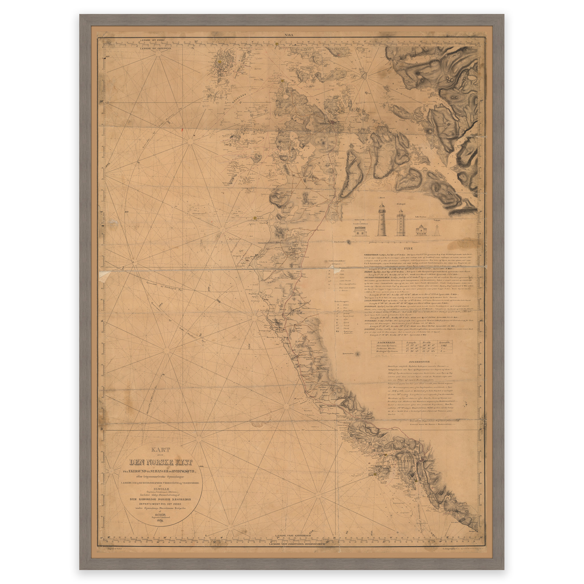
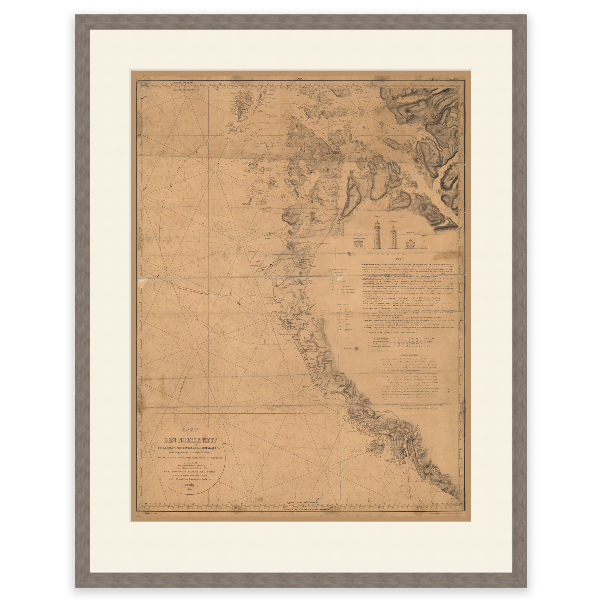
Historical nautical chart of the area Egersund, Kvitsøy, Tau and Forsand
The map is from 1859 and covers the area of Egersund, Kvitsøy, Tau and Forsand. The map is delivered in its original size of 102.7 x 61.5 cm. Do you want the map in a different size? Just get in touch – we’ll be happy to give you a quote for customization.