
 Kristiania and surroundings 1881
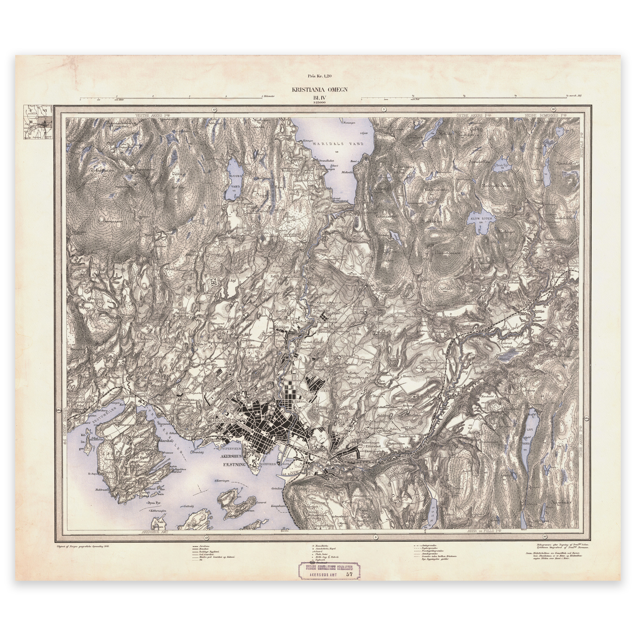
Kristiania and surroundings 1881
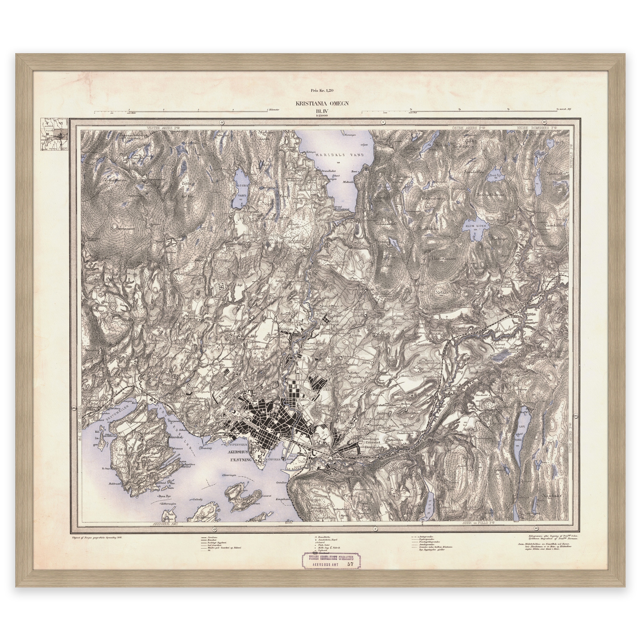
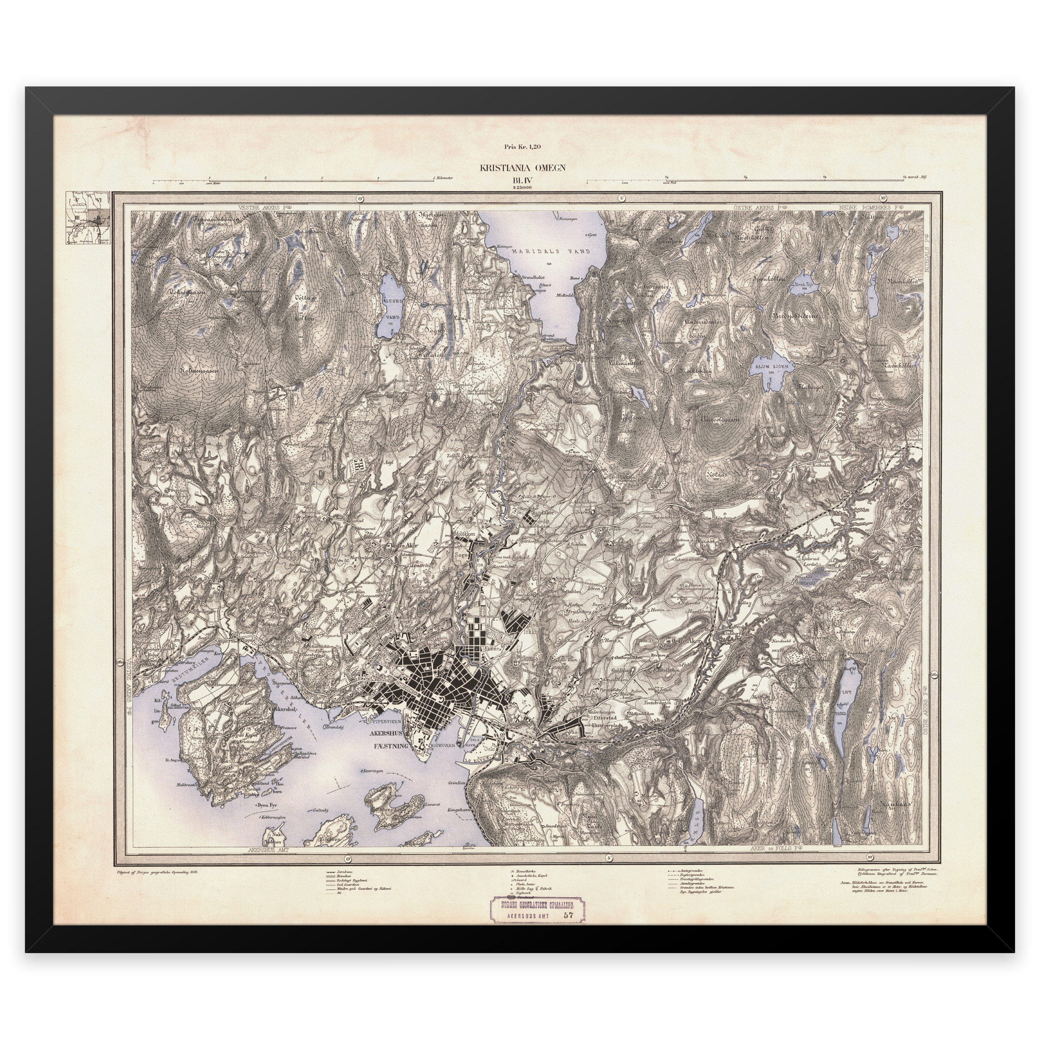
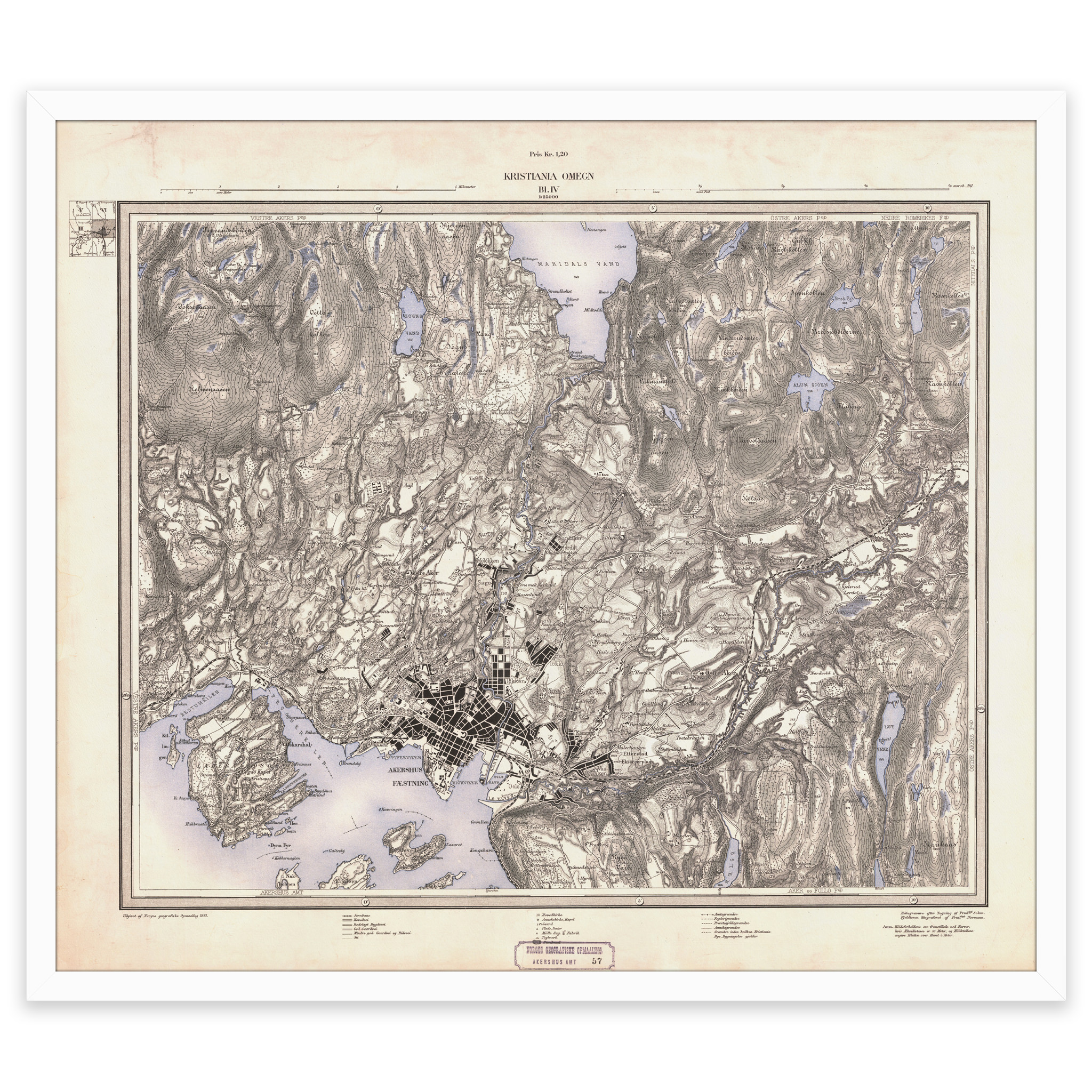
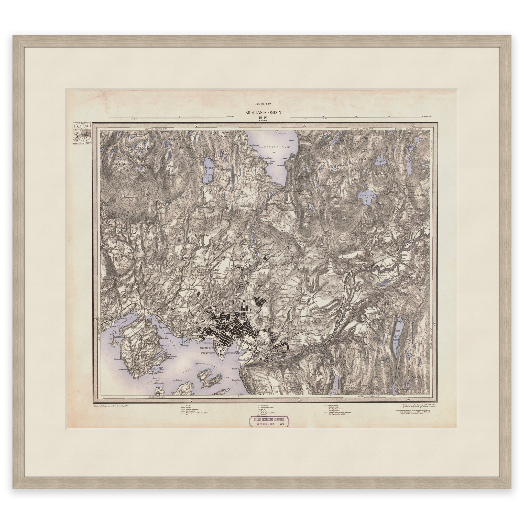
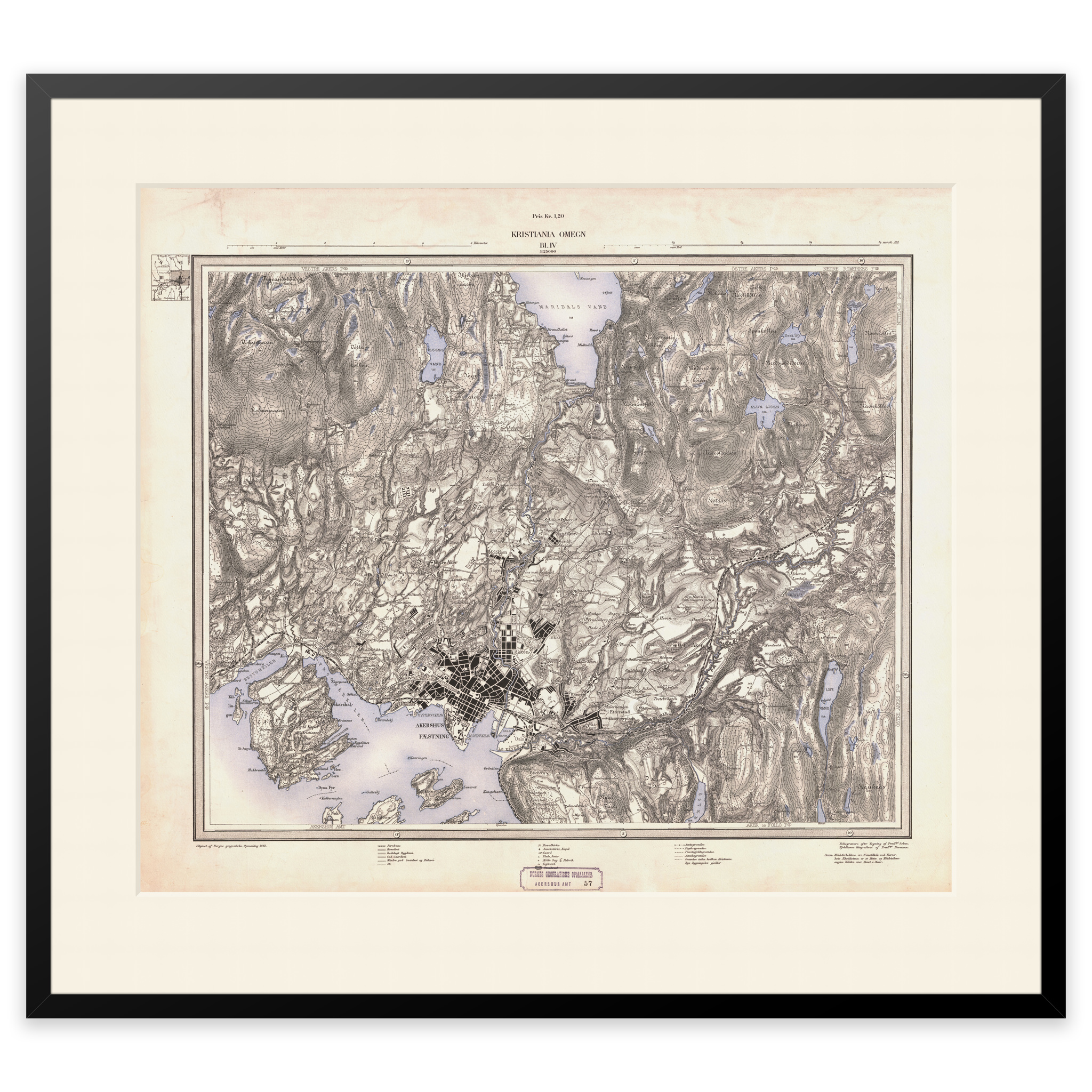
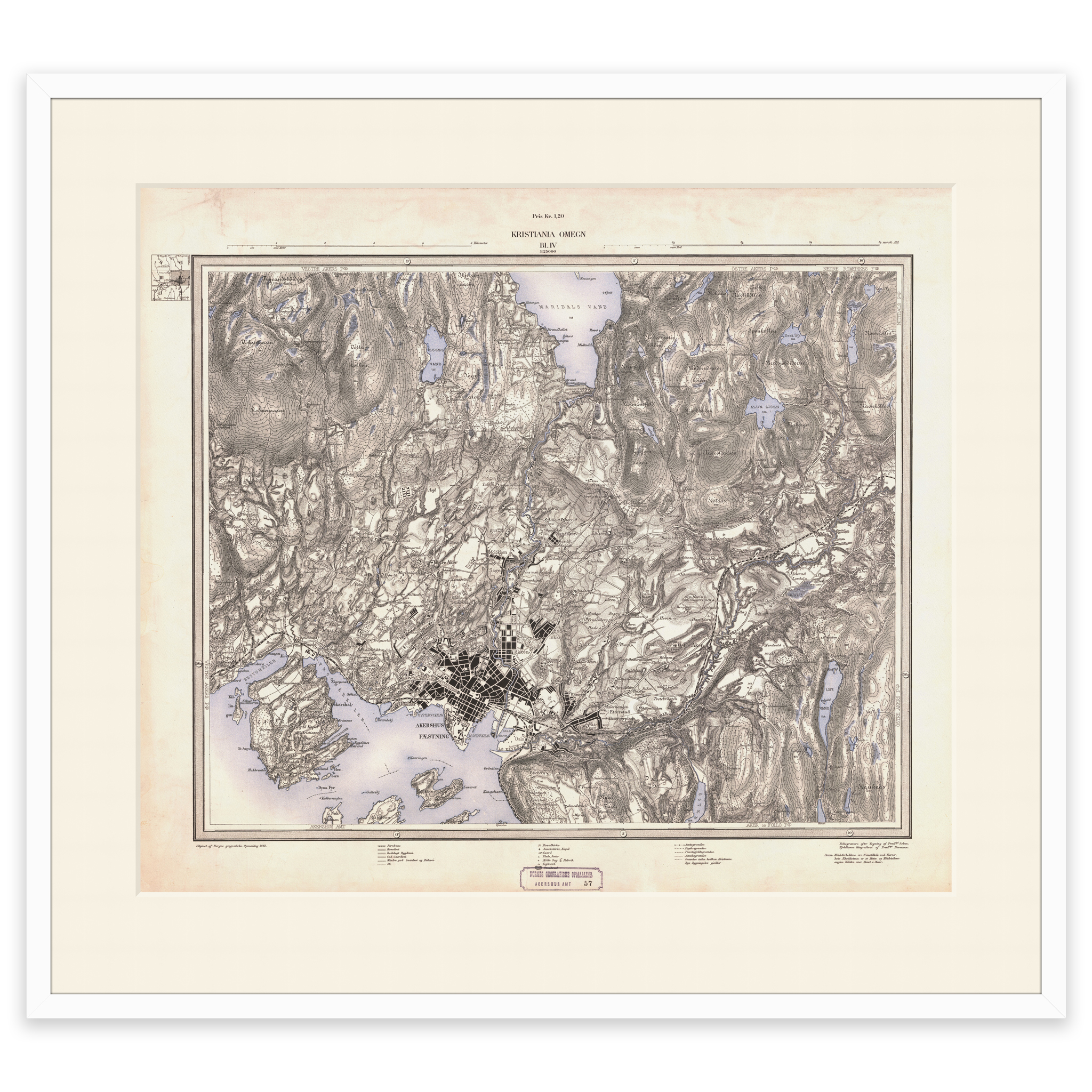
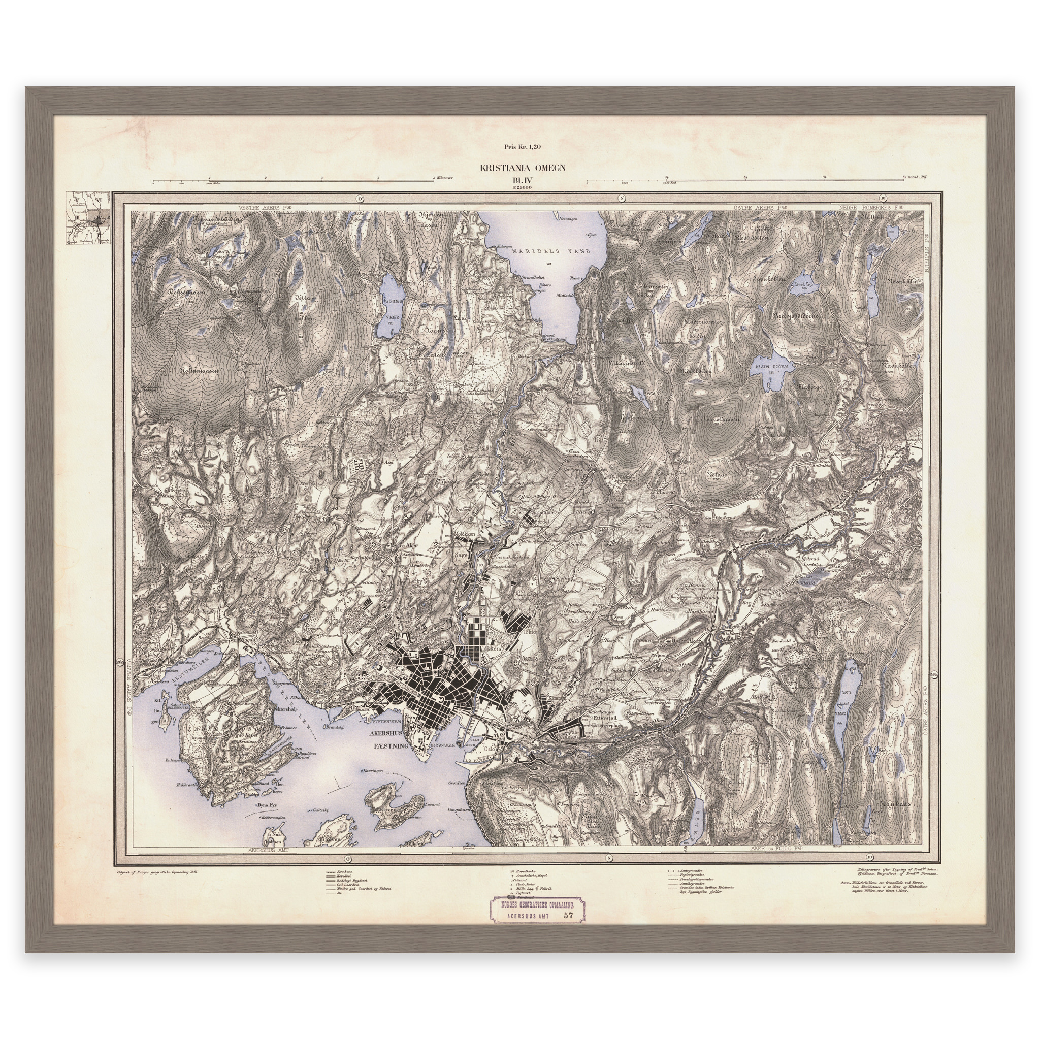
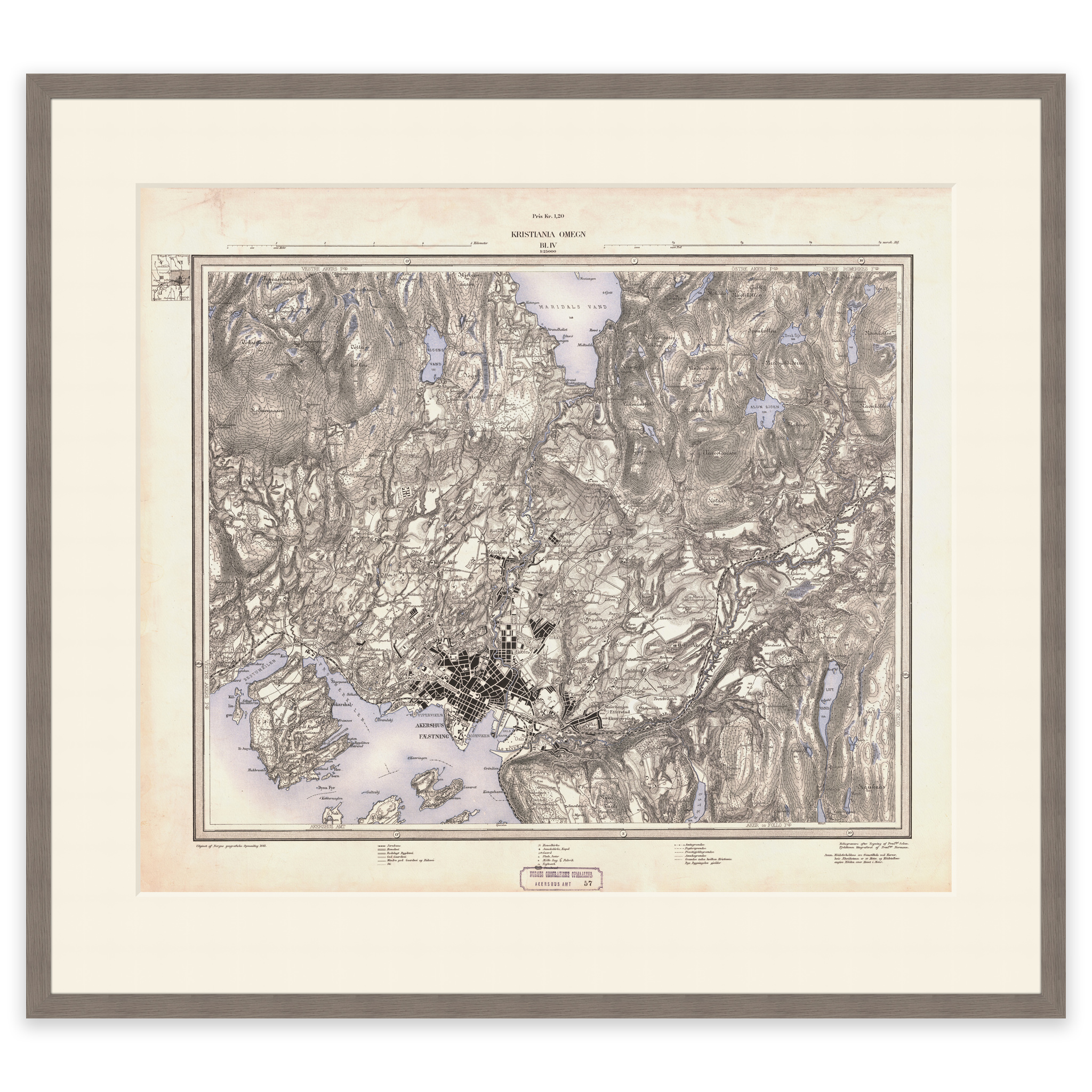
Map of Kristiania and surroundings from 1881. Covers the area between Bygdøy, Holmenkollen, Romsås and Oppsal. The map is delivered in original size 69 x 55.6 cm. The size with frame and passepartout is 87 x 74.6 cm. Do you want the map in a different size? Just get in touch – we’ll be happy to give you a quote for customization.