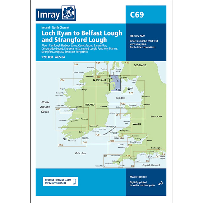
Description
This boating chart covers the stretch from Loch Ryan on the southwest coast of Scotland to Belfast Lough and Strangford Lough on the east coast of Northern Ireland. The chart has been developed for recreational boating and sailing navigation in the waters around the North Channel, an area characterized by tidal currents, traffic and variable weather conditions.
The map provides an overview of coastlines, islands, shipping lanes and key approaches to ports and fjords in both Scotland and Northern Ireland. It is ideal for route planning and overview navigation, and is often used in combination with more detailed port and local charts for safe navigation through the area.
Imray is a renowned British chart manufacturer with extensive experience in nautical charts and publications for leisure boats. Their charts are designed with practical on-board use in mind, combining clear cartography with reliable nautical information for sailors and powerboaters.