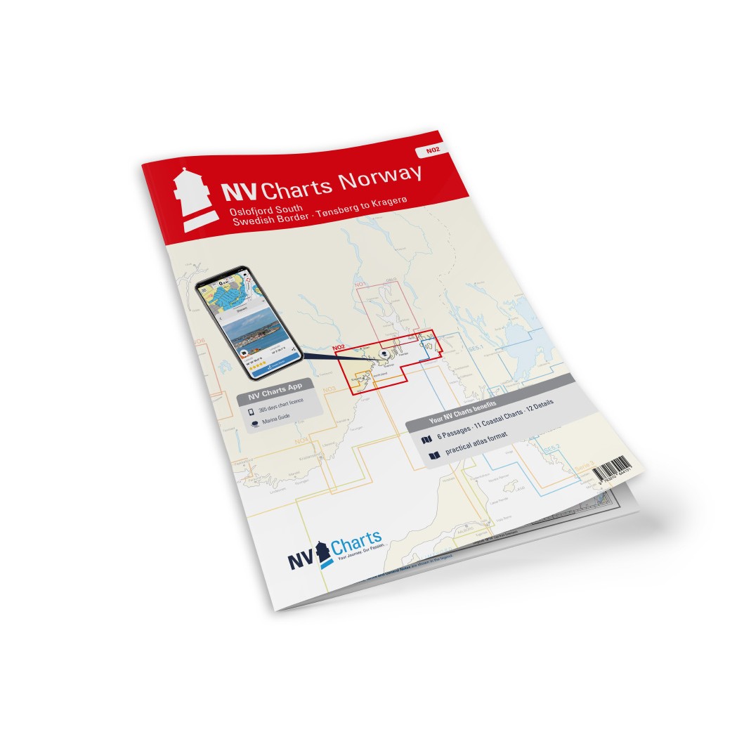
Description
NV Charts NO2 Oslofjord South is a complete map package with both paper and digital charts for the southern part of the Oslofjord, from the Swedish border to Kragerø. The charts are based on official data from the Norwegian Mapping Authority and provide detailed and reliable information about the coastline, approaches, ports and anchorages – ideal for both planning and safe navigation along the coast.
The package includes paper charts in convenient atlas format (A3), combined with digital access via the NV Charts app and PC/Mac. The digital charts can be used offline and activated on up to 5 devices, so you can easily use the charts both on board and on land.
Characteristics
Paper map in A3 atlas format with a good balance between overview and details.
Digital access via NV Charts (app + PC/Mac) with offline use.
Detailed map basis for sailing, approaches and port calls in the southern part of the Oslofjord.
Map overview
C1 Skagerrak – Oslofjord (1:375 000).
C2 Oslofjord South (1:120 000).
C3 Larvik to Risør (1:120 000).
C21 Norway – Oslo to Mo-i-Rana (1:1,750,000).
C22 Norway – Mo-i-Rana to Kirkenes (1:1 750 000).
C23 North Atlantic (1:14 500 000).
C4 Fredrikstad approach (1:40 000).
C5 Singlefjord (1:40 000).
C6 Søndre Sandøy to Torbjørnskjær (1:40 000).
C7 Hollenderbåen to Torbjørnskjær-Færder (1:40 000).
C8 Færder to Veierland (1:40 000).
C9 Veierland to Svenner-Sandefjordsfjorden (1:40 000).
C10 Svenner to Tvistein-Larviksfjorden (1:40 000).
C11 Tvistein to Langesundsbukta (1:40 000).
C12 Langangsfjord, Eidangerfjord and Frierfjord (1:40 000).
S13 Langesundsbukta to Jomfruland (1:40 000).
S14 Kragerø inlets (1:40 000).
Updates
Always delivered in the latest available edition from NV Charts. If a new and updated edition is launched within 30 days of purchase, the map can be exchanged for a new edition free of charge.