Description
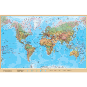
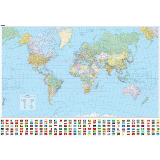
This political world map is a functional wall map at a scale of 1:30,000,000, designed for practical use where durability and easy cleaning are important. The map is laminated and printed on Tyvek material, making it resistant to moisture and wear compared to regular paper maps.
The map displays the world’s countries, political borders, capitals, and national flags, and is produced in a format of 140 × 99 cm. It is supplied as an unframed wall map and is well-suited for use in schools, institutions, warehouses, workshops, or other environments where the map is actively used.
The world map was published in 2017 and reflects the political divisions as they were at the time of publication. It is therefore less suitable where completely updated information is crucial, but functions well as an overview map and educational tool.
This is a robust and practical world map for functional use, rather than a decorative or updated reference map.