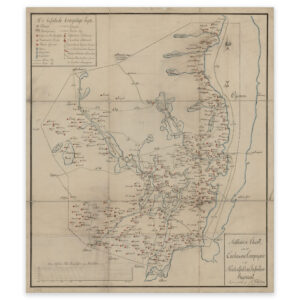


 Romerike 1860
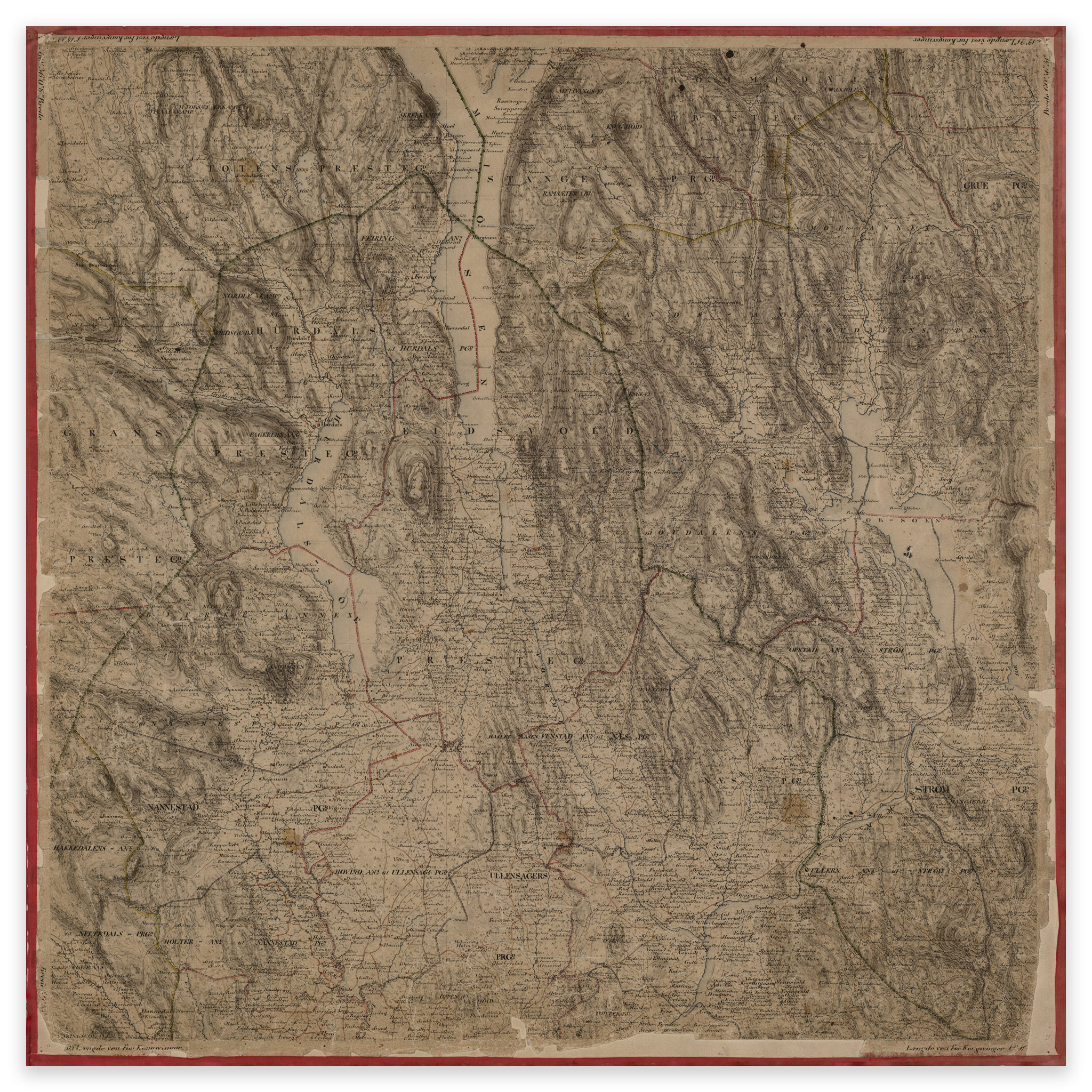
Romerike 1860
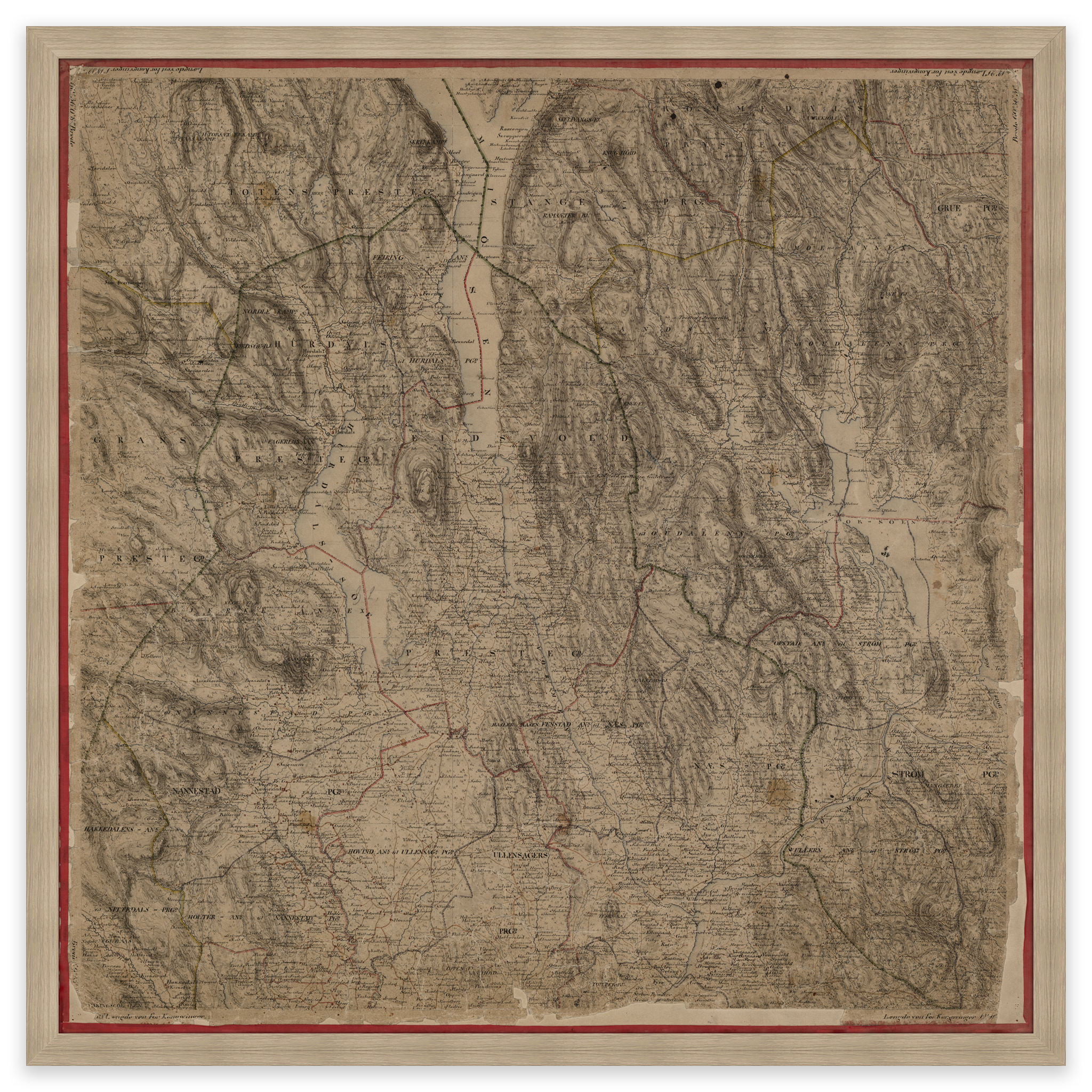
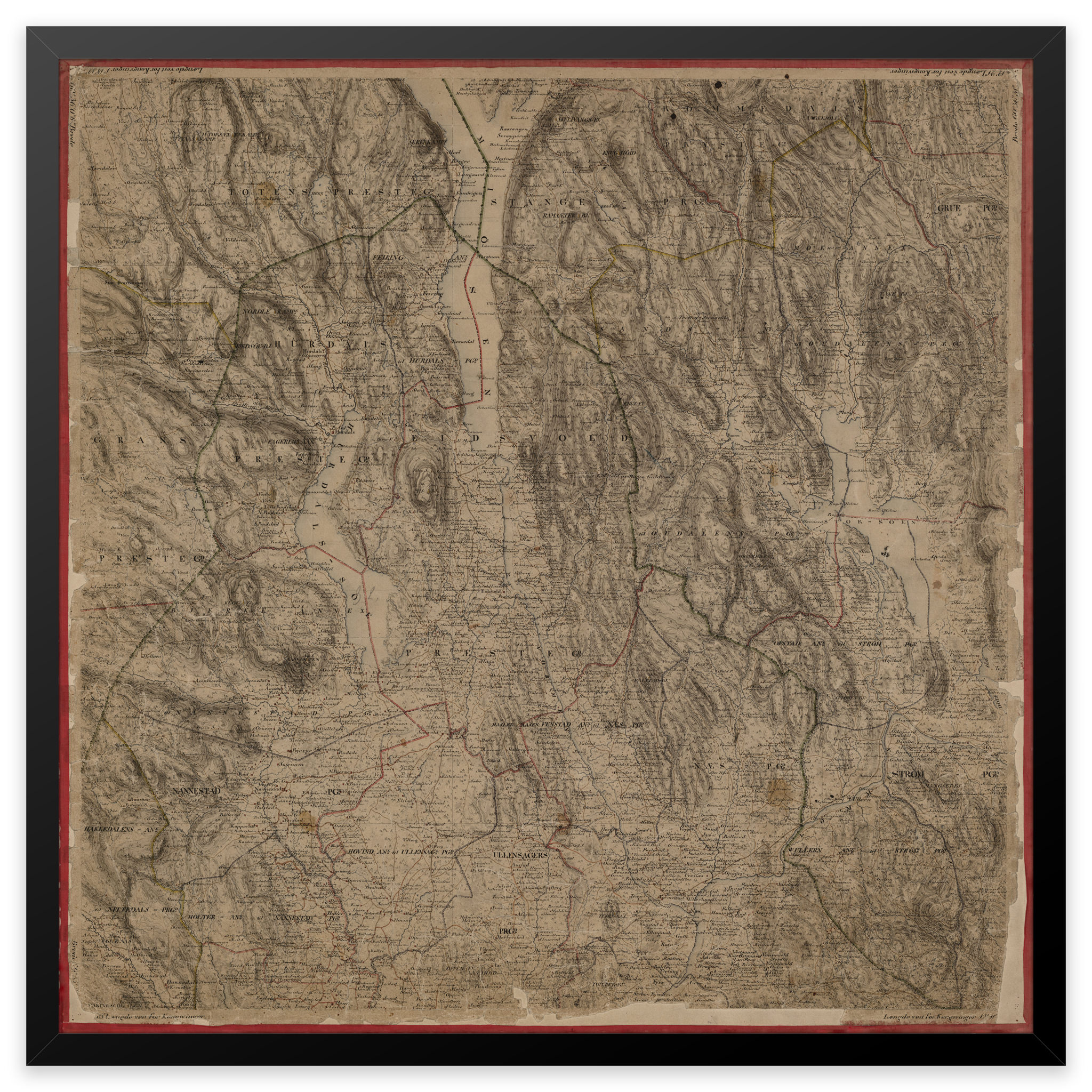
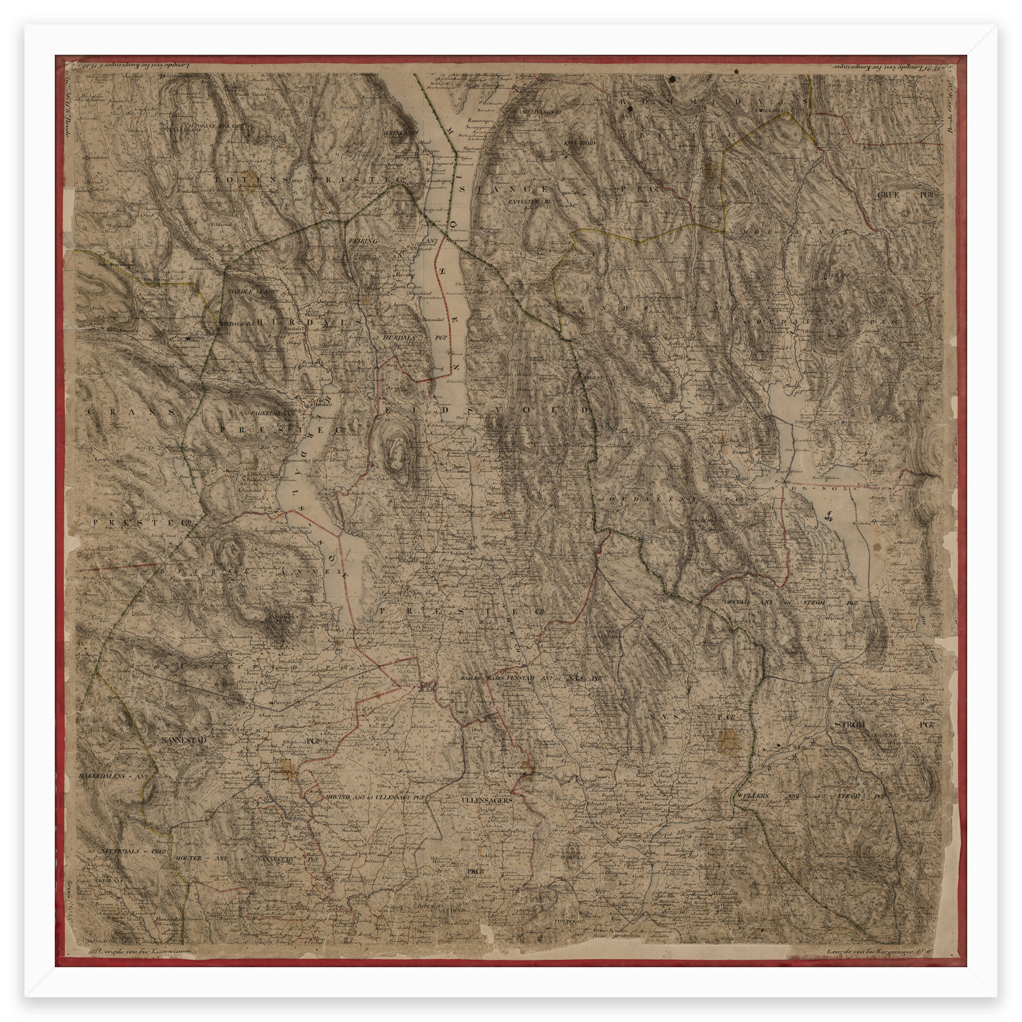
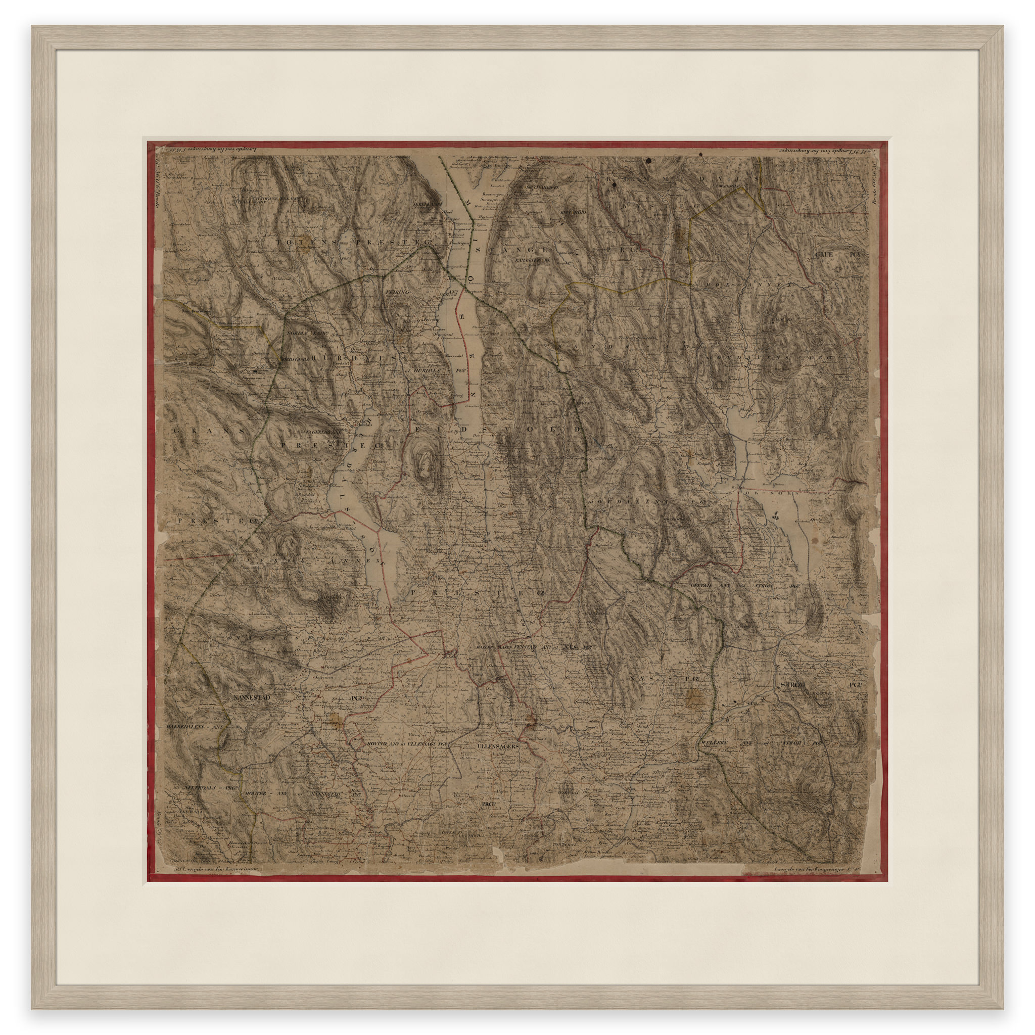
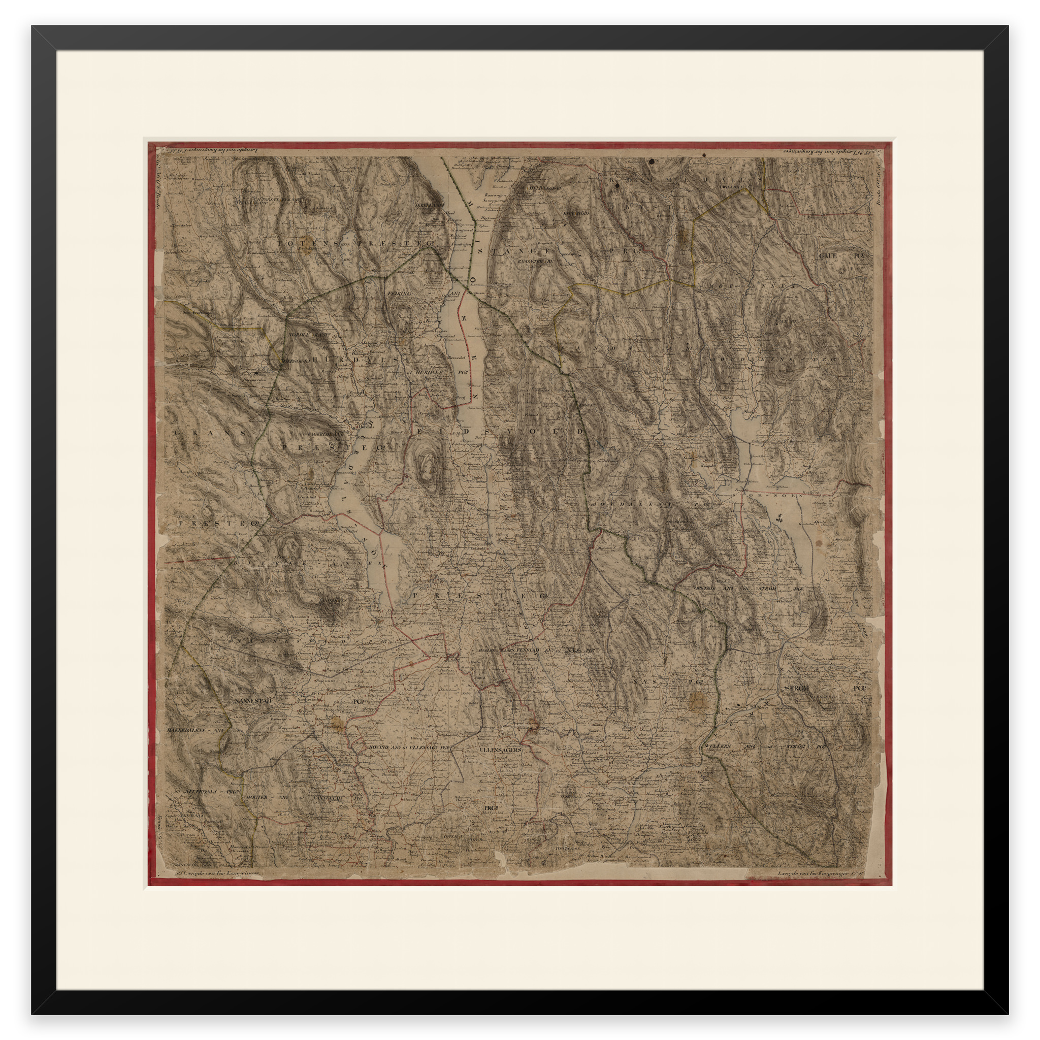
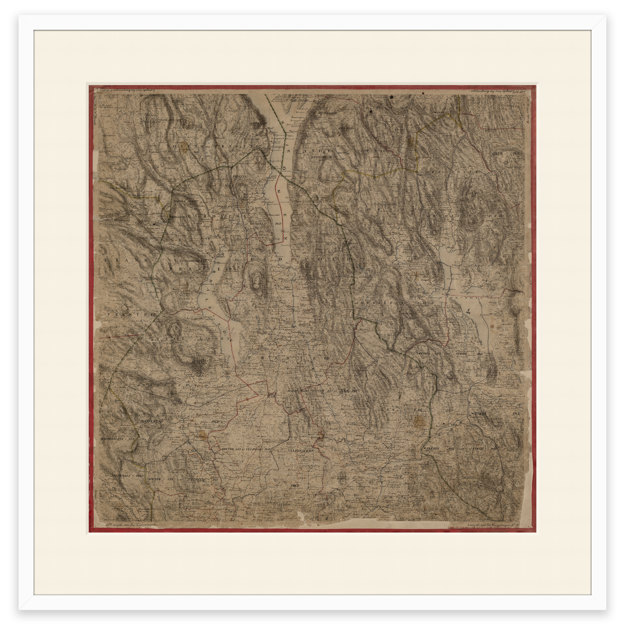
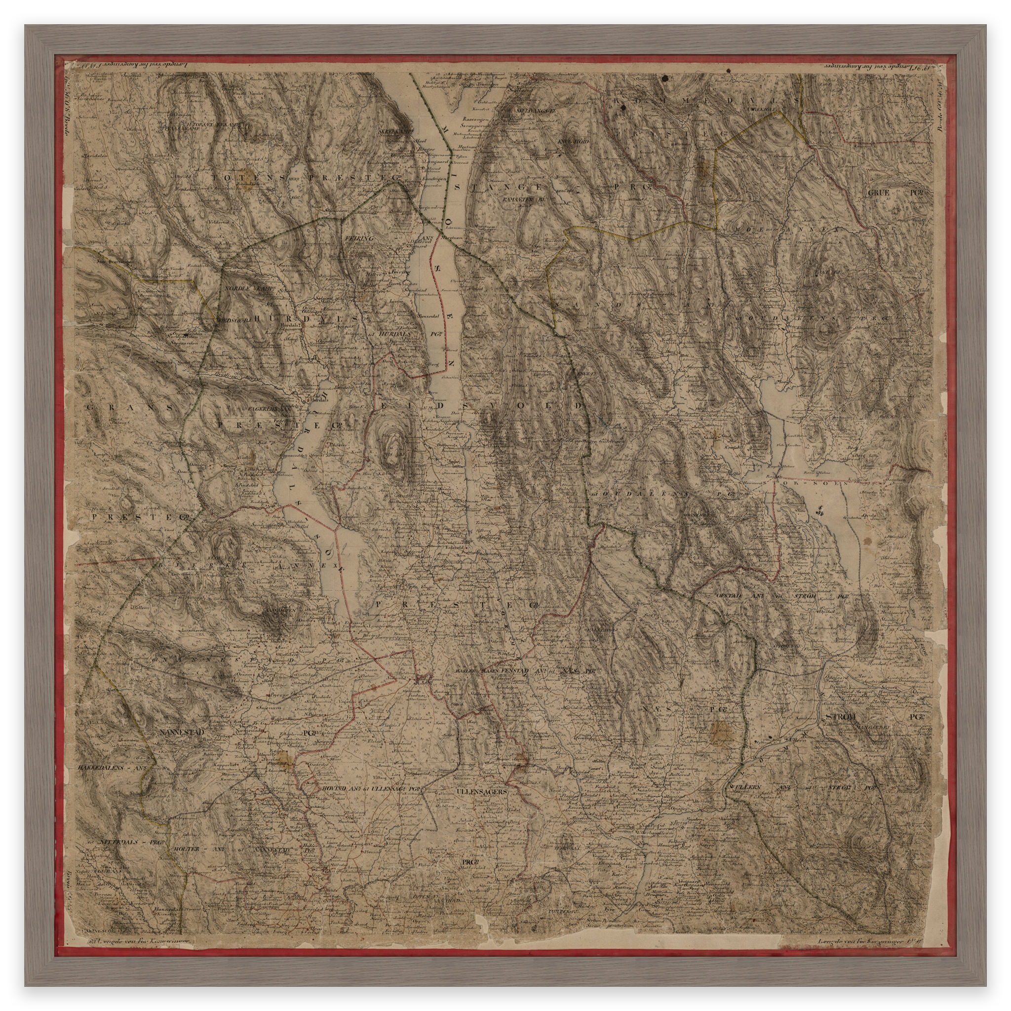
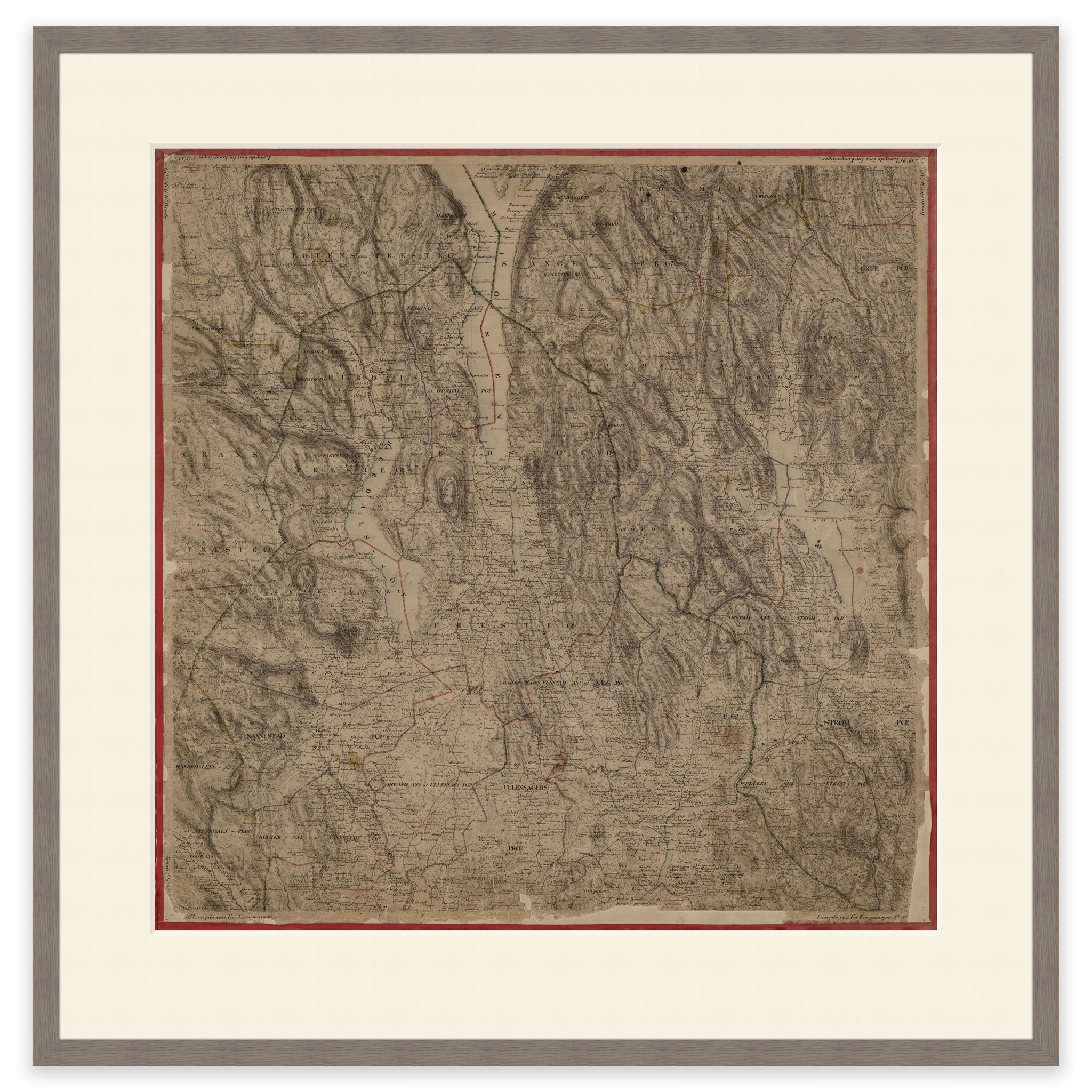
This hand-drawn map from 1860 shows the southern parts of Lake Mjøsa and the areas down to Nannestad, Oslo Airport Gardermoen and Skarnes. The map is delivered in its original size of 60 x 60 cm. The size with frame and passepartout is 78 x 79 cm. Do you want the map in a different size? Just get in touch – we’ll be happy to give you a quote for customization.