Description
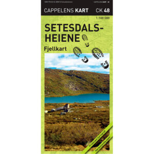
Setesdalsheiene – mountain map (part 48 in the series Cappelens kart) is a detailed mountain map published in 2010. The map is folded and printed on weatherproof paper, developed for use in demanding mountain conditions.
The map covers the area from Tonstad in the south to Røldal in the north. It is divided into a northern and a southern area, printed on opposite sides of the map sheet. This provides broad coverage of the Setesdal moors and makes the map a versatile tool for trip planning.
The scale is 1:100,000, which provides a good overview of large mountain areas and continuous grids. Mountain shading provides a clear understanding of the terrain and makes it easier to visualize the landscape.
The map shows marked trails and groomed winter trails, as well as winter and summer parking lots. Information about trails and cabins is updated in collaboration with DNT and local municipalities.
The map is printed on weather-resistant paper that allows the rain to bounce off and the boards to withstand rough use over time.
Cappelen Damm no longer publishes maps and atlases. This product is sold from existing stock, and will be available while stocks last. When the stock is empty, the map will not be printed in a new edition.