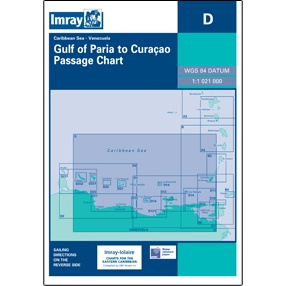
Description
This boating map provides a comprehensive overview of Venezuela’s north coast and adjacent waters in the Caribbean. The map serves as a general overview map for the entire region and covers the coastlines, archipelagos and seas included in Imray’s D-series for Venezuela.
The map is particularly suitable for rough route planning, overall overview and orientation before longer voyages along the coast or between the islands off Venezuela. It is often used in combination with more detailed D-series charts, providing a clear picture of geographical context, distances and overall sailing areas.
Imray is a renowned British chart manufacturer with extensive experience in nautical charts and publications for leisure boats. Their charts are designed with practical on-board use in mind, combining clear cartography with reliable nautical information for sailors and powerboaters.