
 Vestland 1876


Vestland 1876
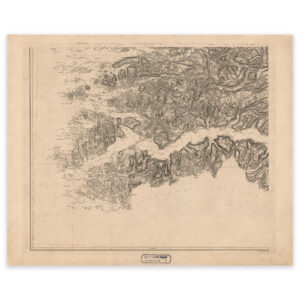
Engraving by Martinius Thorsen KingoH. N. Bergh from 1876 of parts of Vestland county. The map covers the coast from Gulen in the south to Førdefjorden in the north, up to and including Høyanger in Sognefjorden. The map is delivered in original size 66 x 53.3 cm. The size with frame and passepartout is 84 x 72.3 cm. Would you like the map in a different size? Just get in touch – we’ll be happy to give you a quote for customization.