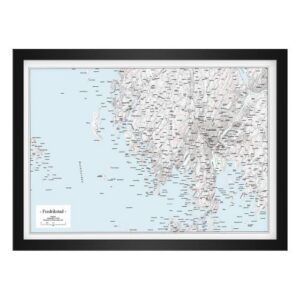
Description
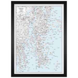
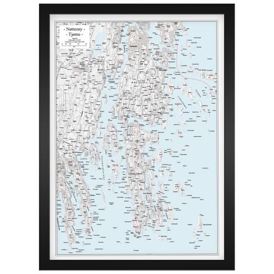
Wall Map Tjøme and Nøtterøy is an exclusive and frame-friendly map at a scale of 1:40,000 that provides a detailed and clear depiction of Tjøme, Nøtterøy and associated coastal and archipelago areas in Vestfold. The map shows islands, islets, reefs, waters, buildings, road connections and terrain shapes on land, and is presented with discrete terrain shadows that give the landscape depth and a clear three-dimensional feel. This provides high legibility combined with a calm and elegant visual expression.
The map comes unframed, but in a fixed and frame-friendly poster format of 50 × 70 cm (portrait), making it easy to frame as desired. The scale makes the map well suited both as a practical reference for local knowledge, boating and coastal travel, and as a decorative wall map in your home, cabin or boathouse.
The map is released in 2025. Although some details of the buildings, infrastructure or coastline may have changed since publication, Veggkart Tjøme og Nøtterøy still provides a very good and inspiring overview of the area and works well as both an orientation map and an atmospheric wall map.
For those looking for maps in other formats, styles or presentation solutions, we also offer a wide range of print-on-demand map products at kart.no.