-
Antirefleks (Artglass UV70)
-
Antirefleks (Artglass UV70)
-
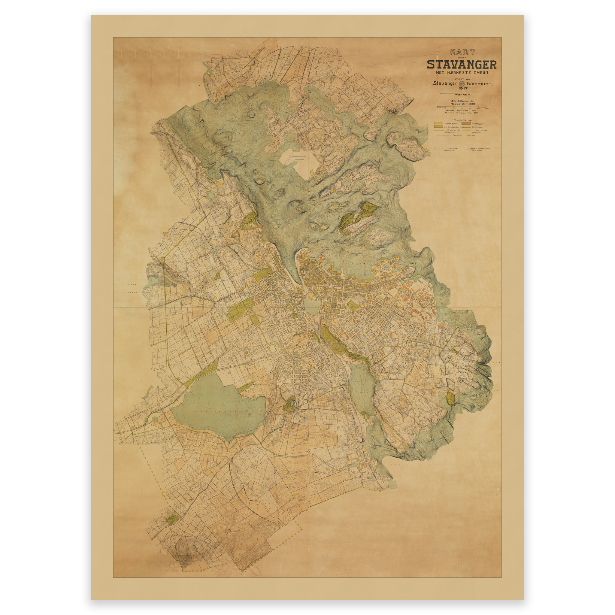
City map Stavanger 1917
Unique hand-drawn city map of Stavanger and the surrounding area, published by Stavanger municipality in 1917. At this time, the municipality of Stavanger was planning to establish a tramway, and proposals for where the route should go are drawn in. With a scale of 1:5000, this is a very detailed map, with streets, street names…
-
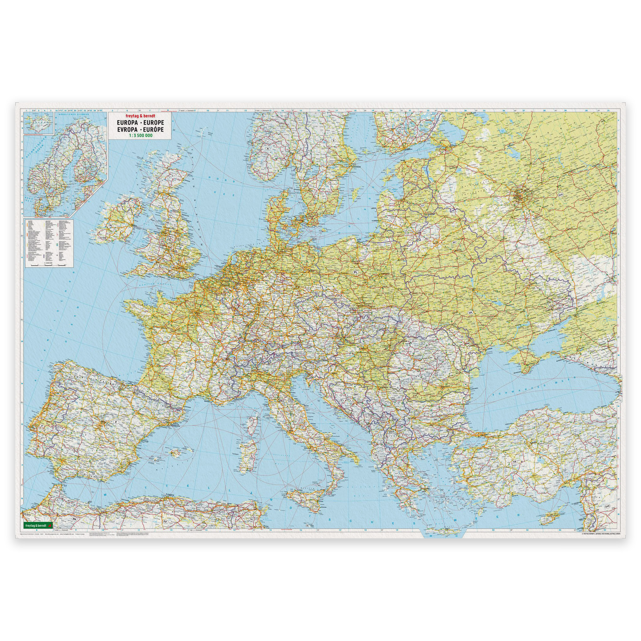
Europe Map – Physical – approx. 172 × 123 cm – Freytag & Berndt
Physical wall map of Europe in large format, scale 1:2,600,000, with a focus on terrain, mountains and natural features. Supplied as a poster or poster with hanging.
-
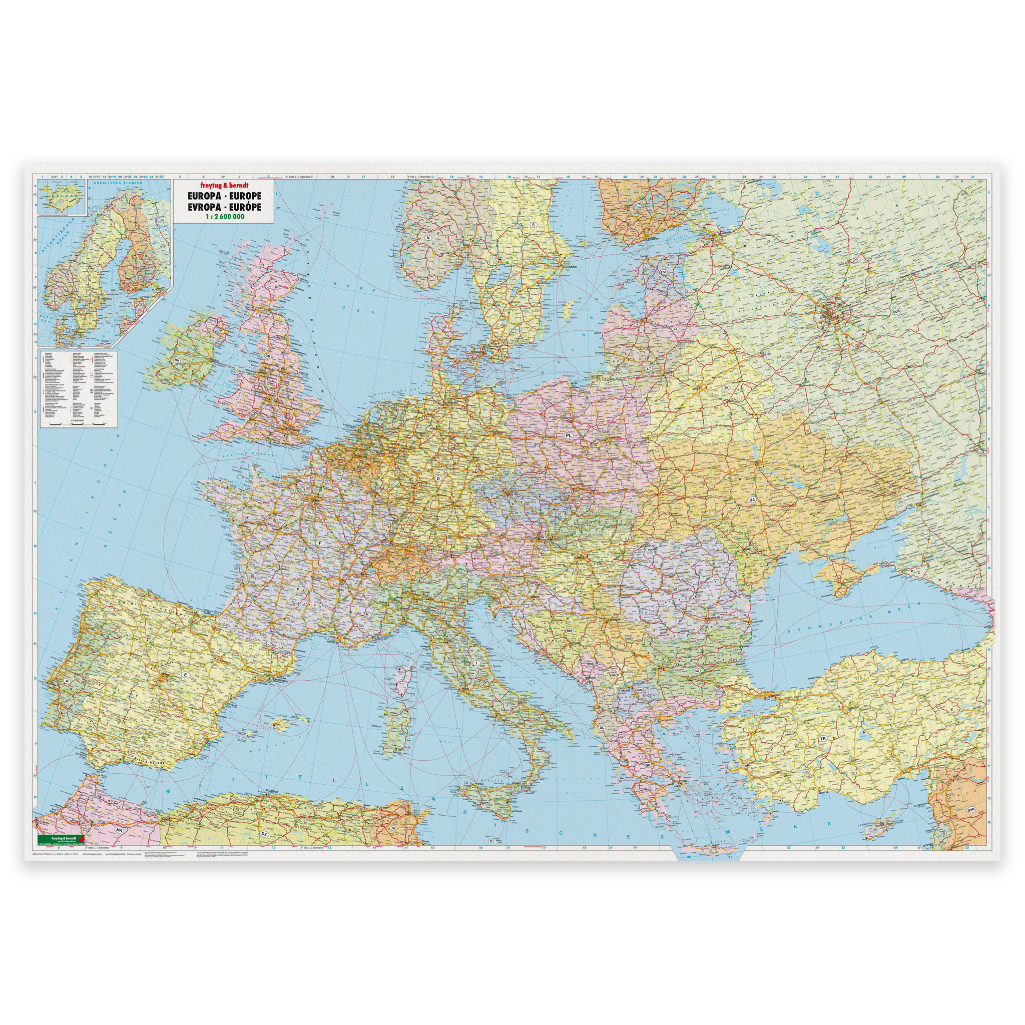
Europe Map – Political – 172 × 123 cm – Freytag & Berndt
Large political wall map of Europe at a scale of 1:2,600,000. Large format map poster with good readability, suitable for offices, meeting rooms and teaching.
-
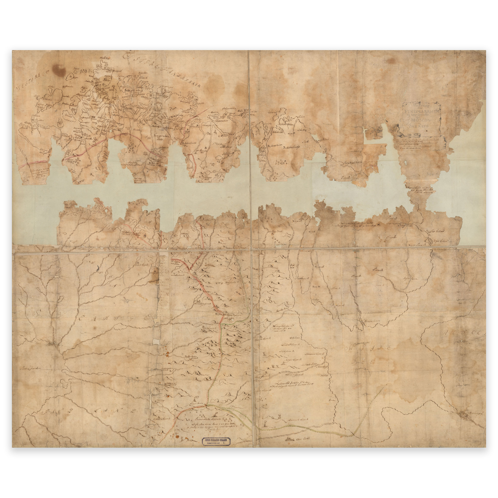
Finnmark 1700
Hand-drawn map from 1700 of what in 2024 is Finnmark county. The map is delivered in its original size of 131.9 x 80.9 cm. Do you want the map in a different size? Just get in touch – we’ll be happy to give you a quote for customization.
-
Floatglass (vanlig glass)
-
Floatglass (vanlig glass)
-
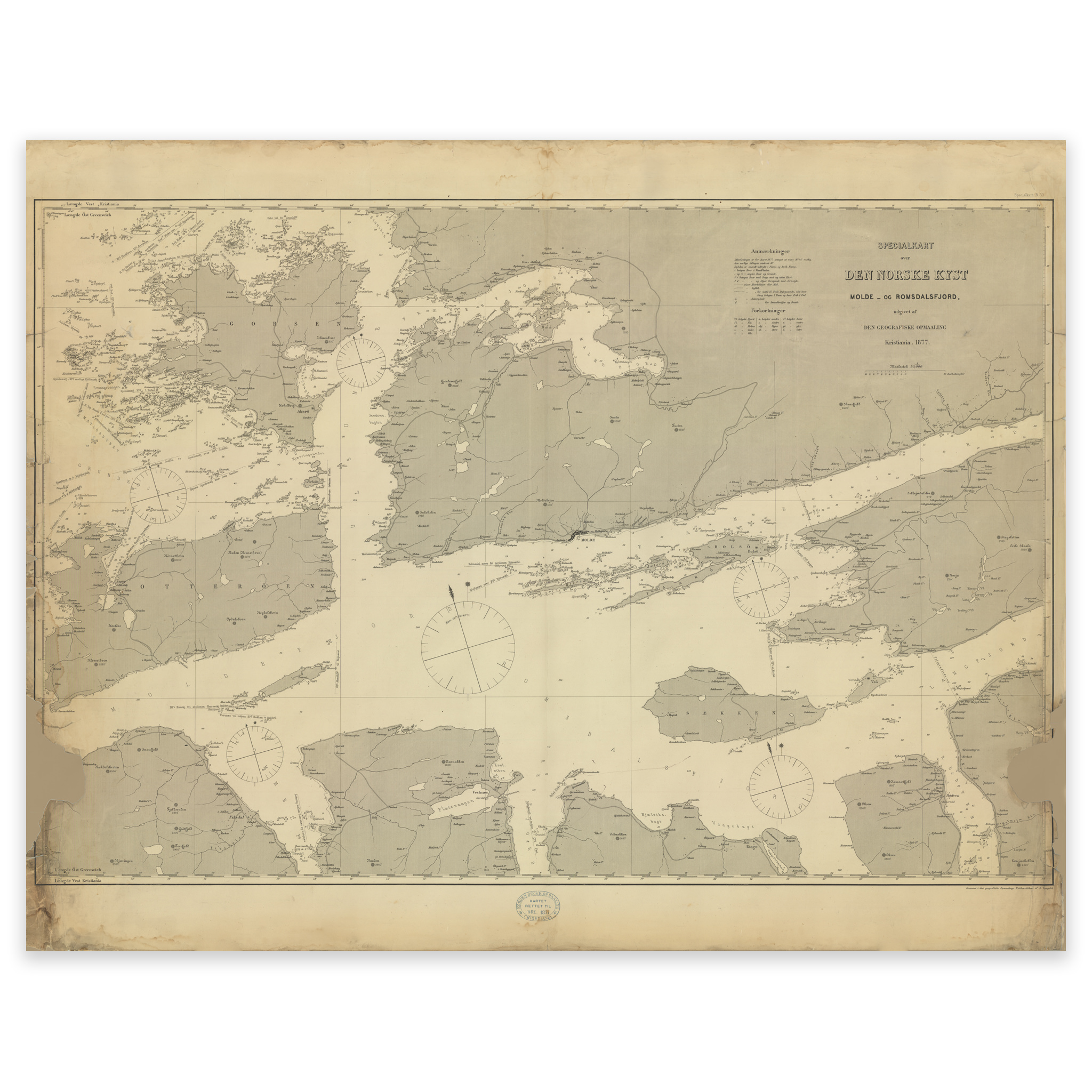
Gossa-Vestnes – Molde 1877
Nautical chart from 1877 of the area Gossa, Ålesund and Molde. The map is delivered in original size 105 x 141.8 cm. Do you want the map in a different size? Just get in touch – we’ll be happy to give you a quote for customization.
-
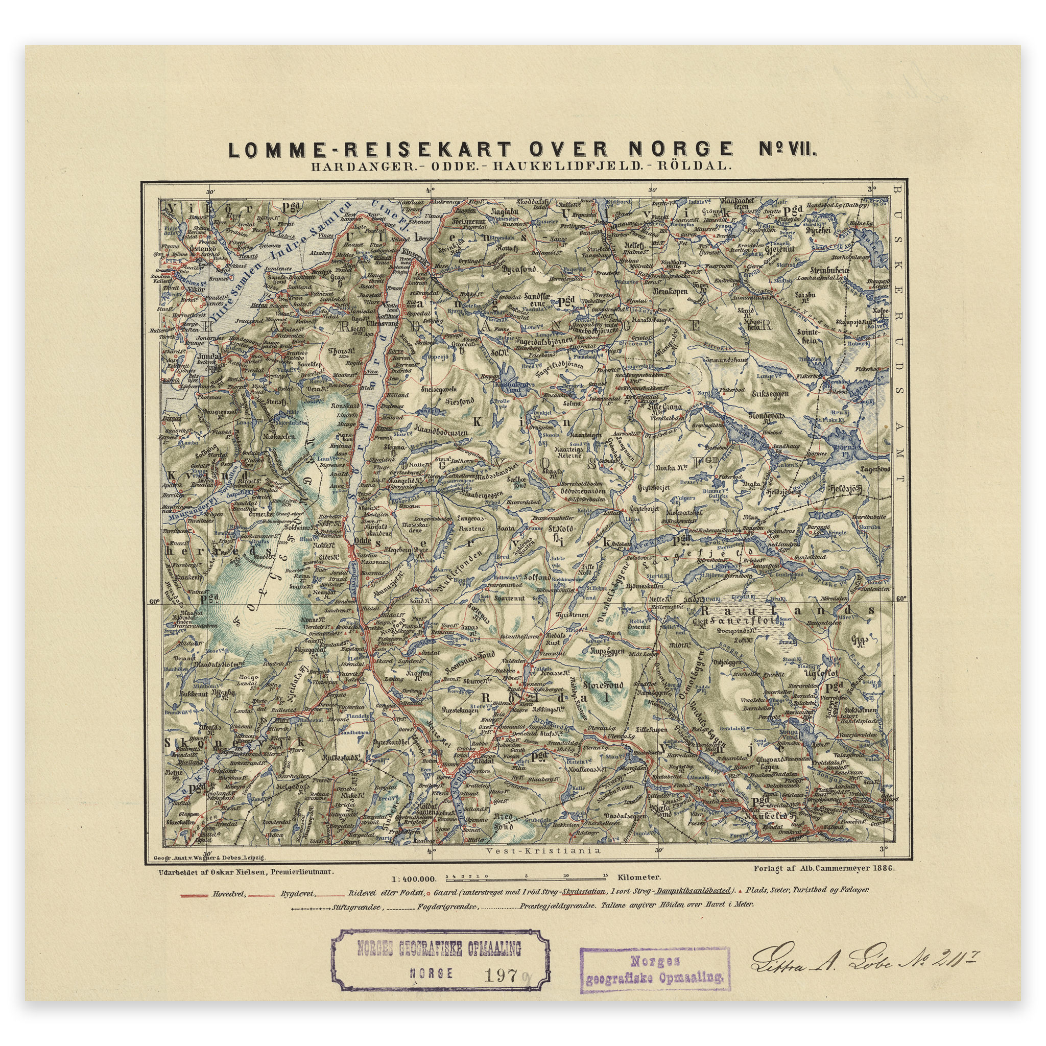
Hardanger 1886
Pocket travel map of Hardanger, Odda, Haukelifjell and Røldal. The map is delivered in original size 31 x 29.7 cm. The size with frame and passepartout is 47 x 46.7 cm. Would you like the map in a different size? Just get in touch – we’ll be happy to give you a quote for customization.
-
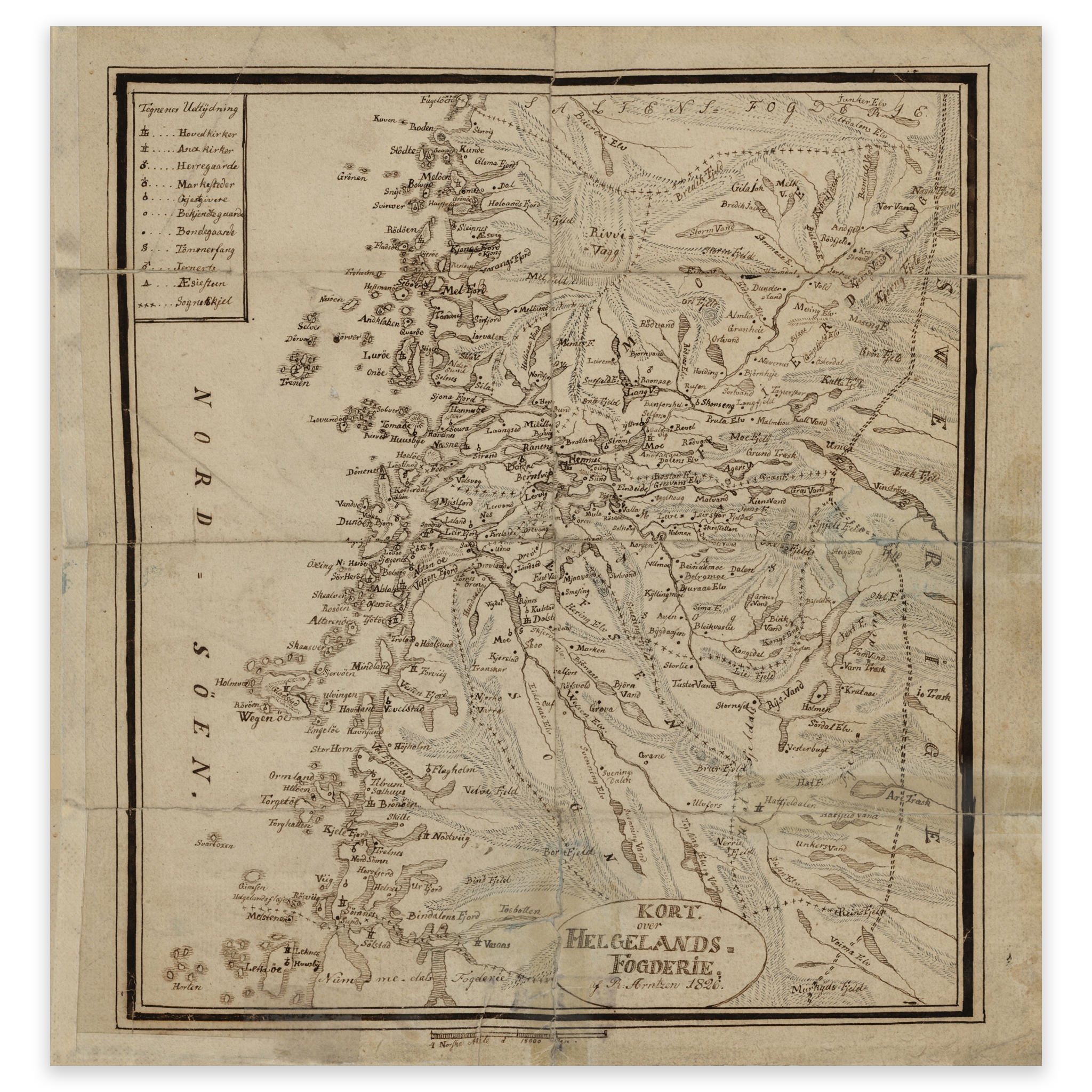
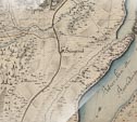
Helgeland bailiffs 1826
Map of Helgeland’s bailiwick in 1826. The map covers the area between Brønnøysund and Ørnes. The map is delivered in its original size of 25.9 x 27.2 cm. The size with frame and passepartout is 45.9 x 49.2 cm. Would you like the map in a different size? Just get in touch – we’ll be…
-

Historical nautical chart of Korshavn, Loshavn and Farsund
Historical nautical chart of Korshavn, Loshavn and Farsund from 1862. The map is delivered in its original size of 28.4 x 25.3 cm. The size with frame and passepartout is 48.4 x 47.3 cm. Do you want the map in a different size? Just get in touch – we’ll be happy to give you a…
-
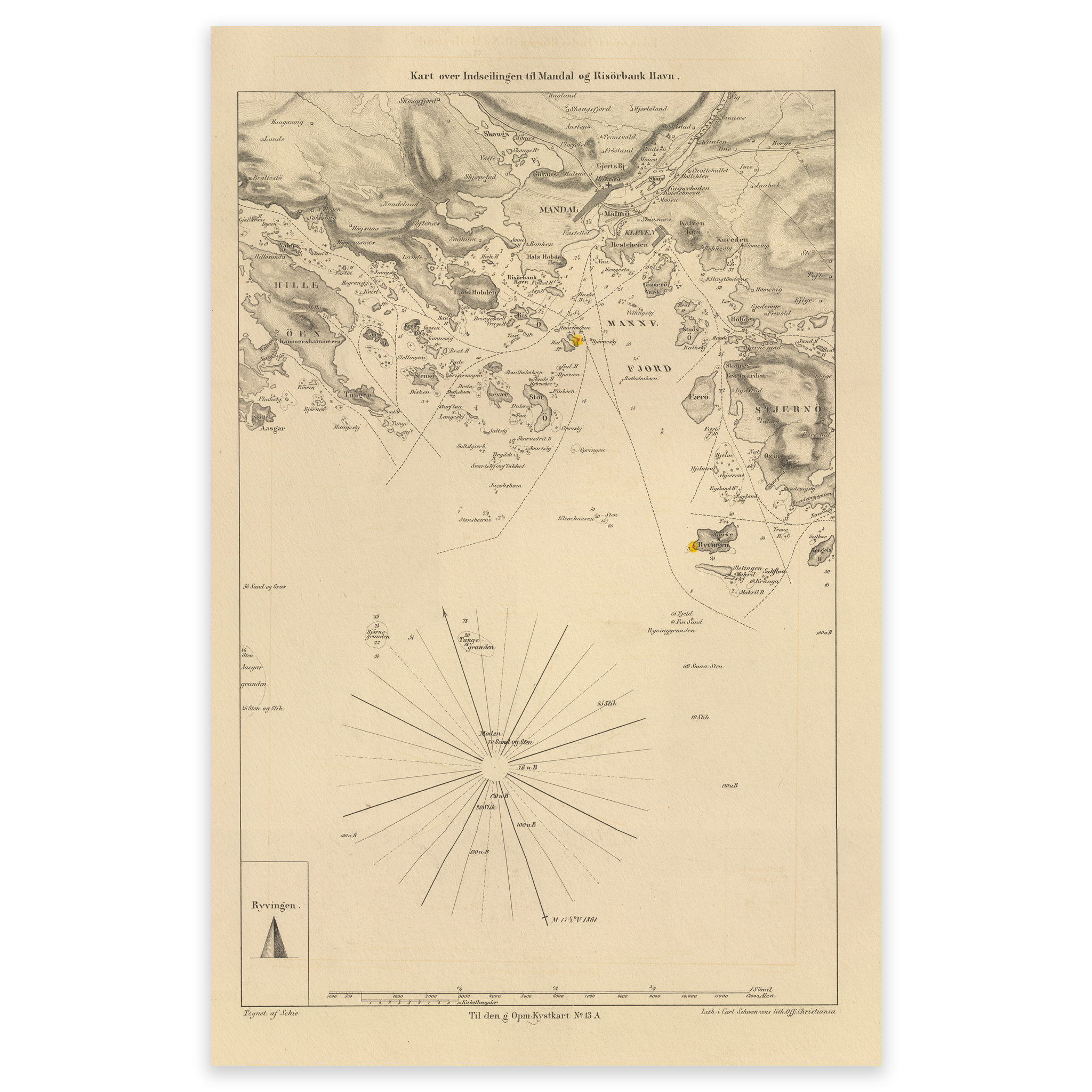
Historical nautical chart of the entrance to Mandal
The map from 1866 shows the entrance to Mandal. The map is delivered in its original size of 18.1 x 28 cm. The size with frame and passepartout is 38.1 x 50 cm. Do you want the map in a different size? Just get in touch – we’ll be happy to give you a quote…
-
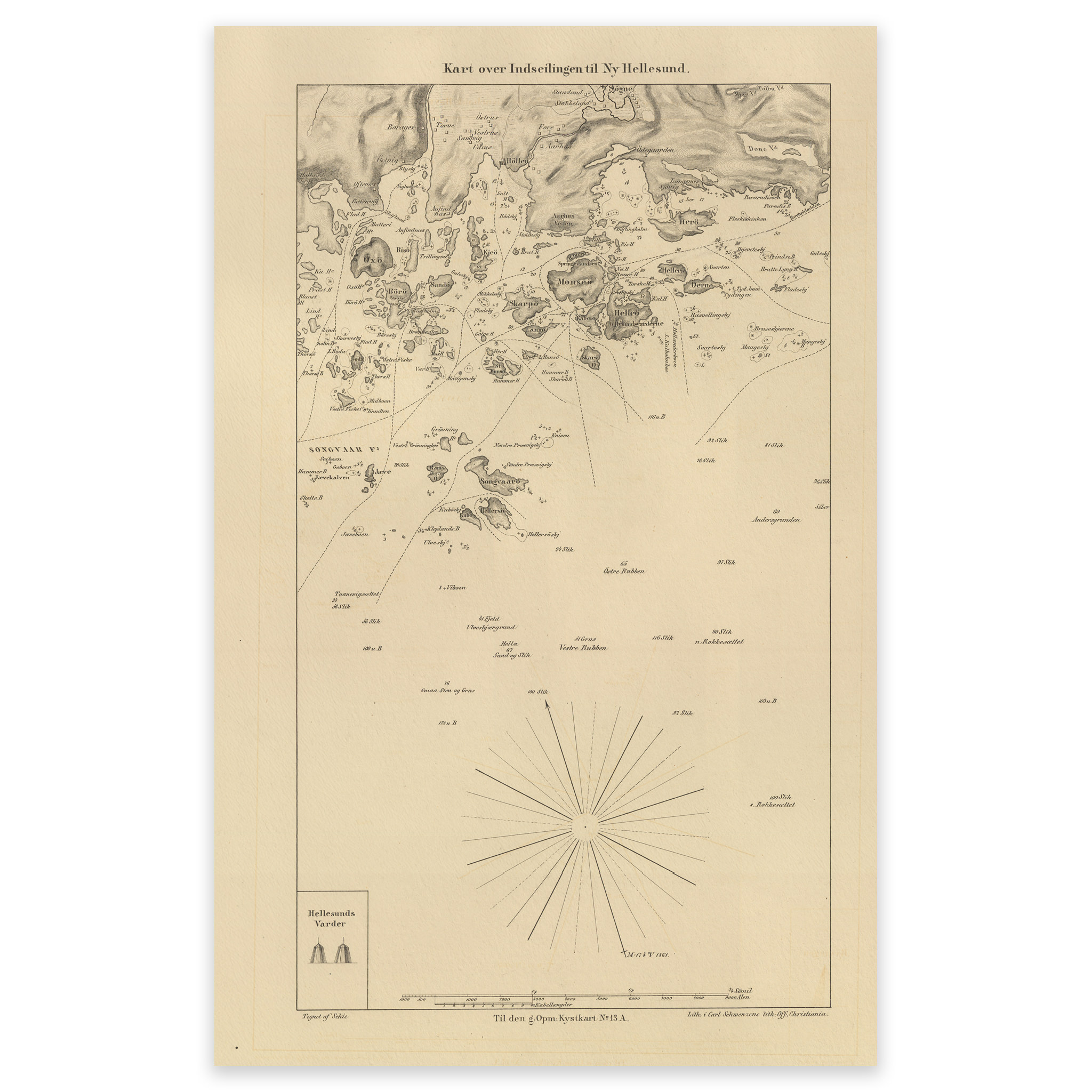
Historical nautical chart of the entrance to Ny-Hellesund
The map from 1866 shows the entrance to Ny-Hellesund. The map is delivered in its original size of 17.6 x 27.6 cm. The size with frame and passe-partout is 41.6 x 53.6 cm. Would you like the map in a different size? Just get in touch – we’ll be happy to give you a quote…
-
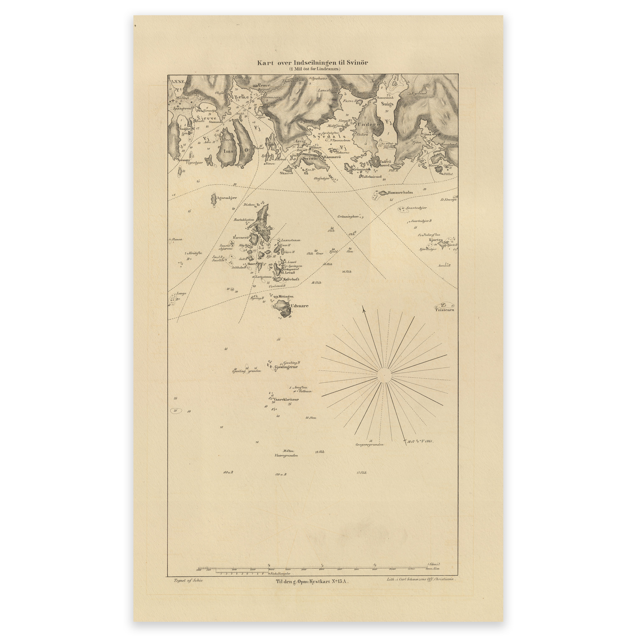
Historical nautical chart of the entrance to Svinør
Sea map of the entrance to Svinør from 1866. The map is delivered in its original size of 18.1 x 29.7 cm. The size with frame and passe-partout is 38.1 x 51.7 cm. Would you like the map in a different size? Just get in touch – we’ll be happy to give you a quote…
-

Historical nautical map of the entrance to Kristiansand
This map from 1866 shows the entrance to Kristiansand. The map is delivered in its original size of 19.4 x 28.1 cm. The size with frame and passepartout is 39.4 x 50.1 cm. Do you want the map in a different size? Just get in touch – we’ll be happy to give you a quote…
-
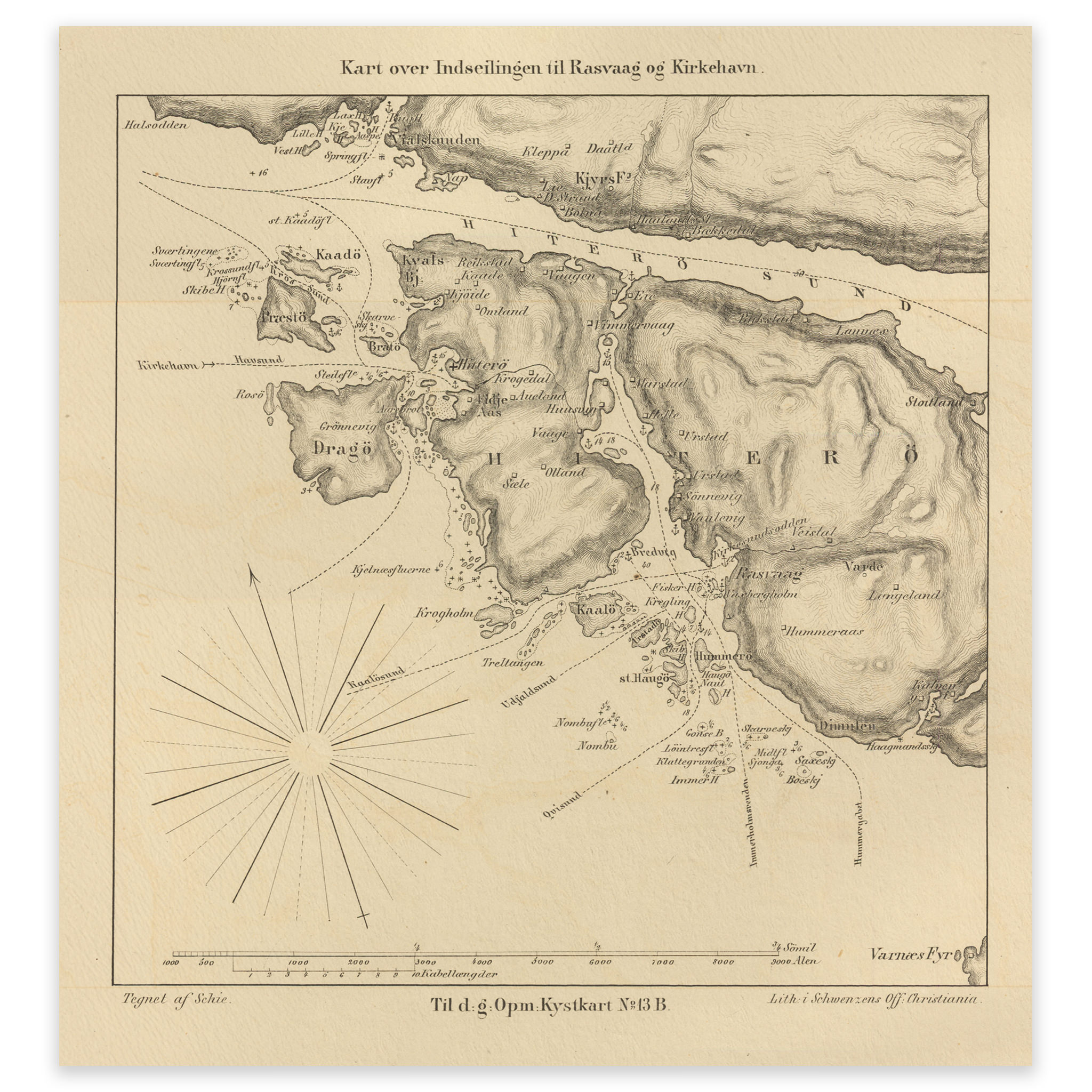
Historical nautical map of the entrance to Rasvåg and Kirkehavn on Hidra
Map of the entrance to Rasvåg and Kirkehavn on Hidra, from 1862. The map is delivered in its original size of 13.9 x 14.9 cm. The size with frame and passe-partout is 37.9 x 40.9 cm. Would you like the map in a different size? Just get in touch – we’ll be happy to give…
-
Innramming uten passepartout
-
Innramming uten passepartout
-
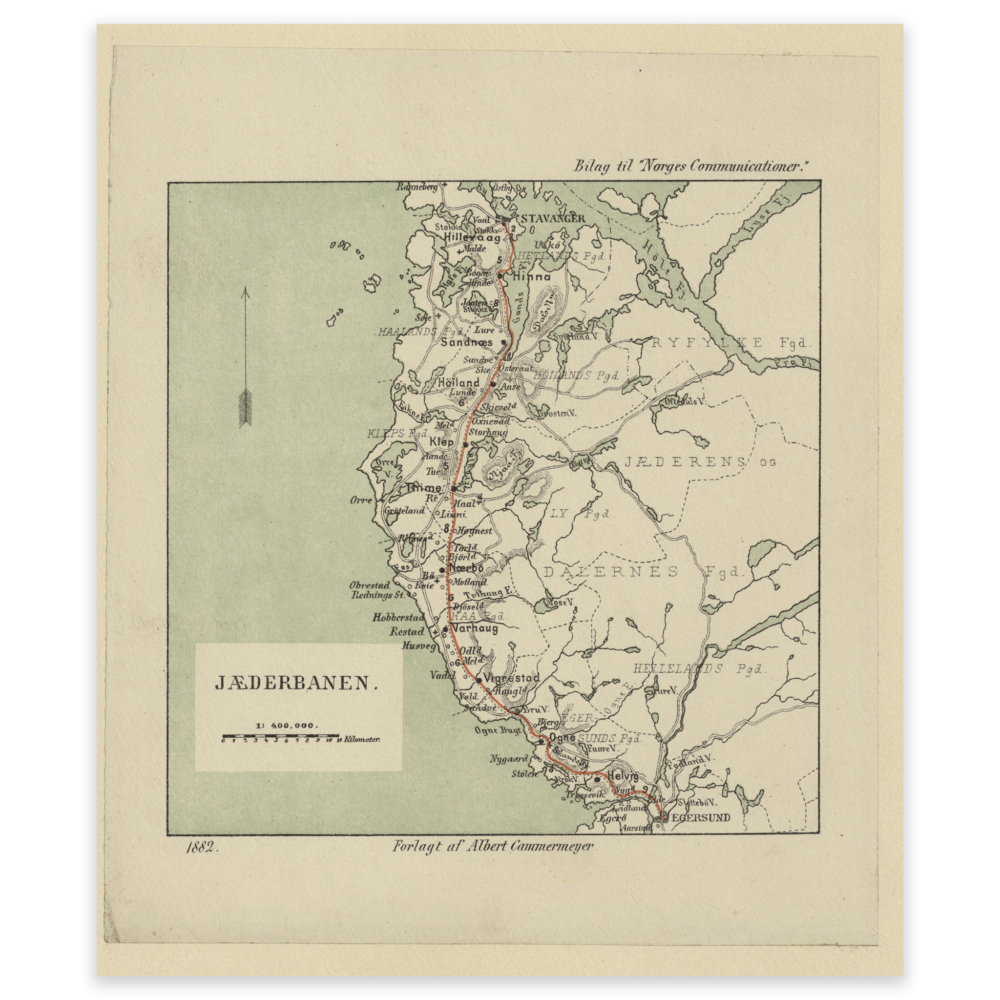
Jærbanen 1882
Map of Jærbanen between Stavanger and Egersund. The map is delivered in its original size of 19.3 x 22.8 cm. The size with frame and passepartout is 43.3 x 48.8 cm. Do you want the map in a different size? Just get in touch – we’ll be happy to give you a quote for customization.