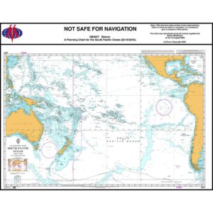
Description
This British Admiralty planning chart covers much of the South Pacific, showing the connections between Australia, New Zealand, South America, Polynesia and adjacent island groups. The chart provides a comprehensive overview of one of the world’s largest and most open oceans, with a focus on long-distance sailing and overall route planning.
The chart has been prepared for strategic navigation work and is primarily used in the planning phase before sailing. It provides an overview of the main sailing routes, distances and geographical structures on a large scale, but is not intended for operational navigation or detailed use near coasts and ports.
This chart is suitable for sailors, professional navigators and maritime operators who need an overall planning chart of the South Pacific, either in support of operational charts or as a reference in training and navigation preparation.