Description
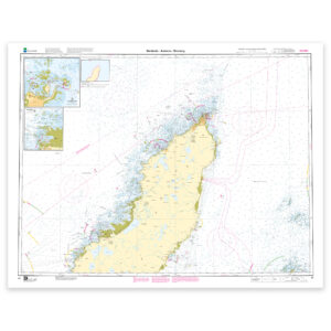
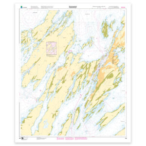
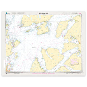
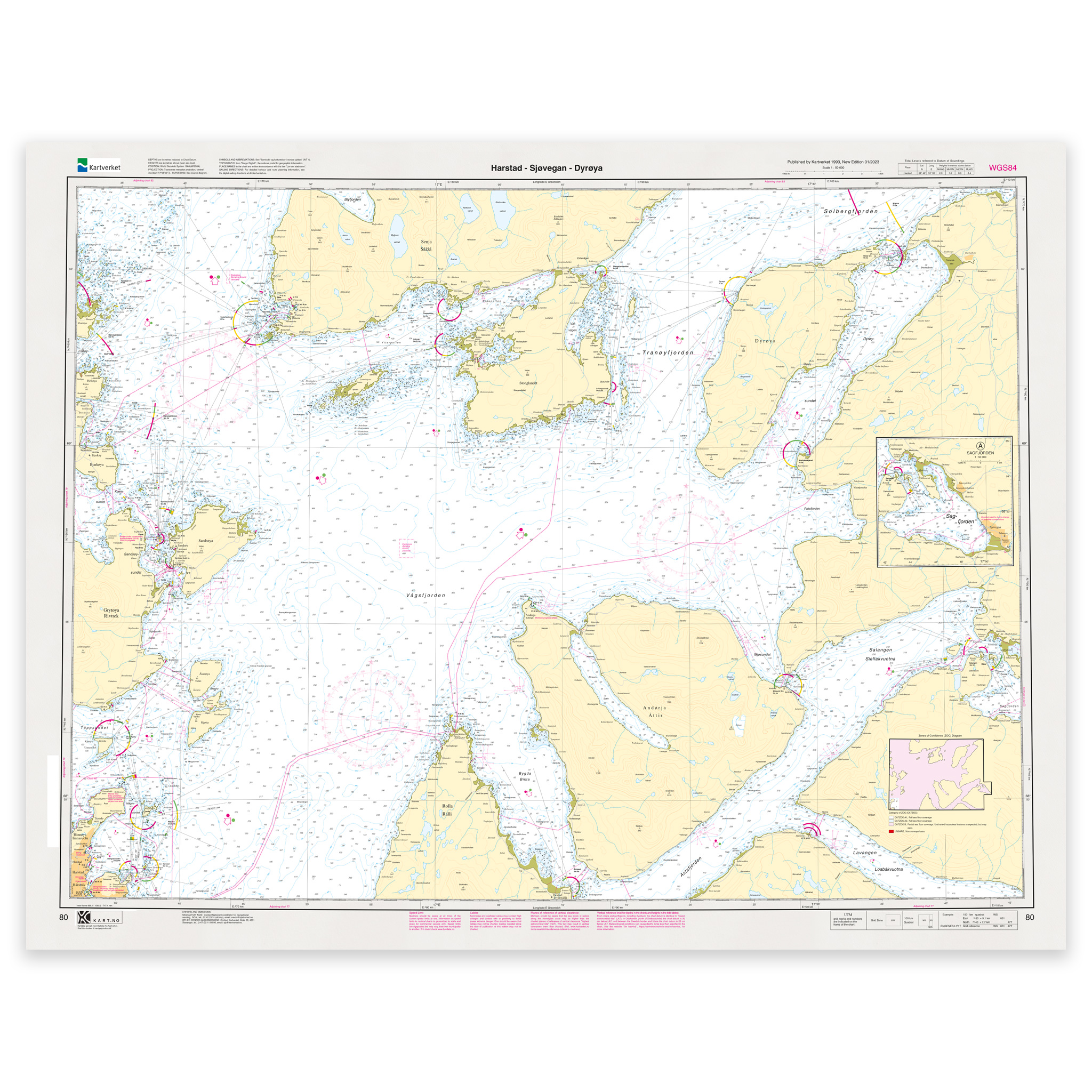
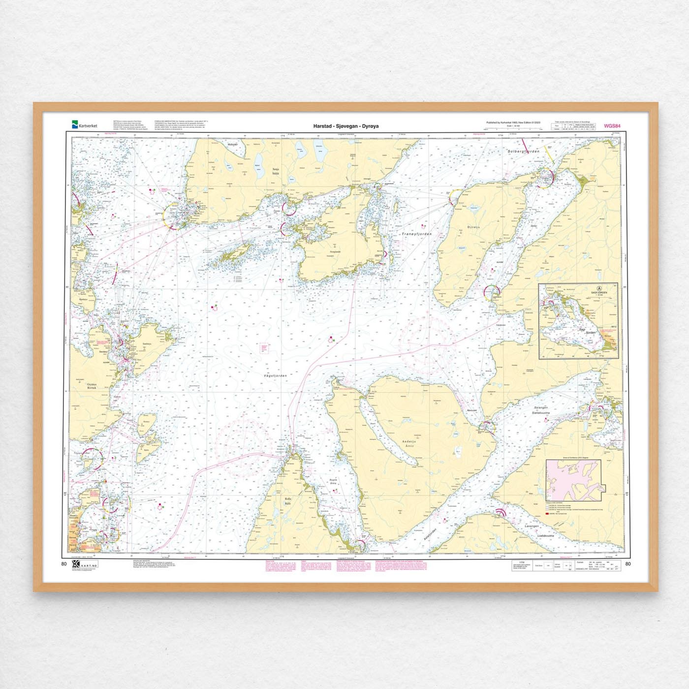
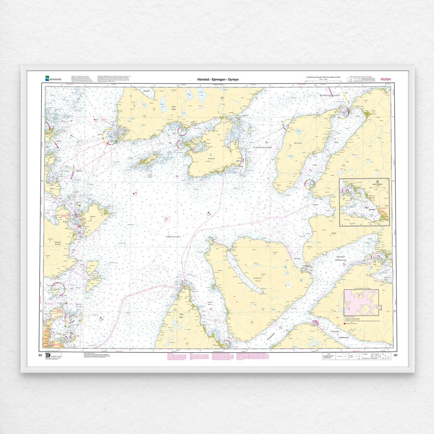
Nautical chart covering the waters Harstad – Sjøvegan – Dyrøya. Map sheet 80 in the Norwegian Mapping Authority’s main map series. The map is 86 x 112 cm and has a scale of 1:50,000. Can also be delivered on a plate or framed. Size with passepartout and frame is 107 x 132 cm.
For the waters around Harstad – Sjøvegan – Dyrøya, this nautical chart is a solid tool for both planning and safe navigation. By covering specific locations in the area, the map is well suited for those looking for a nautical chart with local relevance and clear geographical boundaries.
Map sheet 80 in the Norwegian Mapping Authority’s main map series. With a scale of 1:50,000 and a size of 86 x 112 cm, you get a nautical chart that is easy to read and well suited for both use and overview. Since the map is printed when ordered as print-on-demand, you will receive a product with the latest available updates from the Mapping Authority.
Based on official data from the Swedish Mapping Authority, the map provides a safe and reliable basis for navigation and planning.
The choice of material can be adapted to the application. 125 gram map paper is thin, matt and space-saving, and is ideal as a spare map. 180-gram map paper is a carefully selected, matt and sturdy paper that is ideal for active map use on board. Tyvek is made for rough conditions and can withstand both water and rough handling. Art paper is a good choice when the chart is to be framed or used as a wall chart, and gives a more exclusive finish.
If you want a ready-to-hang solution, the map can be delivered pre-framed or mounted on aluminum plate. This also makes it well suited as a wall map. Size with passepartout and frame is 107 x 132 cm.