Description
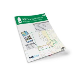
NV Charts DE13 Nordsee Ostfriesland Borkum-Helgoland & Ems is a complete chart package of paper and digital charts covering the German North Sea area from the island of Borkum via Helgoland to the river Ems. The charts provide detailed navigational information with approaches, harbors, tides and current data, and are particularly useful for leisure sailing, coastal cruising and coastal navigation in the North Sea.
The package includes paper charts in convenient atlas format with clear cartography, combined with digital access via the NV Charts app and PC/Mac. The digital charts can be used offline, giving you up-to-date information when you’re at sea or planning your route at home.
Features
Paper charts in atlas format with high level of detail and good overview.
Digital access via the NV Charts app (offline use on multiple devices).
Tide and current data included.
Detailed harbor plans and approaches for the areas around Borkum, Helgoland and Ems.
Navigation details for North Sea coastal waters.
Map overview
C1 Nordsee – Borkum to Helgoland (1:375,000).
C2 Ems River and associated waters (1:150,000).
C3 Jadebukta and adjacent areas (1:150,000).
C4 Helgoland approaches (1:50,000).
C5 Borkum approaches (1:50,000).
C6 Sailing routes and coastal waters in the area (1:250,000).
Detailed maps for ports such as Emden, Borkum, Cuxhaven, Wilhelmshaven and Helgoland.
Updates
Always delivered in the latest available edition from NV Charts. If a new and updated edition is launched within 30 days of purchase, the map can be exchanged for a new edition free of charge.
EAN / ISBN
9783910644236