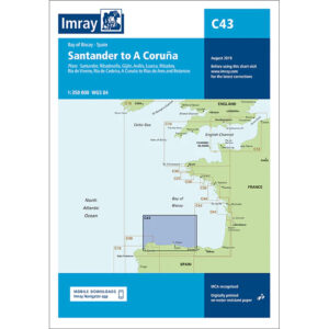
Description
This boating map covers the coastline along the Bay of Biscay from Santander to A Coruña on the north coast of Spain. The map includes detailed plans of important harbors and ports of call such as Santander, Ribadesella, Gijón, Avilés, Luarca, Ribadeo, Ría de Viveiro, Ría de Cedeira as well as A Coruña and Rías de Ares and Betanzos.
The chart is well suited for leisure boats and sailboats sailing along the often weather-prone north coast of Spain, either as part of coastal sailing or longer legs in the Bay of Biscay. It provides a solid foundation for route planning and safe navigation between ports and harbors in an area with varying depths, currents and weather.
Imray is a recognized British manufacturer of nautical charts for leisure and long-distance sailing. The charts are developed with a focus on practical use, good readability and clear presentation of navigation-relevant information for sailors and powerboaters.